Plizio Visual Lab
Maya Mountains
Weather…
Water temperature…
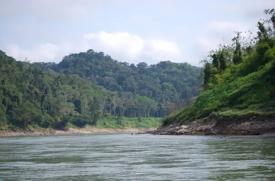
The Maya Mountains (Montañas Mayas) are a mountain range in eastern Guatemala and Belize, notable for their unique geological composition. Unlike the rest of Guatemala's volcanic highlands, the Maya Mountains are predominantly composed of Paleozoic granites and sedimentary rocks. The region is covered in dense tropical rainforest and represents one of the most remote and least explored areas in Central America. These mountains are a critical biodiversity hotspot, hosting endangered species such as the scarlet macaw and the Central American tapir. Numerous rivers originate in this range, supplying water to the surrounding lowlands. Archaeologically, the Maya Mountains hide many undiscovered ruins of the ancient Maya, who utilized the difficult terrain for ceremonial purposes and as retreats. Preserving this ecosystem is vital for protecting watersheds and ensuring genetic exchange across Central American forests.
- Location: Guatemala
- Nearby: Lake Izabal (9 km)
Best time to visit & climate
The most pleasant time to visit is Feb–Apr.
| Jan | Feb | Mar | Apr | May | Jun | Jul | Aug | Sep | Oct | Nov | Dec | |
|---|---|---|---|---|---|---|---|---|---|---|---|---|
| Avg °C | 23 | 24 | 25 | 27 | 28 | 27 | 26 | 27 | 27 | 26 | 24 | 23 |
| Rain mm | 121 | 82 | 68 | 48 | 130 | 240 | 191 | 205 | 237 | 252 | 217 | 143 |
📋 Practical info
Geography
Facts
- The highest elevation in the Maya Mountains reaches about 1,124 meters.
- The range is one of the oldest landmasses in Central America.
- The region receives up to 4,000 mm of annual rainfall.
- The Maya Mountains contain significant deposits of quartz and limestone.
- The mountains form a natural barrier between Petén and the Caribbean coast.
- Large portions of the range are under strict environmental protection.
Explore nearby
Notable places around
Route planner — Car & Motorhome
Where do you start? We build the route here, with stops and country notes along the way.
© OpenStreetMap contributors · OpenRouteService
Sights nearby
Frequently asked questions
What is the difficulty level of the hikes?
Are there guided groups?
What insect repellent is advisable?
Is the region safe?
Can you also camp there?
Maya Mountains: where is it located?
Maya Mountains: when is the best time to visit?
Maya Mountains: why is it worth visiting?

Nearby cities
Nature
More places