Plizio Visual Lab
San Benito
ℹ️Practical info — San Benito
▾
🌤 Weather — 5 days
📍 Nearby
Sights nearby
💡 Tips
- San Benito is the bustling commercial hub next to Flores; you'll find cheaper accommodations and restaurants here.
- Traffic can be chaotic, so taking a tuk-tuk is the most convenient way to travel back and forth to Flores.
- Exercise a bit more caution on quiet streets at night compared to the heavily touristic island of Flores.
- The town has several ATMs, which is handy if the machines in Flores happen to run out of cash.
🍽 Food
Along the main arteries, you will find plenty of evening stalls selling these crispy fried snacks cheaply.
Head into the large market for authentic and very cheap set lunches (Almuerzo) typically featuring chicken and rice.
Look for small eateries near the lake that serve fresh Guatemalan-style ceviche.
🛍 Shopping · 🧘 Quiet spots
A massive, bustling local market where you can find everything from cheap clothing to fresh tropical fruits.
Take advantage of the larger supermarkets and pharmacies here, which have better selections than shops in Flores.
A walk along the waterfront away from the bridge to Flores features some quiet time and nice lake views.
Head further west along the shore where the dense buildings thin out and the atmosphere gets more relaxed.
Water temperature…
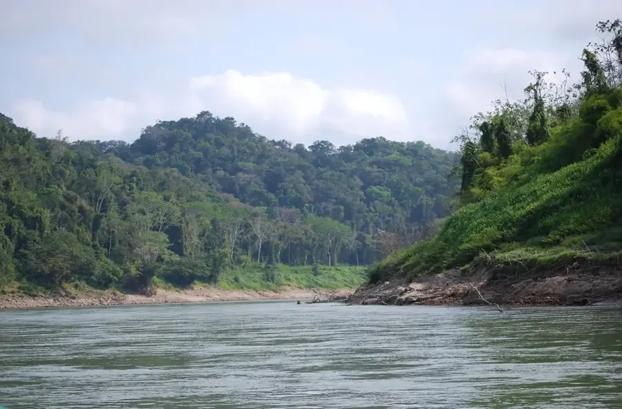
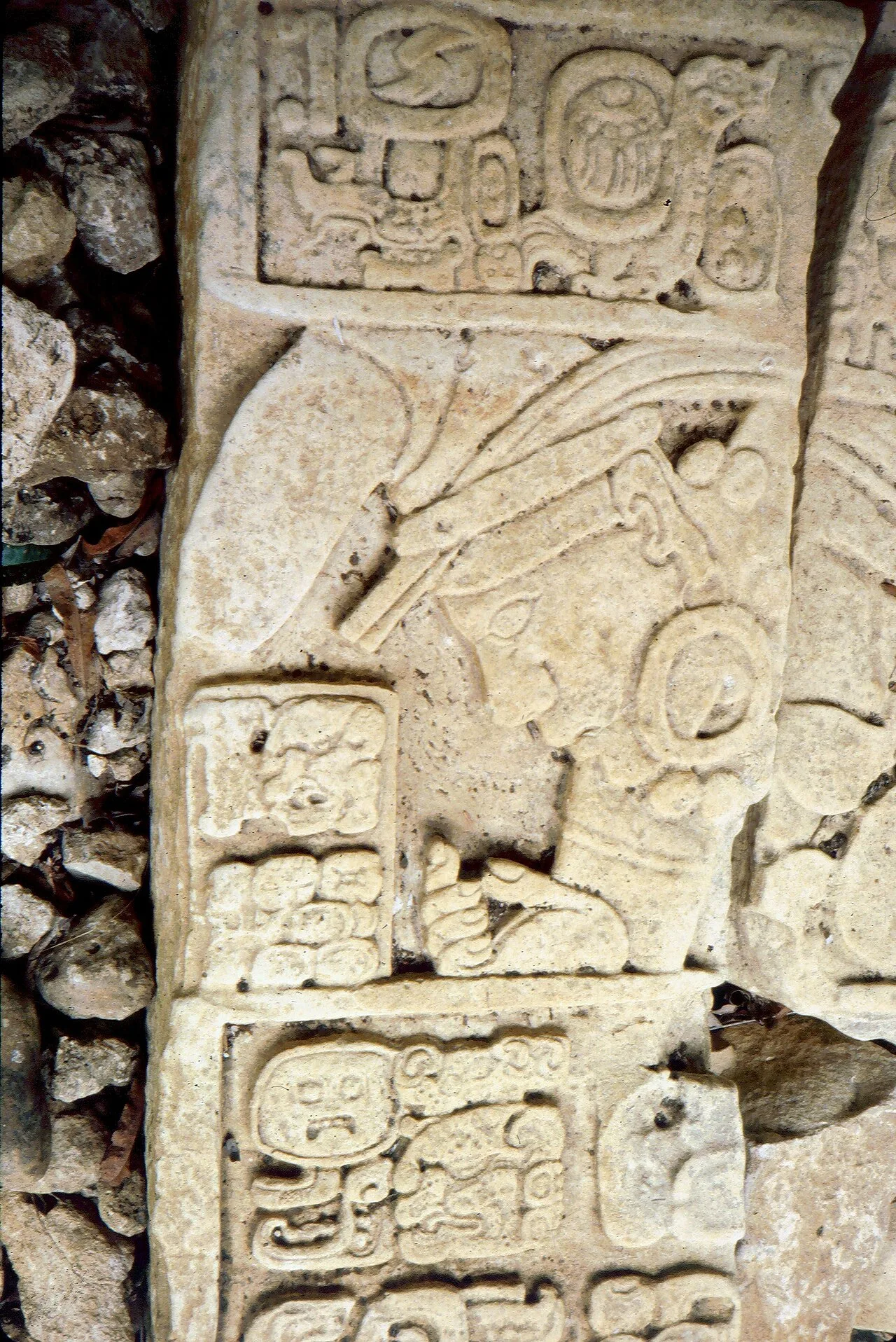
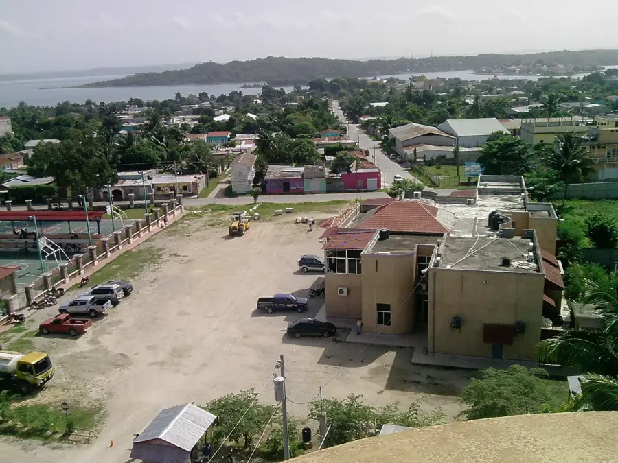
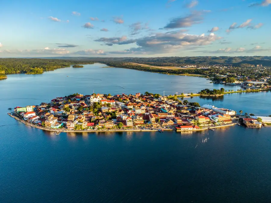
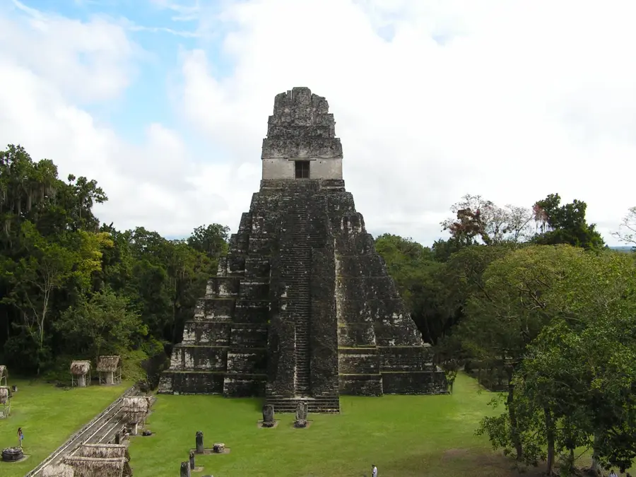
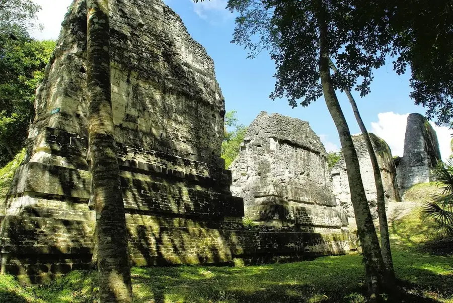
San Benito is located in the Petén Department on the southern shores of Lake Petén Itzá, acting as the commercial counterpart to the nearby island city of Flores. Established in the 18th century by settlers from Yucatán, it has grown to be the most populous urban center around the lake. Geographically, it sits in a tropical lowland area at an elevation of 127 meters, experiencing high temperatures and humidity throughout the year. The city serves as a vital logistics and trade hub for the Petén region, providing essential services, markets, and education to the surrounding municipalities. While Flores is the primary destination for international tourists, San Benito functions as the economic backbone of the metropolitan area. Historically, this region was the last stronghold of the Itzá Maya until the Spanish conquest in 1697. Today, San Benito provides critical infrastructure for those traveling to archaeological sites such as Tikal and El Mirador. The city is seamlessly connected to Flores via causeways and bridges, facilitating a integrated urban economy.
- Location: Guatemala
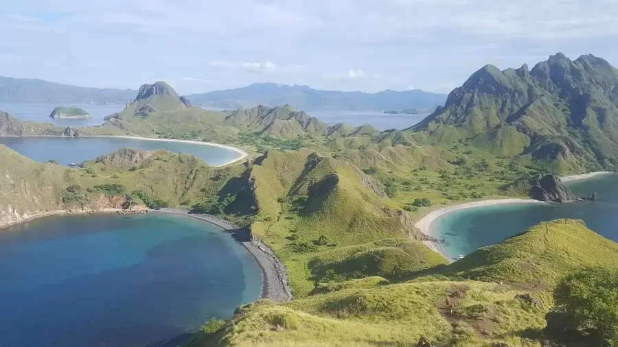
- Top sights: San Benito, Guatemala · Santa Elena, Guatemala · Petén Basin
- Nearby: Lanquín (7 km)
- Population: ~30.764 (2020)
Best time to visit & climate
The most pleasant time to visit is Jan, Feb, Dec.
| Jan | Feb | Mar | Apr | May | Jun | Jul | Aug | Sep | Oct | Nov | Dec | |
|---|---|---|---|---|---|---|---|---|---|---|---|---|
| Avg °C | 22 | 24 | 26 | 29 | 29 | 26 | 26 | 26 | 26 | 25 | 23 | 22 |
| Rain mm | 88 | 51 | 47 | 41 | 137 | 263 | 171 | 224 | 275 | 247 | 148 | 109 |
Geography
Facts
- The elevation is 127 meters above sea level.
- Located on the southern shore of Lake Petén Itzá.
- Founded in the 18th century by settlers from Yucatán.
- It is the commercial twin city to the tourist hub of Flores.
- Serves as the main supply point for the Petén department.
- The region was the final part of Guatemala to be conquered in 1697.
Explore nearby
Notable places around
Route planner — Car & Motorhome
Where do you start? We build the route here, with stops and country notes along the way.
© OpenStreetMap contributors · OpenRouteService
Frequently asked questions
What is the connection between San Benito and Flores?
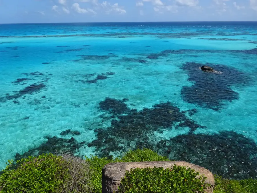
Can you swim in Lake Petén Itzá?
Are there hotels in San Benito?
What is the climate like in Petén?
What is the most important market in the area?
San Benito: where is it located?
San Benito: what is there to see?
San Benito: when is the best time to visit?
San Benito: why is it worth visiting?

Nearby cities
Nature
More places