Plizio Visual Lab
Flores
ℹ️Practical info — Flores
▾
🌤 Weather — 5 days
📍 Nearby
Sights nearby
💡 Tips
- Walk the island perimeter at sunset for the best views and a cooler breeze.
- ATMs on the island can run out of cash on weekends; stock up when you can.
- Tuk-tuks to the mainland (Santa Elena) are cheap, but agree on the fare beforehand.
- Book Tikal shuttle tours through your hotel or established agencies to avoid scams.
- Be prepared for heavy, brief afternoon rainstorms during the wet season.
🍽 Food
Fresh fish from the lake, best enjoyed at the waterfront restaurants on the western shore.
In the evenings, vendors set up on the malecon near the bridge offering cheap, delicious snacks.
A regional style of tamales that can be found at traditional comedores over in Santa Elena.
🛍 Shopping · 🧘 Quiet spots
Colorful traditional Guatemalan fabrics can be found in small shops along the narrow island streets.
A few boutiques in the center of Flores offer authentic jade carvings and jewelry.
Rent a canoe and paddle out onto the quiet waters, away from the main tourist strip.
A short boat ride away, a relaxing lakeside spot excellent for swimming and hanging out.
The area at the very top of the island by the church is often much quieter than the waterfront.
Water temperature…
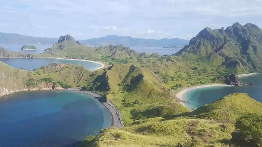
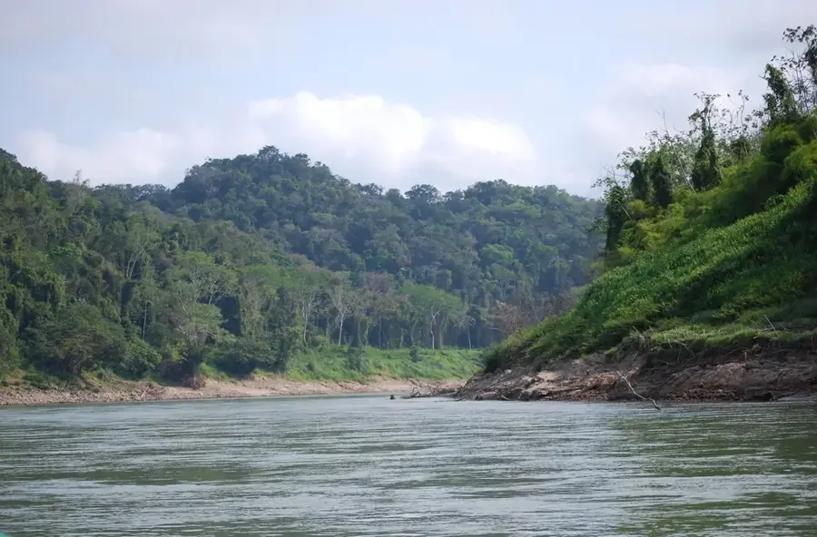
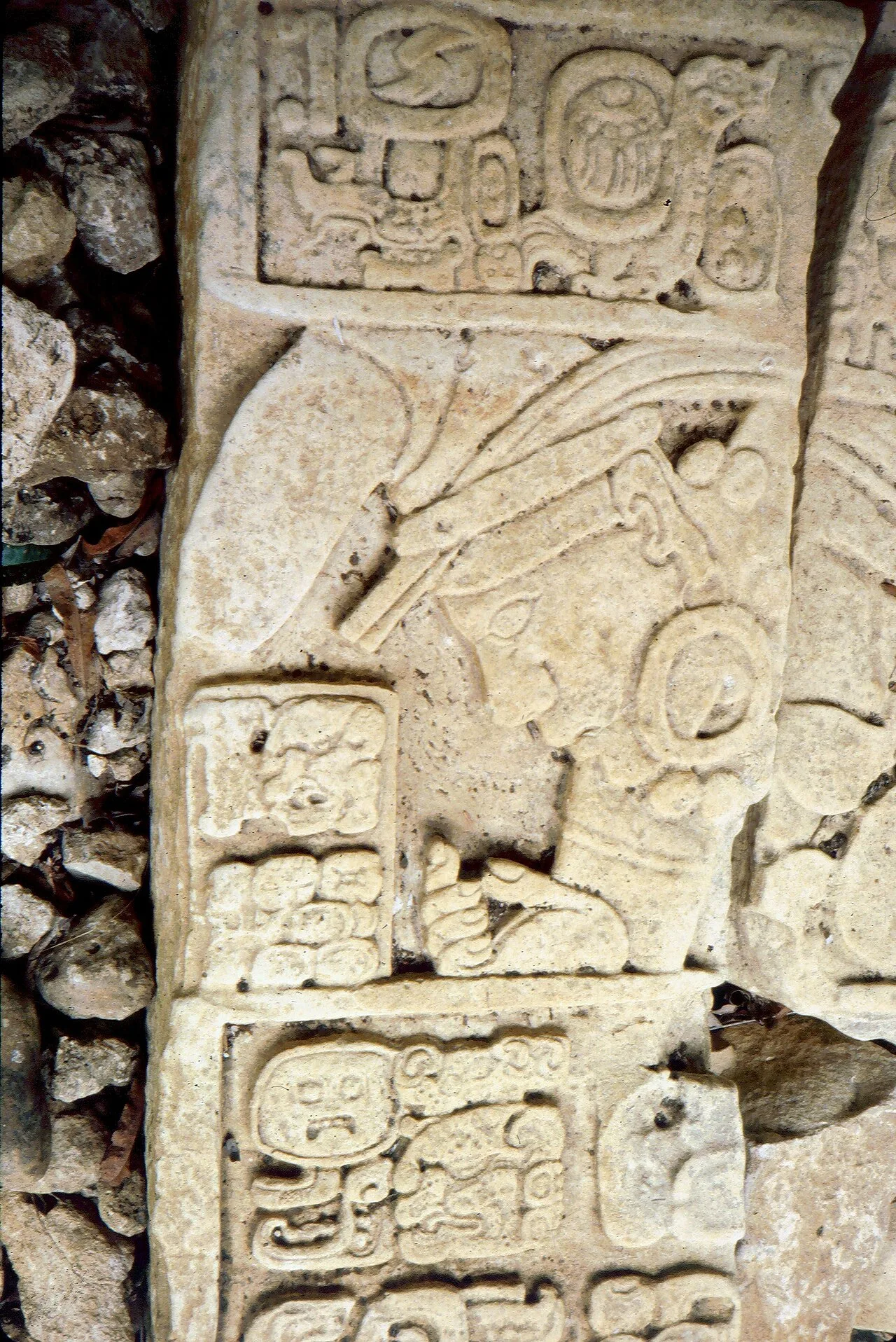
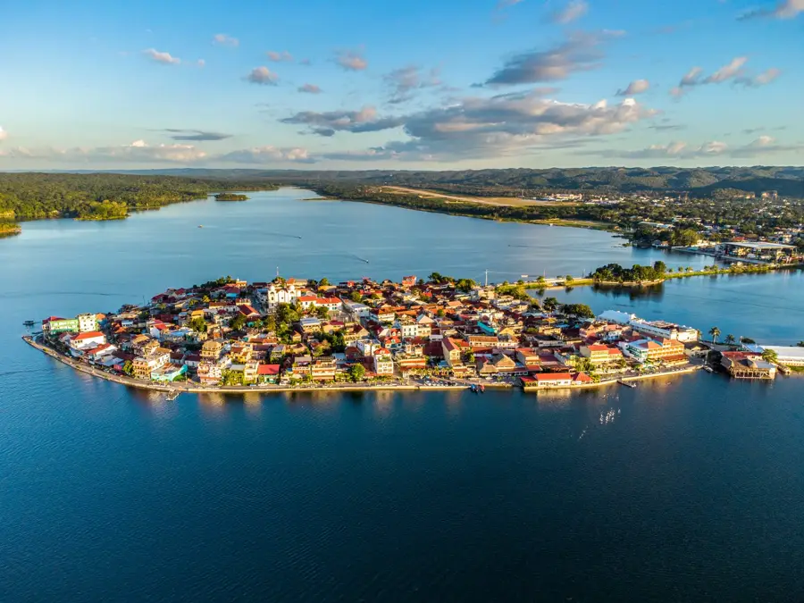
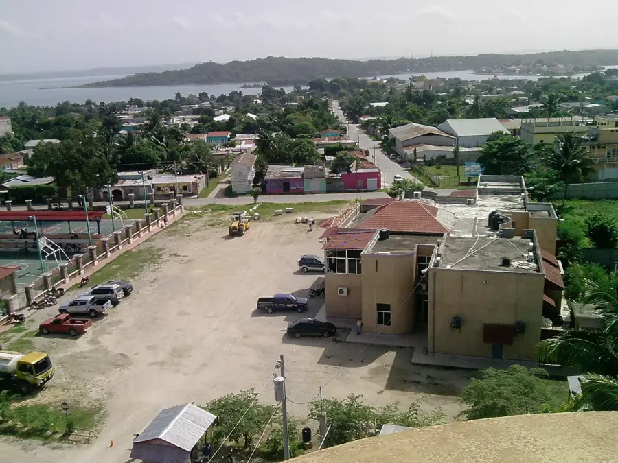
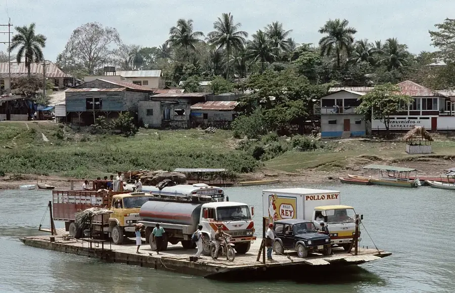
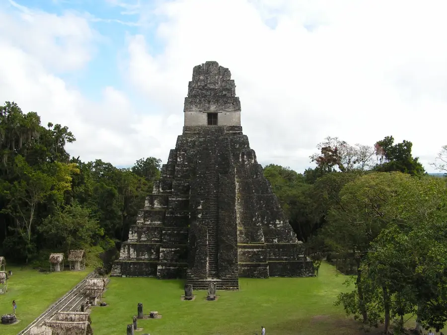
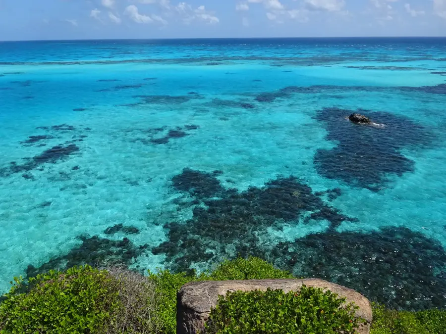
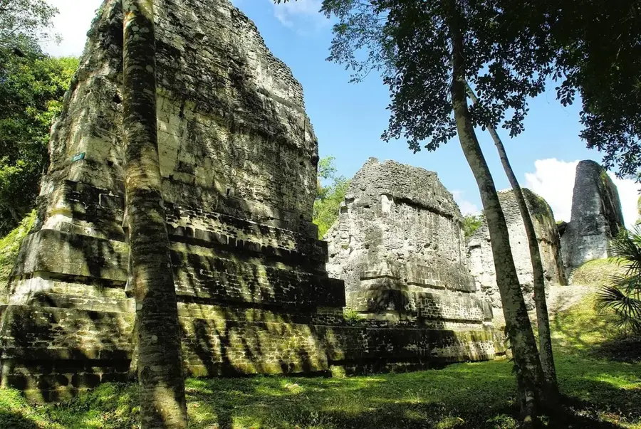
Flores is the administrative center of Guatemala's northernmost department, Petén, and is uniquely situated on a small island in Lake Petén Itzá. Linked to the mainland by a causeway, it forms a conurbation with the neighboring towns of Santa Elena and San Benito. The island's history is legendary; it was the site of Nojpetén, the capital of the Itzá Maya and the very last Maya city to fall to the Spanish conquerors in 1697, over 150 years after the fall of the Aztec and Inca empires. Modern Flores has transformed into a bustling tourism hub, serving as the primary base for expeditions to the monumental ruins of Tikal, Uaxactún, and El Mirador. The town's layout is characterized by concentric streets that rise to a central plaza, dominated by a colonial church and government buildings. The architecture is distinctly Caribbean in influence, with pastel-colored houses and red-tiled roofs that create a photogenic urban landscape. The economy is heavily driven by the travel industry, but the city also oversees the management of the Maya Biosphere Reserve, the largest protected area in Central America. Visitors are drawn to the lake's tranquil waters for swimming, kayaking, and sunset boat tours. Despite its remote location, the nearby Mundo Maya International Airport connects Flores to major cities like Guatemala City and Cancun. The local culture is a rich tapestry of Maya heritage and modern influences, celebrated during the island's annual fair in January, which features traditional dances and fireworks over the lake, making Flores a jewel of the Guatemalan jungle.
- Location: Guatemala
- Top sights: Flores Island, Guatemala · Nojpetén · Flores, Petén
- Nearby: Zapotitlán (8 km)
- Population: ~20.464 (2020)
Best time to visit & climate
The most pleasant time to visit is Jan, Feb, Dec.
| Jan | Feb | Mar | Apr | May | Jun | Jul | Aug | Sep | Oct | Nov | Dec | |
|---|---|---|---|---|---|---|---|---|---|---|---|---|
| Avg °C | 22 | 24 | 26 | 29 | 29 | 26 | 26 | 26 | 26 | 25 | 23 | 22 |
| Rain mm | 88 | 51 | 47 | 41 | 137 | 263 | 171 | 224 | 275 | 247 | 148 | 109 |
Geography
Facts
- Flores was established over the ruins of the Maya capital Nojpetén.
- The causeway connecting the island was built in the mid-20th century.
- It is the main supply center for jungle archaeological projects.
- The city celebrates its principal festival from January 2nd to 15th.
- Lake Petén Itzá covers an area of approximately 99 square kilometers.
- The island’s streets are intentionally narrow to discourage car traffic.
- Flores has one of the highest densities of hotels per capita in Guatemala.
- The average annual temperature in the city is 27°C (81°F).
Explore nearby
Notable places around
Route planner — Car & Motorhome
Where do you start? We build the route here, with stops and country notes along the way.
© OpenStreetMap contributors · OpenRouteService
Sights in the town Flores (3)
Frequently asked questions
Why is Flores a special place?
Is Flores the gateway to Tikal?
What can you do on the lake?
Is there an airport nearby?
When is the best time to visit Flores?
Flores: where is it located?
Flores: what is there to see?
Flores: when is the best time to visit?
Flores: why is it worth visiting?

Nearby cities
Nature
More places