Plizio Visual Lab
Sayaxché
ℹ️Practical info — Sayaxché
▾
🌤 Weather — 5 days
📍 Nearby
Sights nearby
💡 Tips
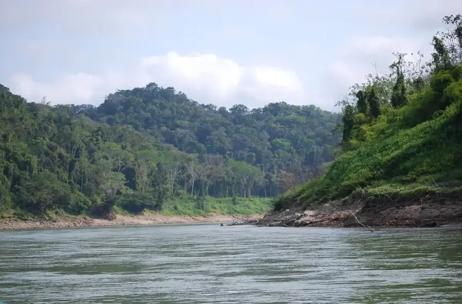
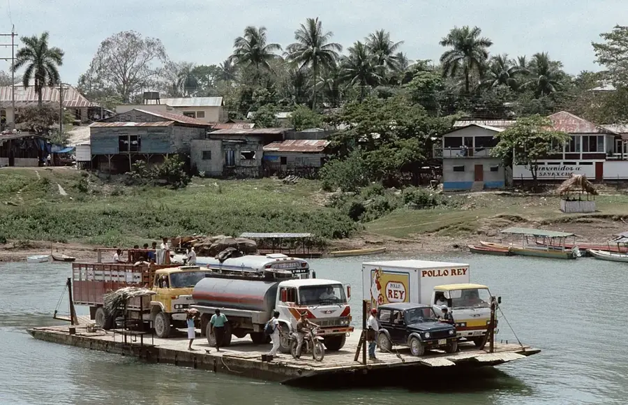
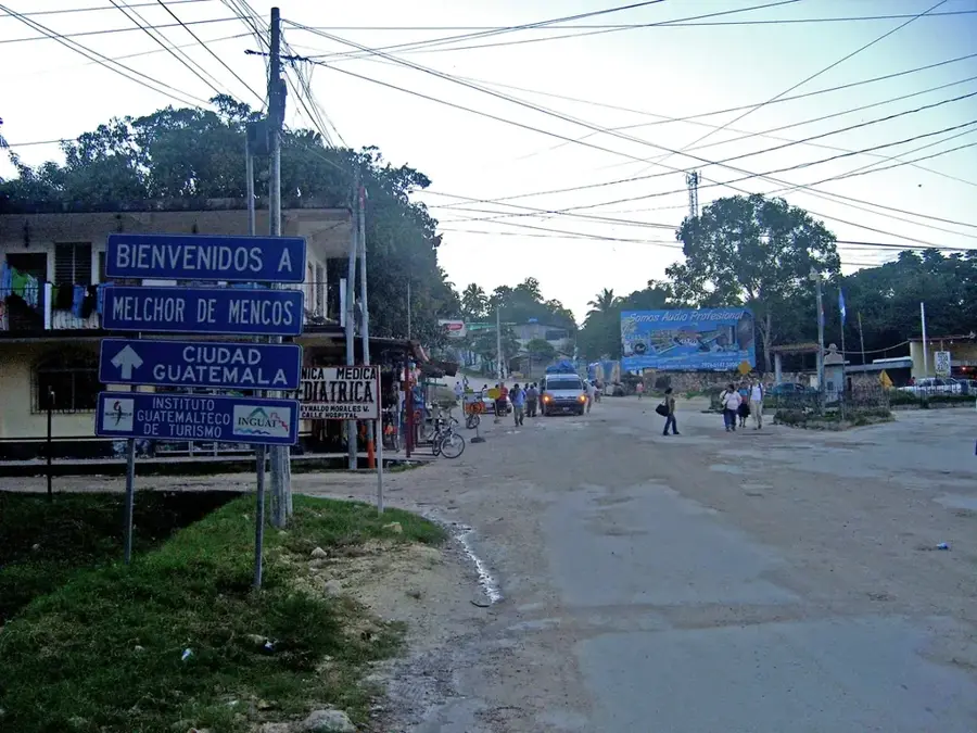
- The town is divided by the Río de la Pasión; you must use the ferry or small boats (lanchas) to cross.
- It serves mainly as a launchpad for deep-jungle Maya sites like Ceibal and Aguateca.
- Bring plenty of cash (Quetzales) as ATMs can be unreliable or empty.
- Insect repellent and sun protection are absolute musts for any river or ruin excursions.
🍽 Food
This local river fish is often served fried in simple eateries near the river docks.
A hearty hen soup, a local favorite available in the market comedores.
Refreshing tropical drinks sold at small stands near the ferry crossing.
🛍 Shopping · 🧘 Quiet spots
The local market is best for stocking up on water, snacks, and basic gear for ruin tours.
Buy locally grown bananas and citrus fruits at the main market.
Hiring a lancha for a slow river trip on the Río de la Pasión is incredibly peaceful and great for bird watching.
Walk away from the busy ferry crossing for quiet spots overlooking the water.
Water temperature…
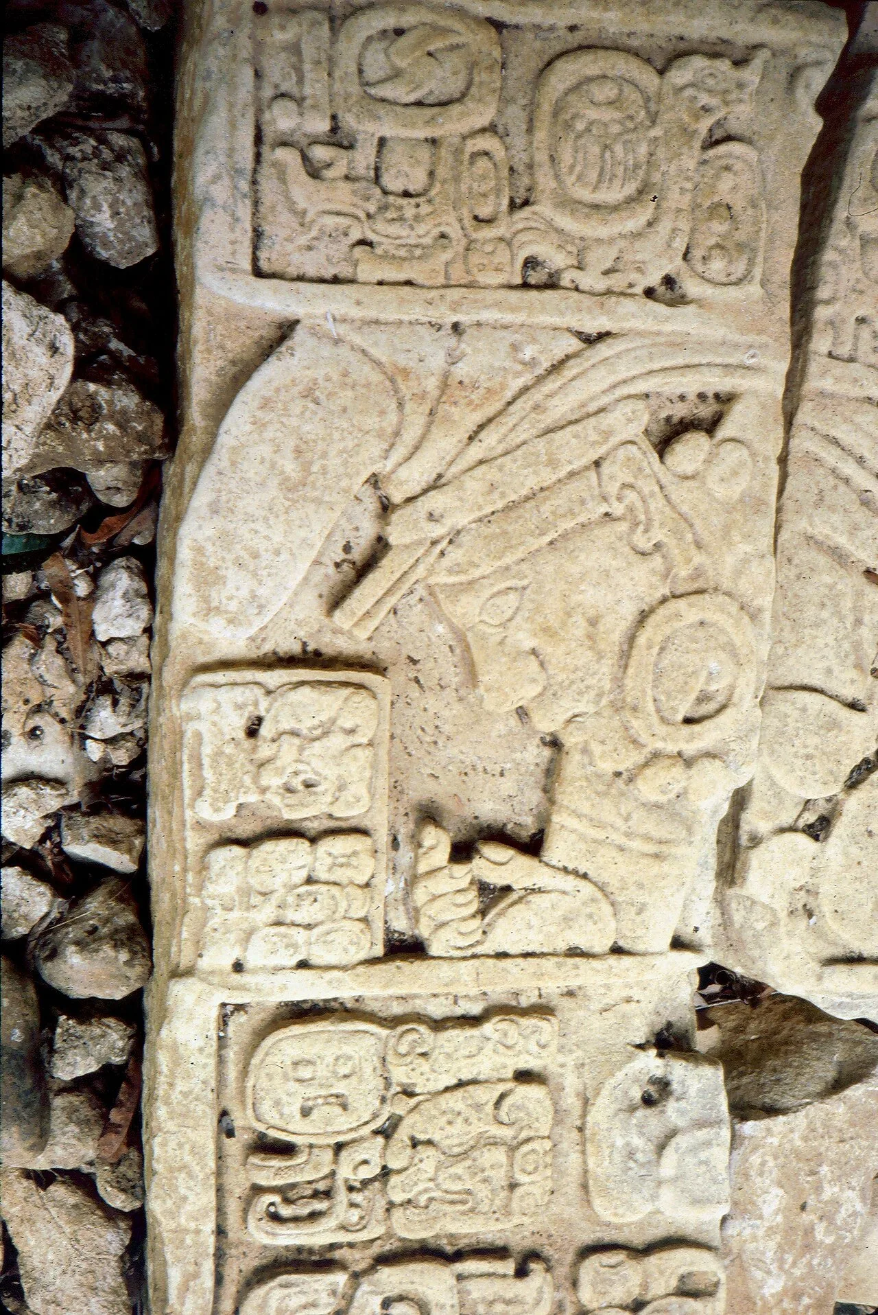
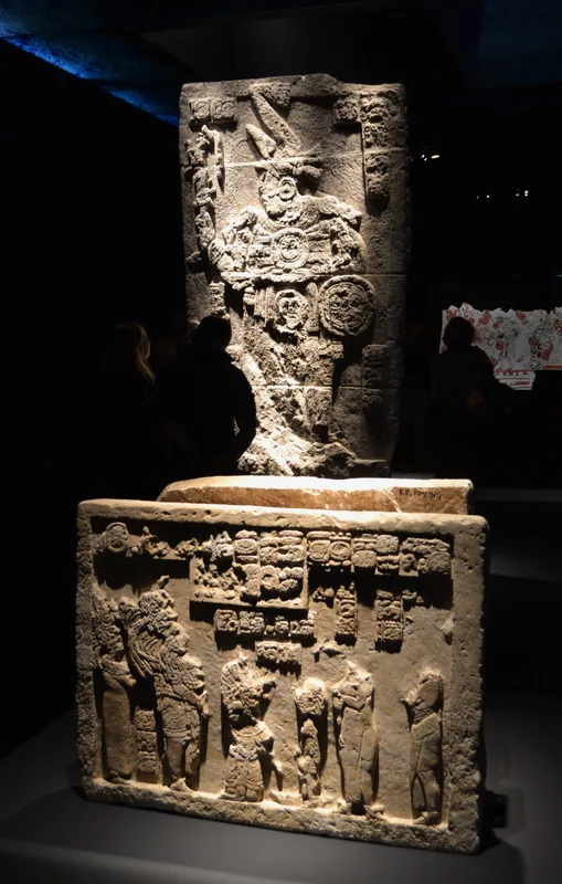
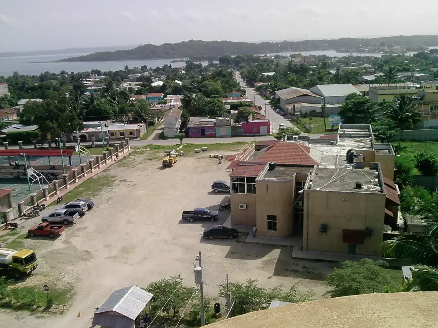
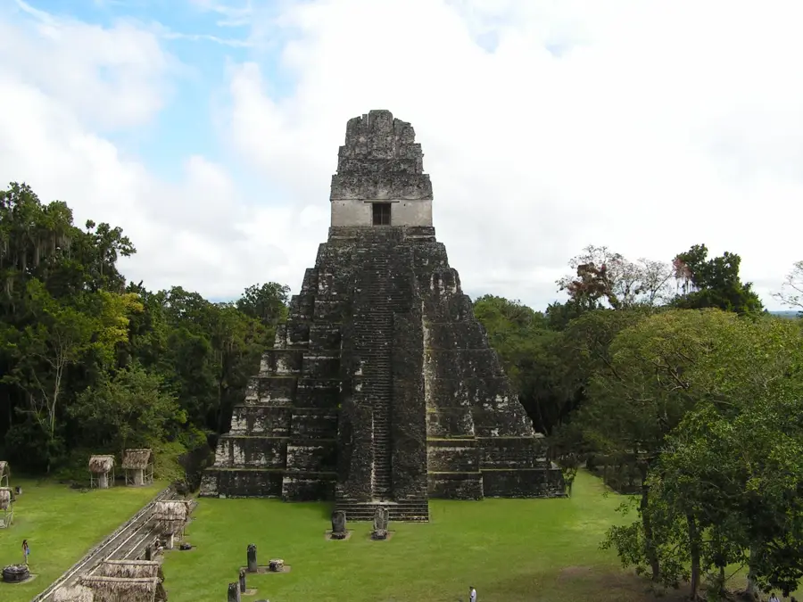
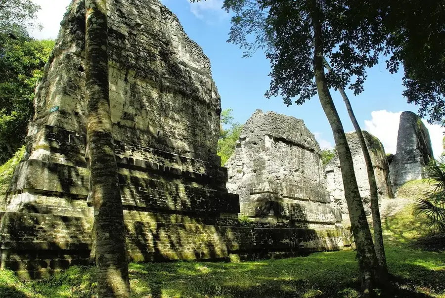
Sayaxché is a fascinating river town in the Petén Department of northern Guatemala, situated on the banks of the majestic Pasión River. The town was officially established as a municipality in 1929 and originally served as a vital outpost for timber exports and chicle resin extraction. Today, Sayaxché is the primary gateway to some of the country's most impressive Maya ruins, including Aguateca, Dos Pilas, and Ceibal, which are accessible only by boat or jungle trails. Geographically, the town is defined by its location along a major waterway, with a ferry being the only connection for vehicles across the river. The local economy has shifted in recent decades from forestry to large-scale oil palm cultivation and petroleum extraction. The surroundings of Sayaxché are rich in biodiversity, particularly in the wetlands of Lake Petexbatún, which serves as a sanctuary for rare animal species. Culturally, the town is a blend of indigenous Maya groups and Ladino settlers, reflected in local cuisine and festive customs. Despite its remote location in the deep jungle of Petén, Sayaxché is steadily developing into a significant center for science and ecotourism.
- Location: Guatemala
- Top sights: Parque Nacional el Rosario · Cruze
- Nearby: Chiquimulilla (6 km)
- Population: ~9.100 (2017)
Best time to visit & climate
The most pleasant time to visit is Jan, Feb, Dec.
| Jan | Feb | Mar | Apr | May | Jun | Jul | Aug | Sep | Oct | Nov | Dec | |
|---|---|---|---|---|---|---|---|---|---|---|---|---|
| Avg °C | 22 | 24 | 26 | 29 | 29 | 26 | 26 | 26 | 26 | 25 | 23 | 22 |
| Rain mm | 93 | 58 | 51 | 46 | 145 | 269 | 189 | 242 | 307 | 257 | 153 | 110 |
Geography
Facts
- Sayaxché is located at an elevation of approximately 125 meters above sea level.
- The municipality was officially founded on December 4, 1929.
- The town is accessible to vehicles only via a ferry across the La Pasión River.
- The ancient Maya center of Ceibal is located just a few kilometers downstream.
- The region is one of the primary areas for palm oil production in Guatemala.
- The patronal festival is celebrated annually on June 13 in honor of Saint Anthony.
Explore nearby
Notable places around
Route planner — Car & Motorhome
Where do you start? We build the route here, with stops and country notes along the way.
© OpenStreetMap contributors · OpenRouteService
Frequently asked questions
What is the main attraction in Sayaxché?
How many days should you plan for?
Are there nature reserves nearby?
What is the local climate like?
Can you reach Sayaxché by car?
Sayaxché: where is it located?
Sayaxché: what is there to see?
Sayaxché: when is the best time to visit?
Sayaxché: why is it worth visiting?

Nearby cities
Nature
More places