Plizio Visual Lab
Chaparrastique Volcano
Weather…
Water temperature…
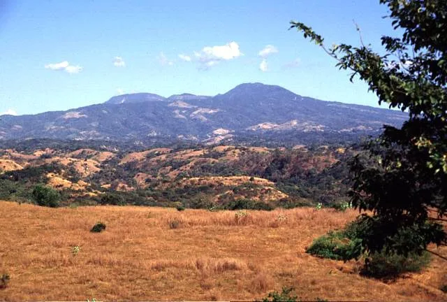
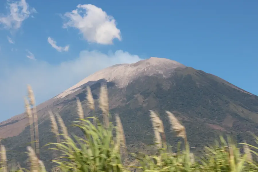
The Chaparrastique volcano, also known as San Miguel, is one of the most active stratovolcanoes in El Salvador, rising to an elevation of 2,130 meters. Located in the eastern part of the country near the city of San Miguel, it is renowned for its nearly great symmetrical cone shape and basaltic composition. Geologically, it has a long history of frequent eruptions, with significant recent activity recorded in 2013 and 2022, characterized by ash plumes and gas emissions. While the lower slopes are covered in coffee plantations, the upper reaches remain barren due to persistent volcanic activity and toxic gas discharge. The volcano is under constant surveillance by geologists to protect the large population living in its vicinity from potential hazards. For the local people, Chaparrastique is both a source of fertile soil and a constant reminder of the geological forces that shape the Salvadoran landscape.
- Location: El Salvador
- Nearby: San Rafael Oriente (6 km)
Best time to visit & climate
The most pleasant time to visit is Jan, Nov, Dec.
| Jan | Feb | Mar | Apr | May | Jun | Jul | Aug | Sep | Oct | Nov | Dec | |
|---|---|---|---|---|---|---|---|---|---|---|---|---|
| Avg °C | 27 | 28 | 29 | 29 | 28 | 27 | 28 | 27 | 26 | 26 | 26 | 26 |
| Rain mm | 3 | 4 | 6 | 32 | 169 | 193 | 155 | 198 | 234 | 204 | 41 | 10 |
📋 Practical info
Geography
Facts
- The peak reaches an elevation of 2,130 meters above sea level.
- It is recognized as one of the most active volcanoes in El Salvador.
- A major ash eruption occurred on December 29, 2013.
- The central crater measures approximately 800 meters in diameter.
- The volcano is primarily composed of basaltic lava and scoria.
- It is located only 11 kilometers from the city of San Miguel.
Explore nearby
Notable places around
Route planner — Car & Motorhome
Where do you start? We build the route here, with stops and country notes along the way.
© OpenStreetMap contributors · OpenRouteService
Sights in the town Chaparrastique Volcano (1)
Sights nearby
Frequently asked questions
Is the volcano accessible for hikers?
How dangerous is this volcano?
Are there guided tours?
What makes the volcano special?
Can you photograph the volcano from a distance?
Chaparrastique Volcano: where is it located?
Chaparrastique Volcano: when is the best time to visit?
Chaparrastique Volcano: why is it worth visiting?

Nearby cities


History & landmarks


Nature


More places