Plizio Visual Lab
Cerro Cacahuatique

Weather…
Water temperature…
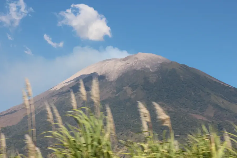
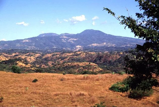
Cerro Cacahuatique is an imposing extinct volcano located in northeastern El Salvador, near Ciudad Barrios in the Morazán Department. Reaching an elevation of approximately 1,663 meters above sea level, it is one of the most prominent peaks in the country's eastern region. The name Cacahuatique is of Lenca origin, meaning 'Mountain of the Cocoa Gardens,' reflecting the ancient agricultural history of the site. Geologically, the mountain is an old volcanic complex whose original crater has been significantly altered by millions of years of erosion. Today, Cacahuatique is best known for the numerous telecommunications towers and antennas situated at its summit, which are critical for the nation's broadcasting infrastructure. The mountain's slopes are blanketed with extensive coffee plantations, famous for producing high-quality altitude coffee. In El Salvador's recent history, the peak was a highly strategic location during the civil war due to its commanding view over the Torola River valley. The remaining forest patches provide habitat for a rich variety of flora and fauna, including various birds of prey and wild orchids.
- Location: El Salvador
- Top sights: Ciudad Barrios · Ciudad Barrios prison
- Nearby: San Miguel (7 km)
Best time to visit & climate
The most pleasant time to visit is Jan, Nov, Dec.
| Jan | Feb | Mar | Apr | May | Jun | Jul | Aug | Sep | Oct | Nov | Dec | |
|---|---|---|---|---|---|---|---|---|---|---|---|---|
| Avg °C | 22 | 23 | 25 | 26 | 25 | 23 | 23 | 23 | 23 | 22 | 21 | 21 |
| Rain mm | 9 | 8 | 9 | 36 | 165 | 193 | 136 | 177 | 229 | 183 | 44 | 19 |
📋 Practical info
Geography
Facts
- The summit elevation is recorded at 1,663 meters.
- The name Cacahuatique translates to 'Mountain of Cocoa Gardens'.
- It is located in the Morazán Department near Ciudad Barrios.
- The peak is a major hub for national telecommunications towers.
- It was a key strategic point during the Salvadoran Civil War.
- The mountain is an extinct volcano with highly fertile soils.
Explore nearby
Notable places around
Route planner — Car & Motorhome
Where do you start? We build the route here, with stops and country notes along the way.
© OpenStreetMap contributors · OpenRouteService
Sights in the town Cerro Cacahuatique (2)
Sights nearby
Frequently asked questions
What are the highlights at Cerro Cacahuatique?
Is there gastronomy nearby?
Is the summit popular with locals?
Do I need special maps?
Are there parking fees?
Cerro Cacahuatique: where is it located?
Cerro Cacahuatique: what is there to see?
Cerro Cacahuatique: when is the best time to visit?
Cerro Cacahuatique: why is it worth visiting?

Nearby cities


History & landmarks


Nature


More places