Plizio Visual Lab
Tecapa Range
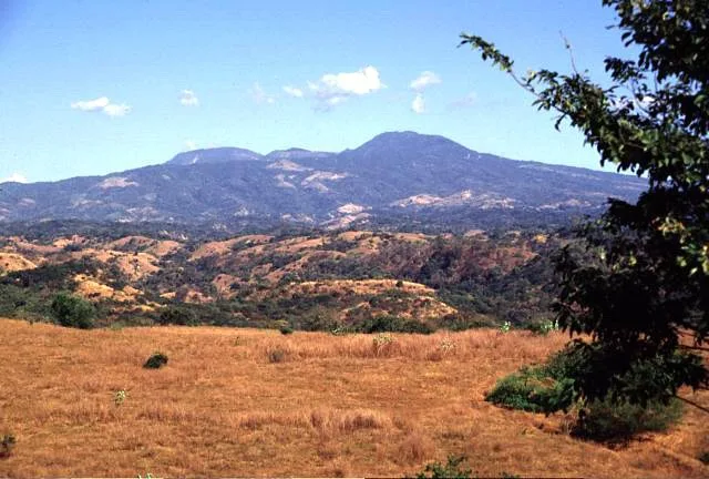
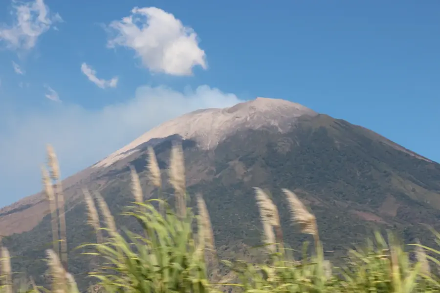
The Sierra Tecapa-Chinameca is a prominent volcanic mountain range in eastern El Salvador, stretching through the Usulután Department. The range consists of several volcanic peaks, the most famous being the Tecapa volcano, which features the easy on the eye Laguna de Alegría in its crater. Geological activity in the region remains high, evidenced by numerous fumaroles and thermal springs, as well as the significant use of geothermal energy for electricity production. The Sierra is characterized by lush vegetation and a cooler climate, which favors the cultivation of excellent high-altitude coffee. Historically, the region was an indigenous settlement area before becoming a hub for the coffee industry in the 19th century. Today, Sierra Tecapa is a key destination for ecotourism, with towns like Alegría and Berlin known for their scenic beauty and colonial-style atmosphere. Preserving the biodiversity in the remaining forest fragments is a central task for local conservation efforts.
- Location: El Salvador
- Top sights: Tecapa · Alegría, El Salvador
- Nearby: Santiago de María (4 km)
Best time to visit & climate
The most pleasant time to visit is Jan, Nov, Dec.
| Jan | Feb | Mar | Apr | May | Jun | Jul | Aug | Sep | Oct | Nov | Dec | |
|---|---|---|---|---|---|---|---|---|---|---|---|---|
| Avg °C | 27 | 28 | 29 | 29 | 28 | 27 | 28 | 27 | 26 | 26 | 26 | 26 |
| Rain mm | 3 | 4 | 6 | 32 | 169 | 193 | 155 | 198 | 234 | 204 | 41 | 10 |
📋 Practical info
Geography
Facts
- Sierra Tecapa is home to the Laguna de Alegría, famous for its color.
- The highest peak in the range reaches 1,593 meters above sea level.
- The Berlin Geothermal Plant is a major source of renewable energy.
- The range is a primary producer of specialty 'strictly high grown' coffee.
- Fumaroles and hot mud pools are common throughout the range.
- The area is known for its biodiversity, including diverse orchid species.
Explore nearby
Notable places around
Route planner — Car & Motorhome
Where do you start? We build the route here, with stops and country notes along the way.
© OpenStreetMap contributors · OpenRouteService
Sights in the town Tecapa Range (2)
Sights nearby
Frequently asked questions
What is special about the Sierra de Tecapa?
Can you swim in the lagoon?
Are the hiking trails difficult?
Are there good viewpoints there?
Do you need a guide?
Tecapa Range: where is it located?
Tecapa Range: what is there to see?
Tecapa Range: when is the best time to visit?
Tecapa Range: why is it worth visiting?

Nearby cities


History & landmarks


Nature


More places