Plizio Visual Lab
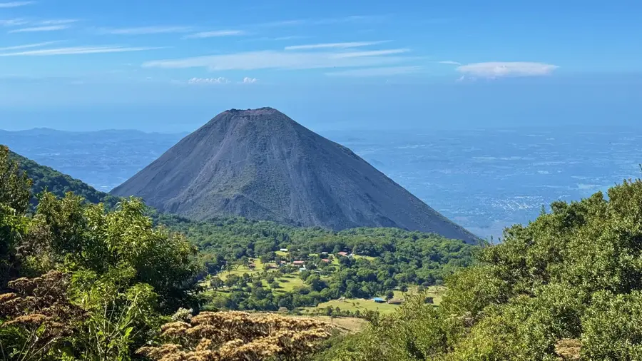
Cerro El Aguila

Weather…
Water temperature…
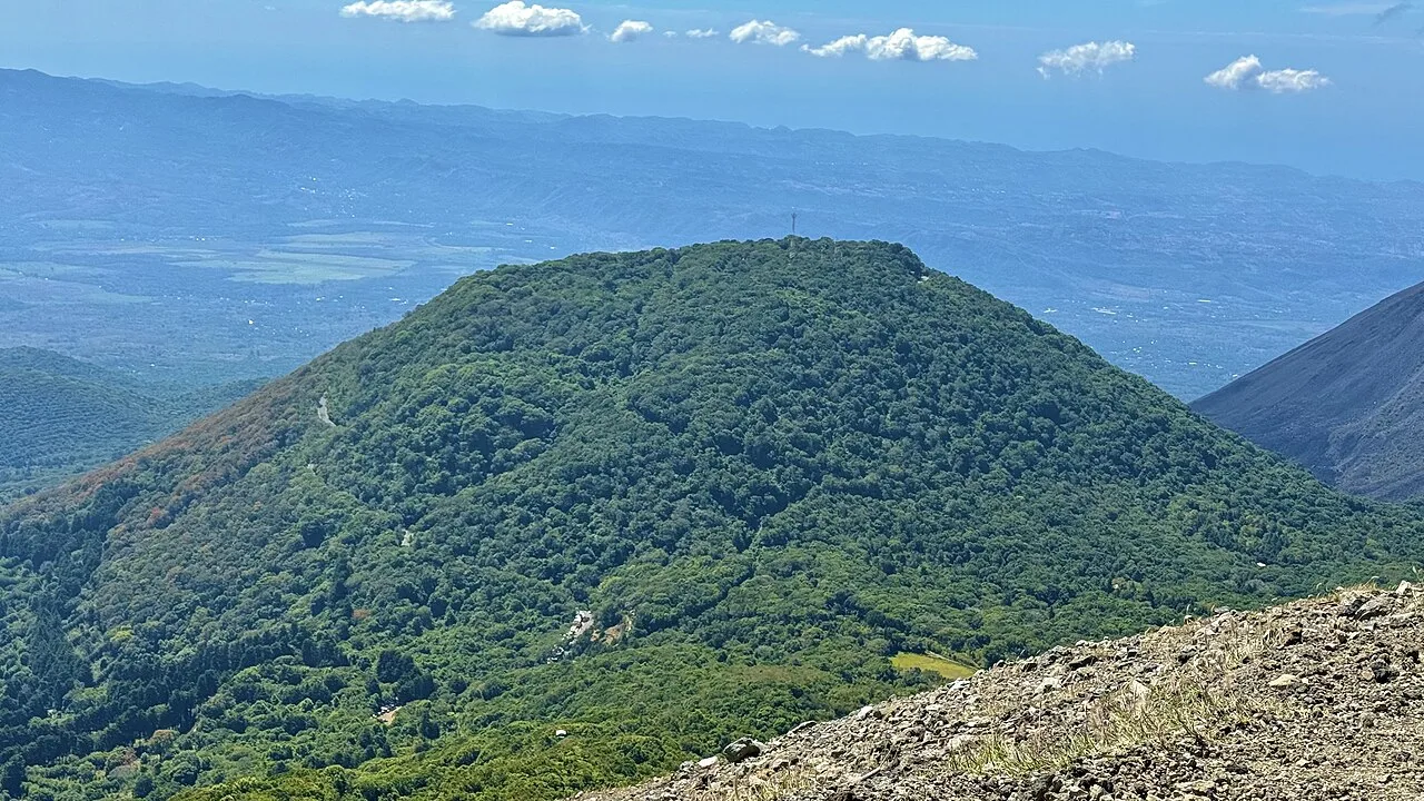
Cerro El Águila is one of the most prominent peaks in the Sierra de Apaneca-Ilamatepec mountain range in western El Salvador, reaching an elevation of approximately 2,036 meters above sea level. This mountain is part of an ancient volcanic complex and is characterized by its dense cloud forests, which host a variety of flora and fauna rare for the region. The slopes are extensively used for growing high-altitude coffee, which is a cornerstone of the economy in the Santa Ana Department. Geographically, the mountain serves as a vital watershed, contributing significantly to the regulation of the local microclimate and water supply. Hikers are drawn to its cooler temperatures and the expansive views that, on clear days, extend all the way to the Pacific coast. The protection of this ecosystem is a high ecological priority for Salvadoran conservation authorities due to the ongoing pressure from agricultural expansion.
- Location: El Salvador
- Nearby: Juayúa (6 km)
📋 Practical info
Geography
Facts
- The peak stands at an elevation of 2,036 meters above sea level.
- It is located within the Santa Ana Department in western El Salvador.
- The mountain belongs to the Sierra de Apaneca-Ilamatepec range.
- It features one of the few remaining cloud forests in the country.
- The area provides essential water resources for local communities.
- The slopes are famous for producing award-winning high-altitude coffee.
Explore nearby
Notable places around
Route planner — Car & Motorhome
Where do you start? We build the route here, with stops and country notes along the way.
© OpenStreetMap contributors · OpenRouteService
Sights in the town Cerro El Aguila (1)
Sights nearby
Frequently asked questions
Are there hiking trails there?
Is Cerro El Águila suitable for beginners?
What is the best starting point?
Is there much shade?
Is the view good?
Cerro El Aguila: where is it located?
Cerro El Aguila: why is it worth visiting?

Nearby cities


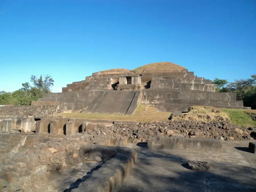
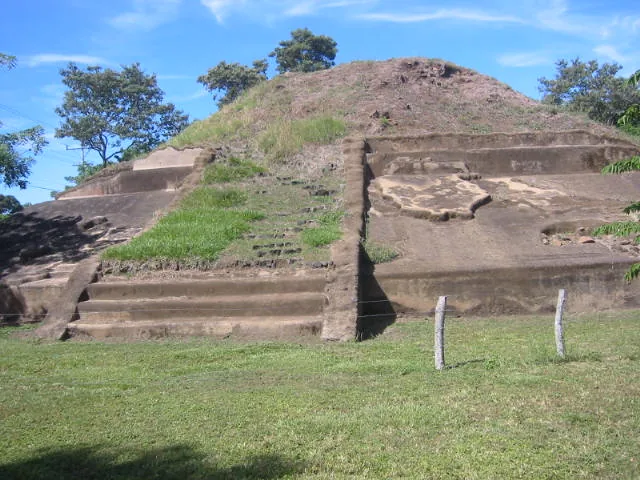
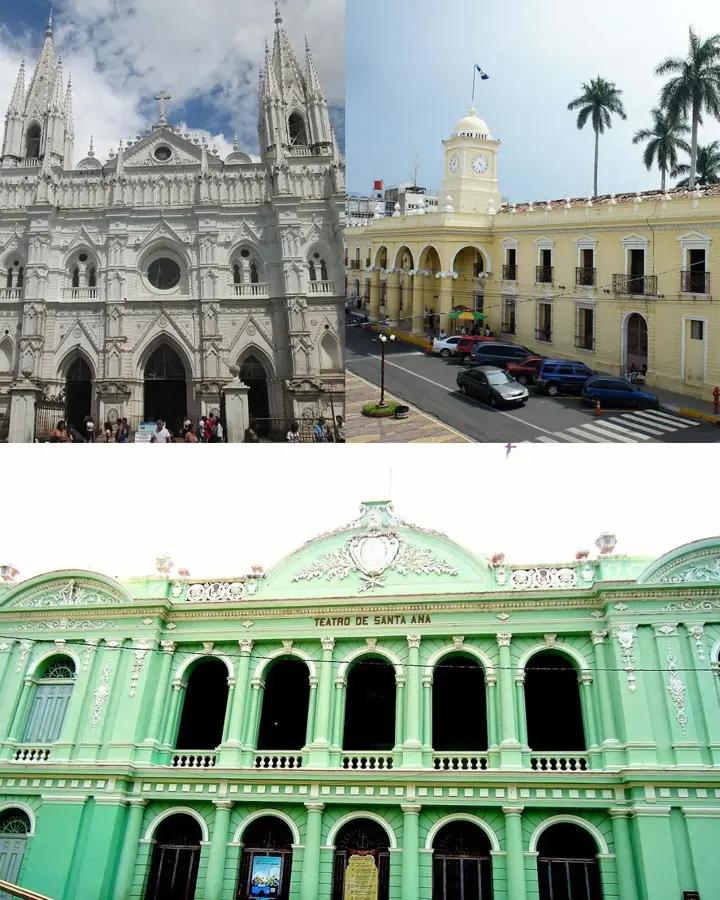
History & landmarks


Nature


More places