Plizio Visual Lab
Conchagua Volcano Viewpoint
Weather…
Water temperature…
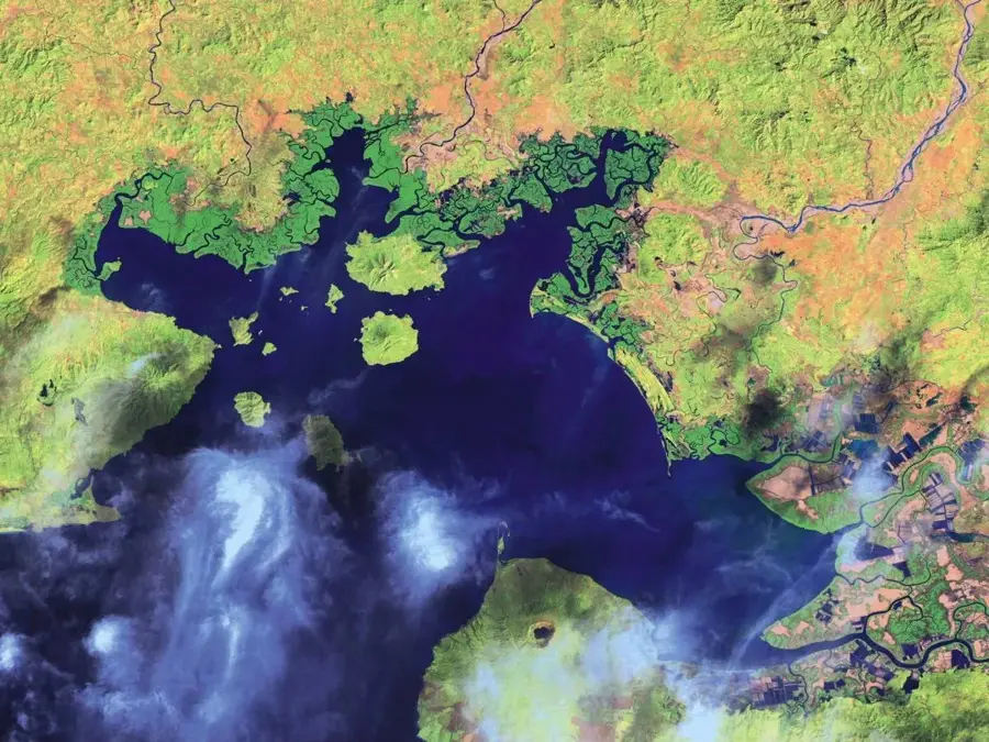
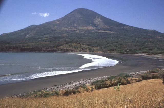
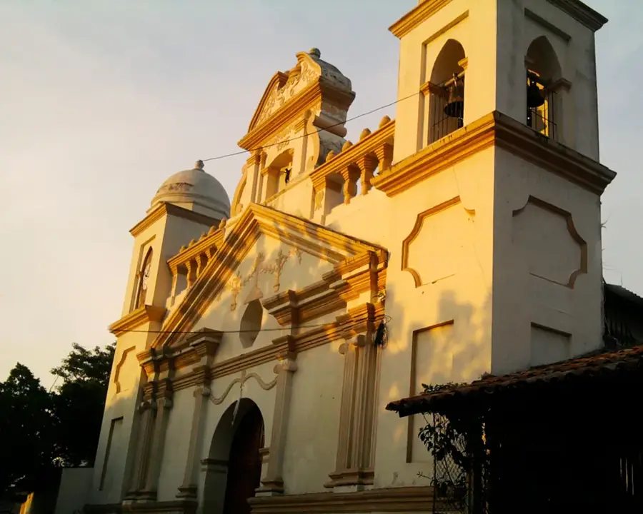
The viewpoint atop Conchagua Volcano provides one of the most spectacular vistas in El Salvador, overlooking the vast Gulf of Fonseca. In the indigenous Lenca language, Conchagua translates to 'flying snake,' reflecting the mountain's mythological significance during the pre-Columbian era. During the Salvadoran Civil War in the 1980s, this elevation served as a critical strategic military observation post used to monitor maritime borders with neighboring Honduras and Nicaragua. The volcano consists of two primary peaks known as Cerro del Piche and Cerro de la Bandera, the latter named after the flag hoisted there during military occupations. Today, the area is a protected nature reserve that attracts hikers and campers drawn to its cool highland climate and unobstructed views of islands like Meanguera and Conchagüita. The ecological diversity of the site encompasses tropical dry forests and cloud forests at higher elevations, providing a sanctuary for various rare wildlife species along the Pacific coast.
- Location: El Salvador
- Top sights: Conchagua (volcano) · Bosque Conchagua · Conchagua
- Nearby: Santa Rosa de Lima (5 km)
Best time to visit & climate
The most pleasant time to visit is Jan, Nov, Dec.
| Jan | Feb | Mar | Apr | May | Jun | Jul | Aug | Sep | Oct | Nov | Dec | |
|---|---|---|---|---|---|---|---|---|---|---|---|---|
| Avg °C | 27 | 28 | 29 | 29 | 28 | 27 | 27 | 27 | 26 | 26 | 26 | 26 |
| Rain mm | 3 | 3 | 6 | 35 | 190 | 199 | 136 | 186 | 246 | 216 | 41 | 10 |
📋 Practical info
Geography
Facts
- The volcano rises to an elevation of approximately 1,225 meters above sea level.
- It features two distinct primary peaks: Cerro del Piche and Cerro de la Bandera.
- From the summit, visitors can see the territories of El Salvador, Honduras, and Nicaragua simultaneously.
- The site was officially designated as a protected nature reserve in 1992.
- The name Conchagua originates from the Lenca language, meaning 'flying snake.'
- The strategic location was heavily utilized for coastal defense and monitoring during the 20th century.
Explore nearby
Notable places around
Route planner — Car & Motorhome
Where do you start? We build the route here, with stops and country notes along the way.
© OpenStreetMap contributors · OpenRouteService
Sights in the town Conchagua Volcano Viewpoint (3)
Sights nearby
Frequently asked questions
When is the best time for the best view at the Conchagua Volcano viewpoint?
Is access to the viewpoint possible for normal cars?
Are there sanitary facilities there?
Should I bring food and drink?
What is the weather like on the volcano?
Conchagua Volcano Viewpoint: where is it located?
Conchagua Volcano Viewpoint: what is there to see?
Conchagua Volcano Viewpoint: when is the best time to visit?
Conchagua Volcano Viewpoint: why is it worth visiting?

Nearby cities


History & landmarks

Nature
More places