Plizio Visual Lab
Zacatillo Island

Weather…
Water temperature…
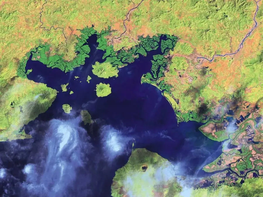
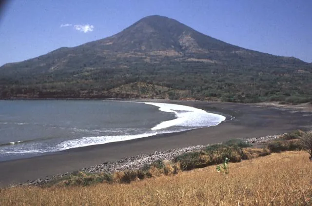
Zacatillo Island is one of the largest and most scenic islands in the Gulf of Fonseca in eastern El Salvador. Belonging to the La Unión Department, it is of volcanic origin, which is evident in its hilly topography and dark-sand beaches. The island covers an area of approximately 4 square kilometers and is surrounded by calm, crystal-clear waters well-suited for snorkeling and swimming. Historically, the island has been an important base for fishing, and today it increasingly serves as a destination for low-impact tourism. The island's inhabitants traditionally rely on fishing and agriculture, with tourism becoming a growing source of income. The vegetation primarily consists of tropical dry forest and coconut palms lining the coast. From its elevations, Zacatillo provides spectacular views of neighboring islands as well as the coasts of Honduras and Nicaragua, which also border the gulf. The island is only accessible by boat from the city of La Unión, contributing to its quiet and secluded atmosphere.
- Location: El Salvador
- Nearby: Concepción de Oriente (6 km)
Best time to visit & climate
The most pleasant time to visit is Jan, Nov, Dec.
| Jan | Feb | Mar | Apr | May | Jun | Jul | Aug | Sep | Oct | Nov | Dec | |
|---|---|---|---|---|---|---|---|---|---|---|---|---|
| Avg °C | 27 | 28 | 29 | 29 | 28 | 27 | 27 | 27 | 26 | 26 | 26 | 26 |
| Rain mm | 3 | 3 | 6 | 35 | 190 | 199 | 136 | 186 | 246 | 216 | 41 | 10 |
📋 Practical info
Geography
Facts
- The island has a total area of approximately 400 hectares.
- The highest point on the island offers panoramic views across three countries.
- The boat trip from La Unión takes about 20 to 30 minutes.
- There are several small beaches such as Playitas and El Chino.
- The island has a small primary school serving the local community.
- Drinking water on the island is primarily obtained through wells.
Explore nearby
Notable places around
Route planner — Car & Motorhome
Where do you start? We build the route here, with stops and country notes along the way.
© OpenStreetMap contributors · OpenRouteService
Sights nearby
Frequently asked questions
How to get there?
Is the island inhabited?
Can you stay overnight?
Are there beaches?
How is the infrastructure?
Zacatillo Island: where is it located?
Zacatillo Island: when is the best time to visit?
Zacatillo Island: why is it worth visiting?

Nearby cities


More places