Plizio Visual Lab
Gulf of Fonseca Mangroves
Weather…
Water temperature…
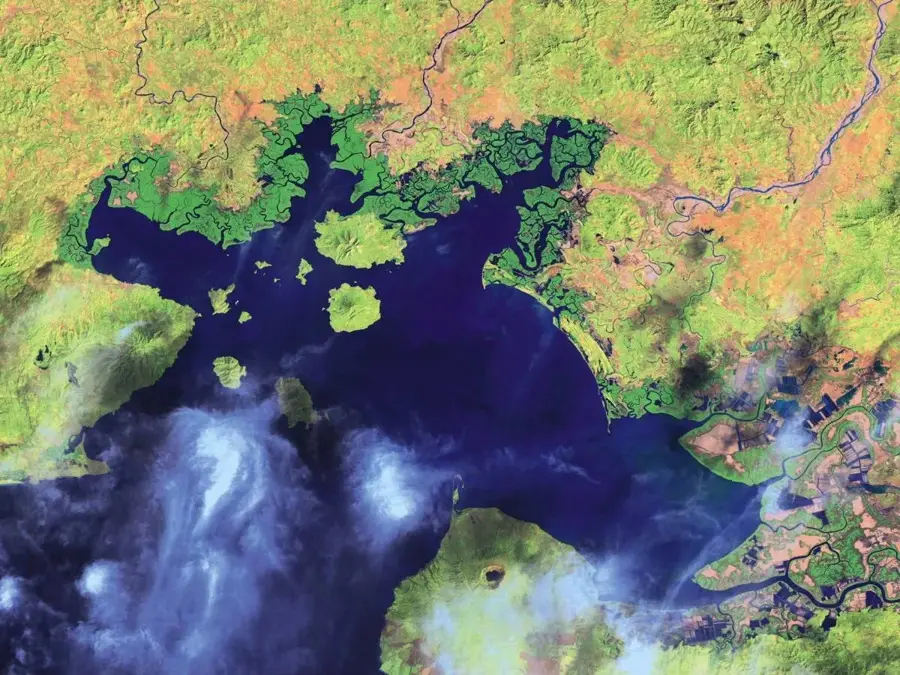
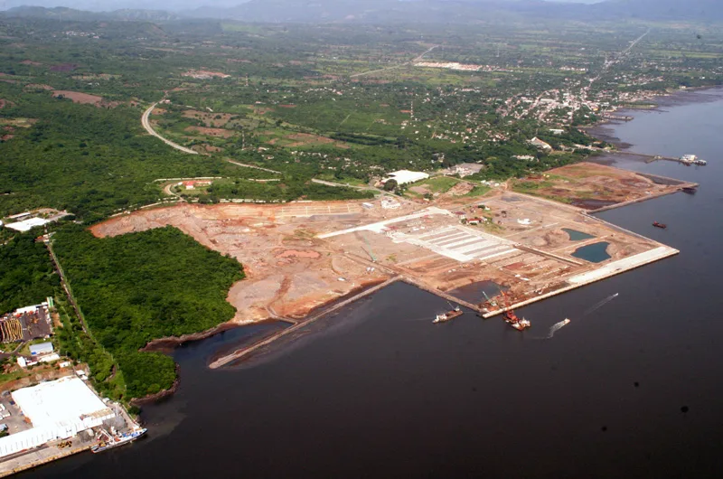
The mangroves of the Gulf of Fonseca span the coastal regions of El Salvador, Honduras, and Nicaragua, forming one of the largest and most productive estuarine ecosystems on Central America's Pacific coast. In El Salvador, this includes significant areas such as the Bay of La Unión and the delta of the Goascorán River. These mangrove forests are primarily composed of species like the red mangrove (Rhizophora mangle) and black mangrove (Avicennia germinans), which are uniquely adapted to fluctuating tides and high salinity. The ecosystem is invaluable to the regional economy, serving as a primary nursery and spawning ground for shrimp and various commercial fish species. Furthermore, the Gulf is a critical stopover and wintering site for thousands of migratory birds traveling along the Pacific Flyway. Despite their importance, these mangroves face threats from shrimp farm expansion and illegal logging. Cooperative international efforts are ongoing to implement sustainable management practices that balance ecological health with the economic needs of the tri-national coastal communities.
- Location: El Salvador
- Nearby: Conchagua (9 km)
Best time to visit & climate
The most pleasant time to visit is Jan, Nov, Dec.
| Jan | Feb | Mar | Apr | May | Jun | Jul | Aug | Sep | Oct | Nov | Dec | |
|---|---|---|---|---|---|---|---|---|---|---|---|---|
| Avg °C | 27 | 28 | 29 | 29 | 28 | 27 | 27 | 27 | 26 | 26 | 26 | 26 |
| Rain mm | 3 | 3 | 6 | 35 | 190 | 199 | 136 | 186 | 246 | 216 | 41 | 10 |
📋 Practical info
Geography
Facts
- Part of one of the most extensive mangrove systems in Pacific Central America.
- The primary breeding and nursery ground for regional shrimp populations.
- Home to over 200 species of birds, including many long-distance migrants.
- Tidal ranges in the Gulf can reach up to 4 meters in depth.
- Dominated by the red mangrove (Rhizophora mangle) species.
- Acts as a natural bio-filter for sediments from inland river basins.
Explore nearby
Notable places around
Route planner — Car & Motorhome
Where do you start? We build the route here, with stops and country notes along the way.
© OpenStreetMap contributors · OpenRouteService
Sights nearby
Frequently asked questions
When is the best time for a boat tour?
Is the water safe for swimming?
Do I need a guide?
Are there many mosquitoes?
How long does a visit take?
Gulf of Fonseca Mangroves: where is it located?
Gulf of Fonseca Mangroves: when is the best time to visit?
Gulf of Fonseca Mangroves: why is it worth visiting?

Nearby cities

More places