Plizio Visual Lab
Cerro El Pital
Weather…
Water temperature…
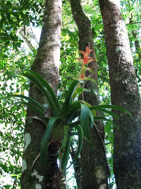
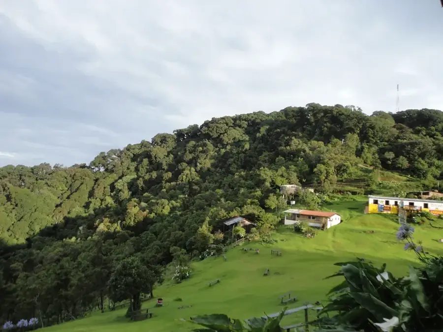
Cerro El Pital, with an elevation of 2,730 meters above sea level, is the highest point in El Salvador and is situated directly on the border with Honduras. It belongs to the Sierra Madre de Chiapas mountain range and is renowned for its cool, often misty climate, which provides a stark contrast to the tropical heat of the lowlands. The region hosts a precious cloud forest where rare plant species such as bromeliads, orchids, and majestic podocarp trees flourish. Hikers appreciate the trails that lead through dense vegetation and offer wide views of the surrounding valleys of both countries. Due to the altitude, temperatures can drop to the freezing point on clear nights, which is a unique phenomenon for the country. The mountain is an important refuge for biodiversity and serves as a significant watershed for the region. For nature lovers, Cerro El Pital gives a rare opportunity to experience the alpine side of Central America and observe the flora and fauna in its untouched form.
- Location: El Salvador
- Nearby: Panchimalco (7 km)
Best time to visit & climate
The most pleasant time to visit is Jan–Mar.
| Jan | Feb | Mar | Apr | May | Jun | Jul | Aug | Sep | Oct | Nov | Dec | |
|---|---|---|---|---|---|---|---|---|---|---|---|---|
| Avg °C | 19 | 21 | 23 | 24 | 24 | 23 | 22 | 23 | 22 | 21 | 20 | 19 |
| Rain mm | 26 | 20 | 19 | 37 | 140 | 193 | 155 | 189 | 218 | 160 | 63 | 36 |
📋 Practical info
Geography
Facts
- The peak elevation is exactly 2,730 meters above sea level.
- Part of the Sierra Madre de Chiapas mountain range in Central America.
- The average annual temperature ranges between 10°C and 16°C.
- Located in the municipality of San Ignacio, Chalatenango department.
- Holds the record for the coldest temperatures ever measured in El Salvador.
- Home to the Quetzal, a rare and culturally significant bird species.
Explore nearby
Notable places around
Route planner — Car & Motorhome
Where do you start? We build the route here, with stops and country notes along the way.
© OpenStreetMap contributors · OpenRouteService
Sights nearby
Frequently asked questions
How difficult is the hike to Cerro El Pital?
When is the best time to visit?
Is there parking at the entrance?
Are there restrooms or restaurants at the summit?
Should I expect extreme cold?
Cerro El Pital: where is it located?
Cerro El Pital: when is the best time to visit?
Cerro El Pital: why is it worth visiting?

Nearby cities


History & landmarks


Nature


More places