Plizio Visual Lab
Brasso Valleys
Weather…
Water temperature…
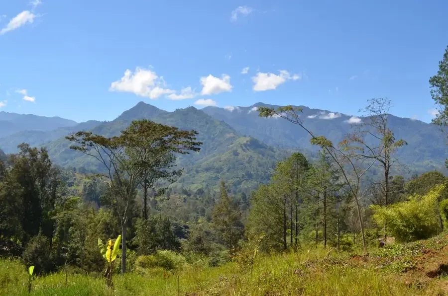
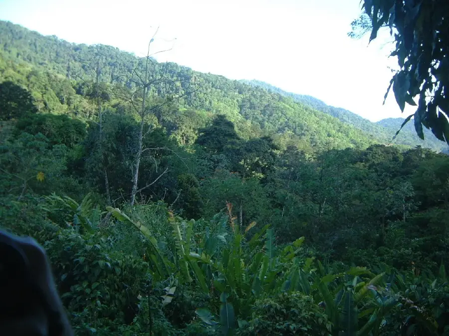
The Brasso Valleys are located within the Central Range of Trinidad, serving as a prime example of a valley landscape shaped by fluvial erosion. The region's geology is dominated by tertiary sedimentary layers, particularly the calcareous clays and siltstones of the Brasso Formation, which are notably rich in marine fossils. These valleys provide good conditions for cocoa cultivation due to their sheltered topography and nutrient-dense soils, a practice that has sustained the local economy for over a century. The landscape is characterized by steep slopes and narrow valley floors drained by the Caparo River and its various tributaries. Historically, the area was linked to the rest of the island via the railway system, which significantly boosted agricultural exports in the early 1900s. Today, Brasso remains a tranquil rural district recognized for the biodiversity of its forest patches and its enduring traditional agricultural heritage.
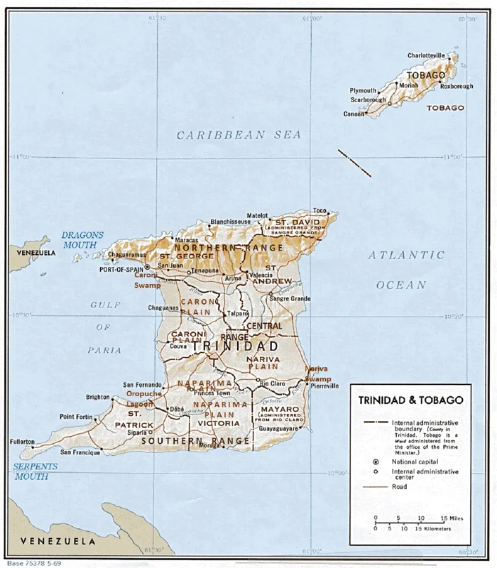
- Location: Trinidad and Tobago
- Nearby: Brothers Road (5 km)
Best time to visit & climate
The most pleasant time to visit is Feb–Apr.
| Jan | Feb | Mar | Apr | May | Jun | Jul | Aug | Sep | Oct | Nov | Dec | |
|---|---|---|---|---|---|---|---|---|---|---|---|---|
| Avg °C | 26 | 26 | 27 | 28 | 28 | 27 | 27 | 27 | 27 | 27 | 27 | 26 |
| Rain mm | 100 | 61 | 52 | 56 | 117 | 222 | 202 | 202 | 141 | 176 | 213 | 178 |
📋 Practical info
Geography
Facts
- Located in the heart of the Central Range
- Features the marine fossil-rich Brasso Formation
- Long-standing center for quality cocoa production
- Drained by the Caparo River and its tributaries
- Characterized by steep valleys and clay-rich soils
- Was formerly a key stop on the island's railway line
Explore nearby
Notable places around
Route planner — Car & Motorhome
Where do you start? We build the route here, with stops and country notes along the way.
© OpenStreetMap contributors · OpenRouteService
Sights in the town Brasso Valleys (1)
Sights nearby
Frequently asked questions
What is the best way to get to Brasso Valleys?
Is the region accessible all year round?
What hiking gear is recommended?
Is there mobile reception there?
Can you explore the nature freely here?
Brasso Valleys: where is it located?
Brasso Valleys: when is the best time to visit?
Brasso Valleys: why is it worth visiting?
More places