Plizio Visual Lab
Navet Dam

Weather…
Water temperature…
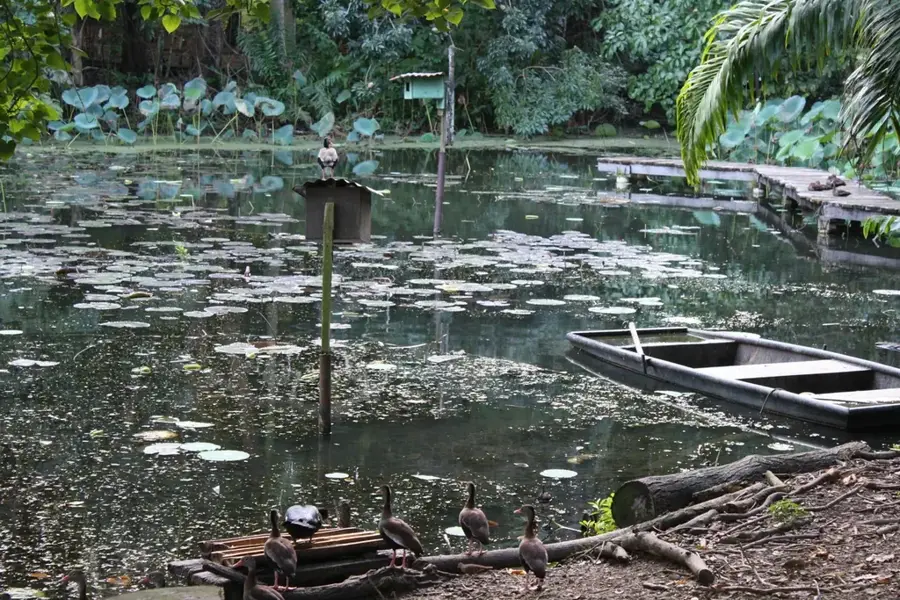
The Navet Dam is the largest drinking water reservoir in Trinidad, located in the Tabaquite region of central Trinidad. Completed in 1962, the dam plays a critical role in the water supply for vast areas of south and central Trinidad, including the city of San Fernando. The reservoir covers a surface area of approximately 324 hectares and is fed by the tributaries of the Navet River. Surrounding the dam is the Navet Sanctuary, a dense forested area that serves as a protected habitat for local flora and fauna. This ecosystem is home to an impressive variety of waterfowl, caimans, and howler monkeys, making it a significant site for biodiversity conservation. Access to the dam is strictly regulated for security purposes and to ensure the continued purity of the water source. The dam's technical infrastructure is managed by the Water and Sewerage Authority (WASA) and remains a cornerstone of the nation's water resource management strategy.
- Location: Trinidad and Tobago
- Nearby: Mamoral (6 km)
Best time to visit & climate
The most pleasant time to visit is Feb–Apr.
| Jan | Feb | Mar | Apr | May | Jun | Jul | Aug | Sep | Oct | Nov | Dec | |
|---|---|---|---|---|---|---|---|---|---|---|---|---|
| Avg °C | 26 | 26 | 27 | 28 | 28 | 27 | 27 | 27 | 27 | 27 | 27 | 26 |
| Rain mm | 100 | 61 | 52 | 56 | 117 | 222 | 202 | 202 | 141 | 176 | 213 | 178 |
📋 Practical info
Geography
Facts
- The Navet Dam project was completed and commissioned in 1962.
- It is the largest surface water reservoir by area in Trinidad.
- The reservoir has a storage capacity exceeding 18 billion gallons.
- The Navet Sanctuary provides a buffer zone of tropical rainforest around the water.
- It serves as the primary water source for the industrial hub of San Fernando.
- The facility is under the strict management of the Water and Sewerage Authority (WASA).
Explore nearby
Notable places around
Route planner — Car & Motorhome
Where do you start? We build the route here, with stops and country notes along the way.
© OpenStreetMap contributors · OpenRouteService
Sights nearby
Frequently asked questions
Can you visit the dam?
Is fishing allowed here?
Are there hiking trails there?
Is the place good for nature photos?
Is a permit required?
Navet Dam: where is it located?
Navet Dam: when is the best time to visit?
Navet Dam: why is it worth visiting?
Nearby cities


Nature
More places