Plizio Visual Lab
Tegucigalpa

ℹ️Practical info — Tegucigalpa
▾
🌤 Weather — 5 days
📍 Nearby
Sights nearby
💡 Tips
- Because the city sits in a valley at over 900 meters elevation, evenings can get quite cool; pack a light jacket.
- For safety, always use radio taxis or ride-hailing apps after dark rather than walking through the streets.
- Traffic congestion is notorious here; always budget extra travel time when crossing the city center.
- The layout is hilly and somewhat chaotic; download offline maps to help navigate the winding roads.
🍽 Food
A traditional bean, cheese, and sometimes chorizo fondue-like dip. Order it as a starter at local Honduran restaurants.
Stuffed corn tortillas. You can find them freshly griddled at street stalls and small eateries across the bustling neighborhoods.
The upscale embassy district of Palmira has excellent cafes where you can enjoy premium local coffee in a secure setting.
🛍 Shopping · 🧘 Quiet spots
Take a short day trip to this nearby colonial town to shop for excellent leather goods and wood carvings.
A sprawling, chaotic market for a raw local experience. Keep a very close eye on your belongings if you go!
Head up to this mountain park for a peaceful escape and a wide-open panoramic view of the entire capital.
The gardens surrounding this major pilgrimage church are surprisingly serene on regular weekdays.
Water temperature…
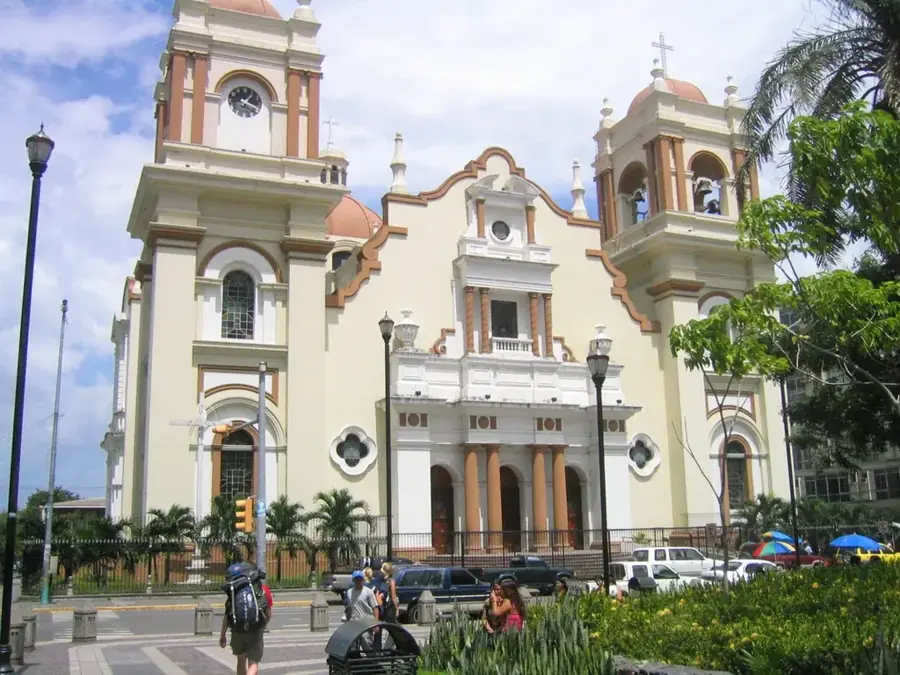
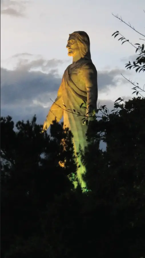
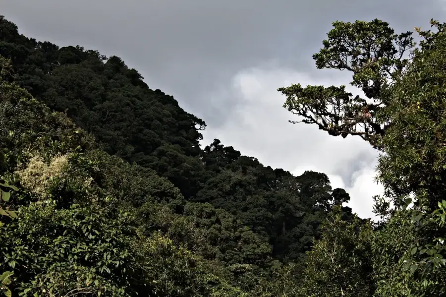
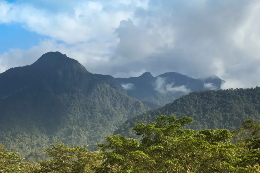
Tegucigalpa, the bustling capital of Honduras, is situated in a high-altitude valley in the central highlands, approximately 990 meters above sea level. Founded in 1578 as a silver mining outpost by Spanish settlers, its name is derived from the Nahuatl language, meaning 'Silver Mountain.' Over the centuries, it evolved from a rugged mining camp into a significant administrative center, eventually becoming the national capital in 1880. Today, Tegucigalpa and its twin city, Comayagüela, form the Central District, the political and economic heart of the nation. The city's geography is uniquely defined by its mountainous terrain, with residential neighborhoods and commercial zones sprawling across steep slopes and narrow ravines, creating a skyline that is both chaotic and visually remarkable. Key landmarks include the monumental Christ at El Picacho, which towers over the city, and the Cathedral of San Miguel Arcángel in the historic plaza. The city serves as the headquarters for the Honduran government and international organizations, while also hosting the country’s leading industrial and financial institutions. Culturally, Tegucigalpa is the nation's premier destination for the arts, home to the National Theatre Manuel Bonilla and the Museum of National Identity (MIN), which has immersive exhibits on Honduran history. The nearby La Tigra National Park, a vital cloud forest, provides the city with much of its fresh water and serves as an important ecological sanctuary. Despite facing modern urban challenges such as traffic congestion and rapid growth, Tegucigalpa remains a city of profound character and resilience, blending its colonial past with its role as a dynamic 21st-century metropolis. Its animated street life, diverse culinary scene, and panoramic vistas make it the indispensable center of Honduran life.
- Location: Honduras
- Top sights: Francisco Morazán Department · Escuela Nacional de Bellas Artes (Nicaragua) · National Congress of Honduras
- Nearby: Sabanagrande (4 km)
- Population: ~850.848 (2024)
Best time to visit & climate
The most pleasant time to visit is Jan, Feb, Dec.
| Jan | Feb | Mar | Apr | May | Jun | Jul | Aug | Sep | Oct | Nov | Dec | |
|---|---|---|---|---|---|---|---|---|---|---|---|---|
| Avg °C | 21 | 23 | 24 | 26 | 25 | 23 | 23 | 23 | 23 | 22 | 21 | 21 |
| Rain mm | 12 | 11 | 12 | 40 | 161 | 197 | 106 | 128 | 190 | 179 | 48 | 38 |
History & landmarks
1578
Geography
Facts
- Tegucigalpa was founded in 1578 as a silver and gold mining center.
- The city officially became the capital of Honduras on October 30, 1880.
- It is located in the Central District municipality, alongside Comayagüela.
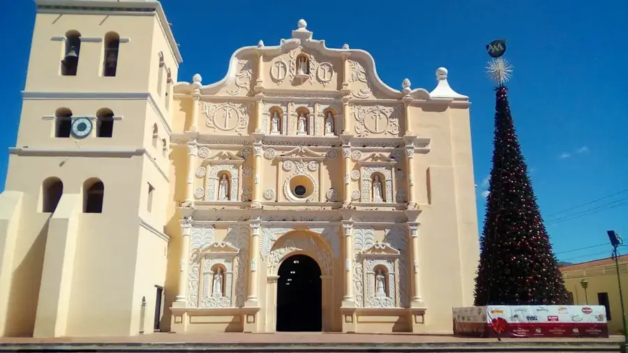
- The Basilica of Our Lady of Suyapa is the most important pilgrimage site in Honduras.
- The Christ at El Picacho was inaugurated in 1997 to commemorate the 425th anniversary.
- Tegucigalpa is one of the few world capitals without a rail transport system.
- The city's climate is tropical highland, with mild temperatures year-round.
- La Tigra National Park, located 22 km away, reaches 2,290 meters in elevation.
Explore nearby
Notable places around
Route planner — Car & Motorhome
Where do you start? We build the route here, with stops and country notes along the way.
© OpenStreetMap contributors · OpenRouteService
Sights in the town Tegucigalpa (3)
Frequently asked questions
How many days should you plan for Tegucigalpa?
What is the best way to get around the city?
Are there dangerous neighborhoods to avoid?
What is the typical food in Tegucigalpa?
Is the city suitable for families with children?
Tegucigalpa: where is it located?
Tegucigalpa: what is there to see?
Tegucigalpa: when is the best time to visit?
Tegucigalpa: why is it worth visiting?

Nearby cities

History & landmarks
Nature
More places