Plizio Visual Lab
Saxon Switzerland National Park
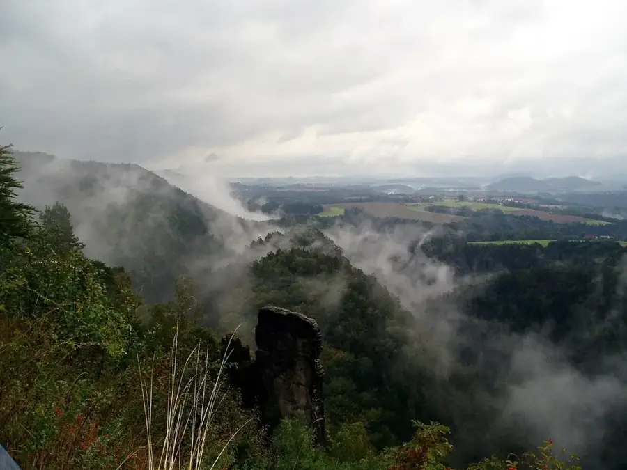
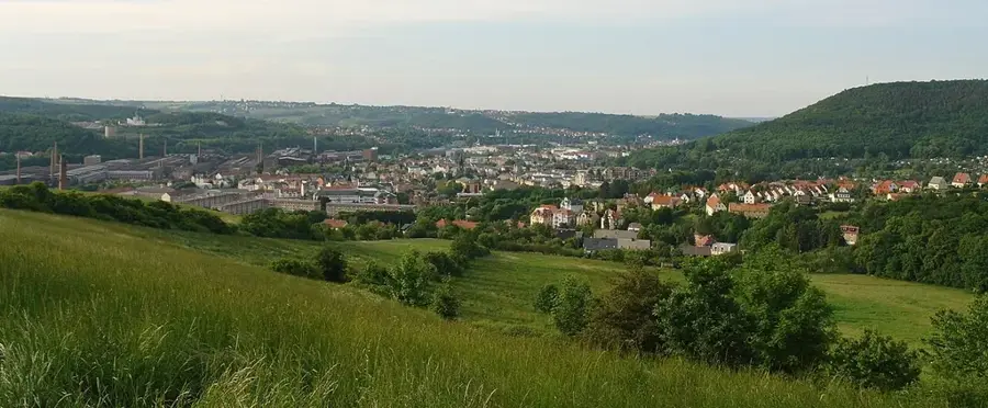
Saxon Switzerland National Park is Germany's only rock national park, spanning an area of approximately 93.5 square kilometers. It was established on October 1, 1990, to provide permanent protection for the unique natural landscape of the Elbe Sandstone Mountains, with its bizarre rock formations and deep gorges. About 75 percent of the area is covered by forest, much of which is allowed to develop naturally without commercial forestry into a 'primeval forest of the future.' The national park serves as a sanctuary for rare animal species such as the peregrine falcon, black stork, and Eurasian otter, which find handy living conditions here. For visitors, the park has a network of over 400 kilometers of marked hiking trails and numerous viewpoints providing spectacular vistas over the Elbe Valley. A key feature is the strict separation between core zones, where nature takes absolute precedence, and accessible areas for recreational activities. The park works closely with the neighboring Bohemian Switzerland National Park in the Czech Republic to ensure transboundary protection of this unique natural environment.
- Location: Saxony, Germany
- Top sights: Elsas Ruh · Konstanzes Weitblick · Götzingerhöhe
- Nearby: Sebnitz (7 km)
Best time to visit & climate
The most pleasant time to visit is Jun–Aug.
| Jan | Feb | Mar | Apr | May | Jun | Jul | Aug | Sep | Oct | Nov | Dec | |
|---|---|---|---|---|---|---|---|---|---|---|---|---|
| Avg °C | -2 | -1 | 3 | 8 | 13 | 17 | 20 | 19 | 14 | 9 | 4 | 0 |
| Rain mm | 61 | 41 | 48 | 38 | 64 | 73 | 87 | 81 | 58 | 54 | 56 | 56 |
📋 Practical info
Geography
Facts
- Area: approx. 93.5 square kilometers
- Established on October 1, 1990
- Over 400 km of marked hiking trails
- Protected area for peregrine falcons
- 75% of the area is forested
- Cross-border cooperation with the Czech Republic
Explore nearby
Notable places around
Route planner — Car & Motorhome
Where do you start? We build the route here, with stops and country notes along the way.
© OpenStreetMap contributors · OpenRouteService
Sights in the town Saxon Switzerland National Park (10)
Götzingerturm
Observation tower on Götzingerhöhe, offering panoramic views of the region.
Richters Berg
Hill in Saxony, near the border with the Czech Republic, wooded.
Unger
Nature reserve in Saxony, protecting rare plant and animal species.
Erlebnisbad Mariba
Outdoor swimming pool with slides and pools in Neustadt, Saxony.
Neustadthalle
Event hall in Neustadt, used for concerts and theatre performances.
Katholische Kirche St. Gertrud
Catholic church in Neustadt, consecrated to Saint Gertrude.
Sights nearby
Frequently asked questions
Is there an entry fee for Saxon Switzerland National Park?
How do I reach the Bastei Bridge most easily?
Is sturdy footwear necessary?
When is the best time to visit?
Are there places to eat in the park?
Saxon Switzerland National Park: where is it located?
Saxon Switzerland National Park: what is there to see?
Saxon Switzerland National Park: when is the best time to visit?
Saxon Switzerland National Park: why is it worth visiting?

Nearby cities