Plizio Visual Lab
Gualaco
ℹ️Practical info — Gualaco
▾
🌤 Weather — 5 days
📍 Nearby
Sights nearby
💡 Tips
- Explore the Susmay Caves with a local guide; bring a flashlight and water-resistant shoes.
- The mountain climate can be cool, especially in the evenings, so pack a light jacket.
- Road access might require a 4x4 vehicle, particularly during the rainy season.
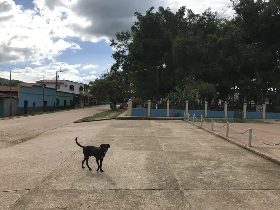
- Visit the local town square to experience the authentic daily life of Olancho.
🍽 Food
Try this local meat and plantain stew at a family-run comedor.
Buy these crispy corn rings fresh from the local village bakeries.
Sample the region's famous cheese at the morning market stalls.
🛍 Shopping · 🧘 Quiet spots
Look in small village workshops for handmade wooden items.
Buy locally roasted beans directly from small grocers.
Take a morning walk toward the national park edge.
A calm spot to listen to the flowing water.
Water temperature…
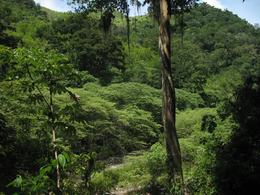
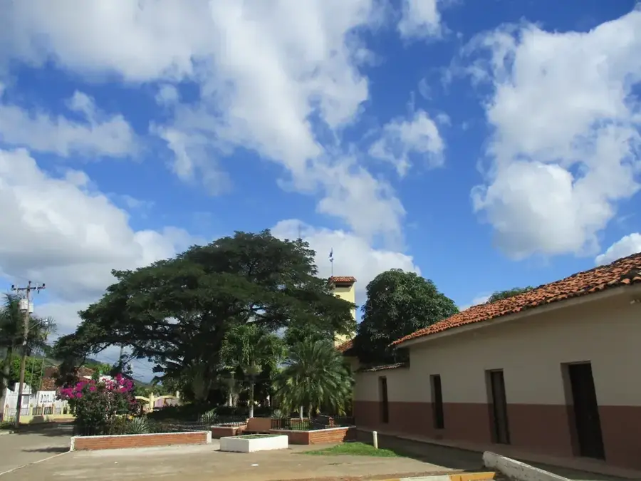
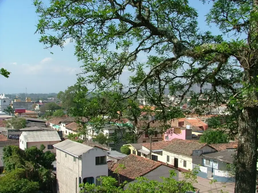
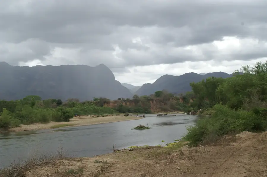
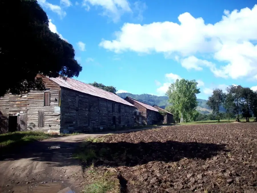
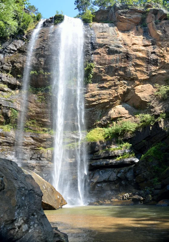
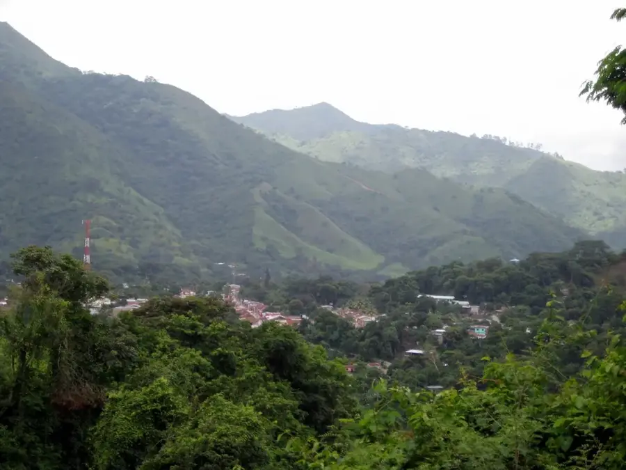
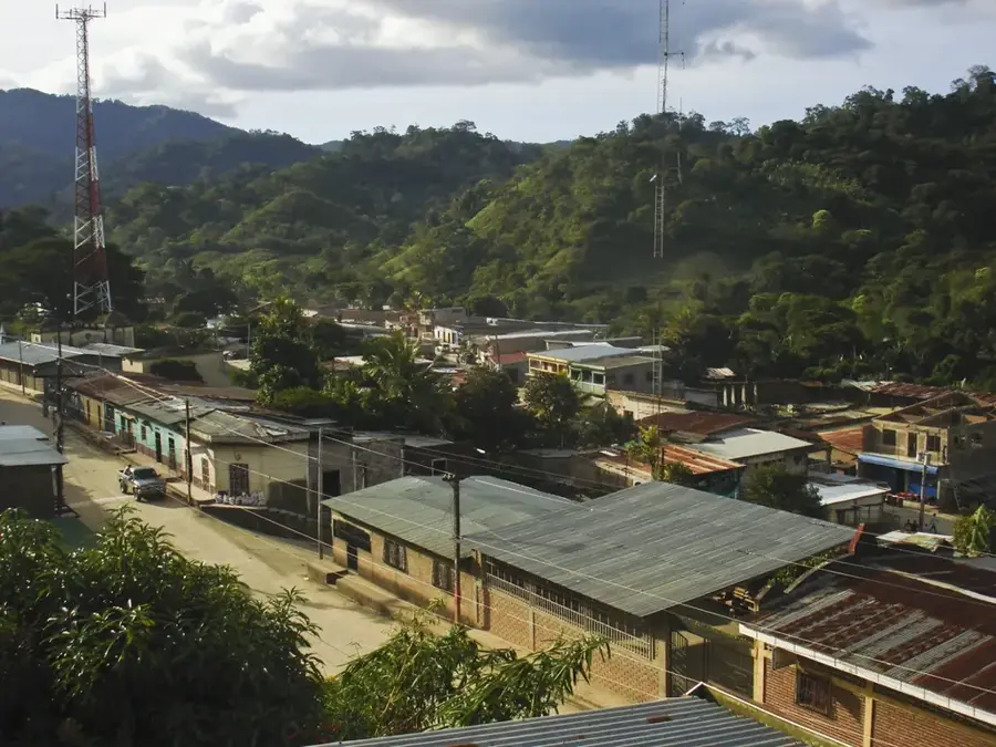
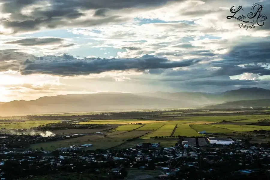
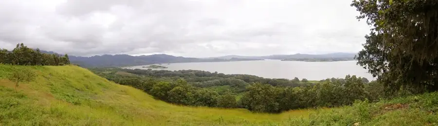
Gualaco lies in Olancho, the largest department of Honduras, and is ringed by the high ridges of the Sierra de Agalta. The municipality is a gateway to one of Central America's most important protected areas, Sierra de Agalta National Park, with its cloud forests, caves and rare bird species such as the resplendent quetzal. Its economy relies on cattle ranching, corn and beans, coffee on higher slopes and timber and other forest products. The town core combines a central park, the parish church and simple commercial streets where farmers, ranchers and travelers come together. The surrounding landscape is a powerful mix of mountain slopes, river valleys and karst zones with extensive cave systems. Gualaco brings together rural life, traditional agriculture and outstanding natural environments in one of the most remote districts of Honduras.
- Location: Honduras
- Nearby: Santa Fe (7 km)
- Population: ~22.327 (2026)
Best time to visit & climate
The most pleasant time to visit is Jan–Mar.
| Jan | Feb | Mar | Apr | May | Jun | Jul | Aug | Sep | Oct | Nov | Dec | |
|---|---|---|---|---|---|---|---|---|---|---|---|---|
| Avg °C | 20 | 21 | 23 | 25 | 25 | 24 | 23 | 23 | 24 | 22 | 21 | 20 |
| Rain mm | 81 | 54 | 45 | 37 | 101 | 147 | 122 | 120 | 125 | 169 | 137 | 93 |
Geography
Facts
- Susmay Caves nearby
- Mountainous landscape
- Agricultural community
- Cattle and coffee production
Explore nearby
Notable places around
Route planner — Car & Motorhome
Where do you start? We build the route here, with stops and country notes along the way.
© OpenStreetMap contributors · OpenRouteService
Frequently asked questions
What is the main attraction of Gualaco?
What is the road there like?
Are there guided tours to the park?
What is the climate like?
When is the town festival?
Gualaco: where is it located?
Gualaco: when is the best time to visit?
Gualaco: why is it worth visiting?

Nearby cities


History & landmarks

Nature
More places