Plizio Visual Lab
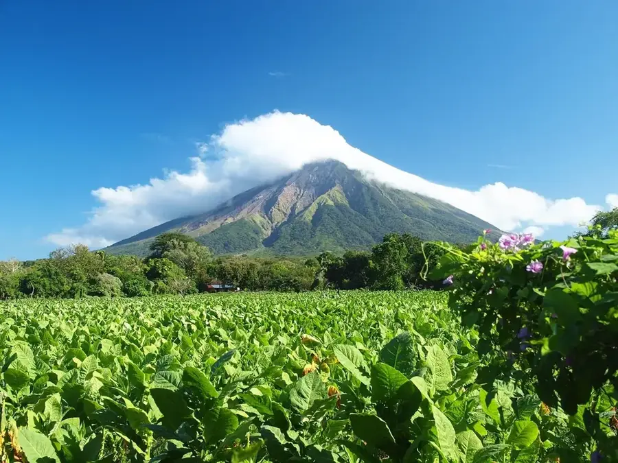
Santa María Volcano
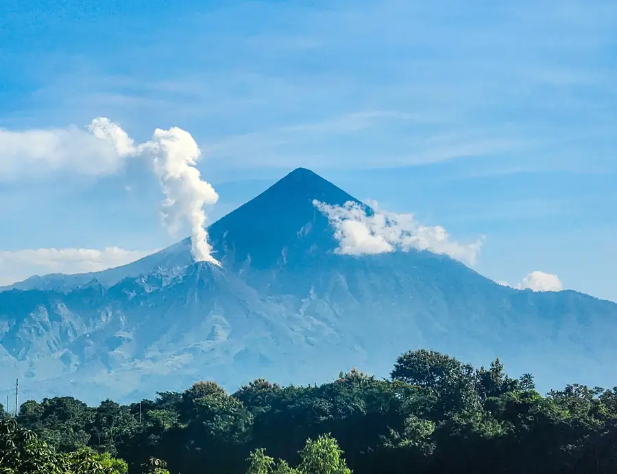
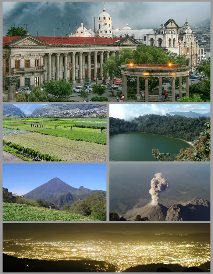
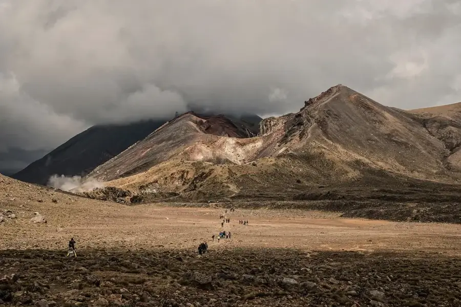
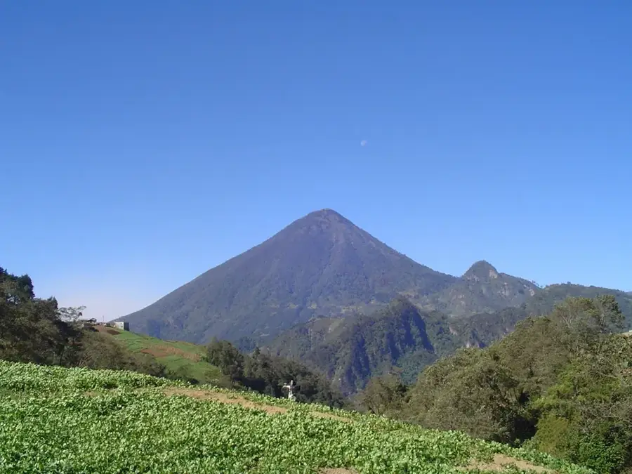
Santa María Volcano is a massive active stratovolcano located in the Guatemalan highlands near the city of Quetzaltenango. Rising to an elevation of 3,772 meters, it dominates the landscape of western Guatemala. Its history is defined by one of the largest volcanic eruptions of the 20th century; in October 1902, a catastrophic explosion tore away the entire southwestern flank of the mountain, leaving behind a gigantic crater. This eruption spread ash as far as San Francisco and resulted in thousands of fatalities. Since 1922, a smaller but highly active lava dome complex known as Santiaguito has formed at the base of this crater, producing nearly continuous ash clouds and lava flows. The summit of Santa María is now a popular destination for hikers, as it has a spectacular vantage point to witness the eruptions of Santiaguito below. The fertile volcanic soils in the vicinity are extensively used for coffee and vegetable cultivation. The volcano is considered one of the most dangerous in the region and is strictly monitored for its scientific significance.
- Location: Guatemala
- Nearby: Todos Santos Cuchumatán (6 km)
Best time to visit & climate
The most pleasant time to visit is Feb–Apr.
| Jan | Feb | Mar | Apr | May | Jun | Jul | Aug | Sep | Oct | Nov | Dec | |
|---|---|---|---|---|---|---|---|---|---|---|---|---|
| Avg °C | 13 | 14 | 16 | 17 | 17 | 16 | 16 | 16 | 16 | 16 | 14 | 14 |
| Rain mm | 6 | 7 | 22 | 63 | 217 | 315 | 226 | 289 | 353 | 291 | 58 | 10 |
📋 Practical info
Geography
Facts
- Santa María Volcano is approximately 30,000 years old.
- The 1902 eruption had a Volcanic Explosivity Index (VEI) of 6.
- The 1902 eruption lasted for about two days.
- Santa María is designated as one of the 'Decade Volcanoes' for study.
- The collapse crater on its southern flank is roughly 1.5 kilometers wide.
- Quetzaltenango, the country's second-largest city, is only 10 km away.
Explore nearby
Notable places around
Route planner — Car & Motorhome
Where do you start? We build the route here, with stops and country notes along the way.
© OpenStreetMap contributors · OpenRouteService
Sights nearby
Frequently asked questions
Is a guided tour necessary?
How long does the ascent take?
What is the weather like at the summit?
Is there accommodation for hikers?
Do I need special equipment?
Santa María Volcano: where is it located?
Santa María Volcano: when is the best time to visit?
Santa María Volcano: why is it worth visiting?

Nearby cities

History & landmarks
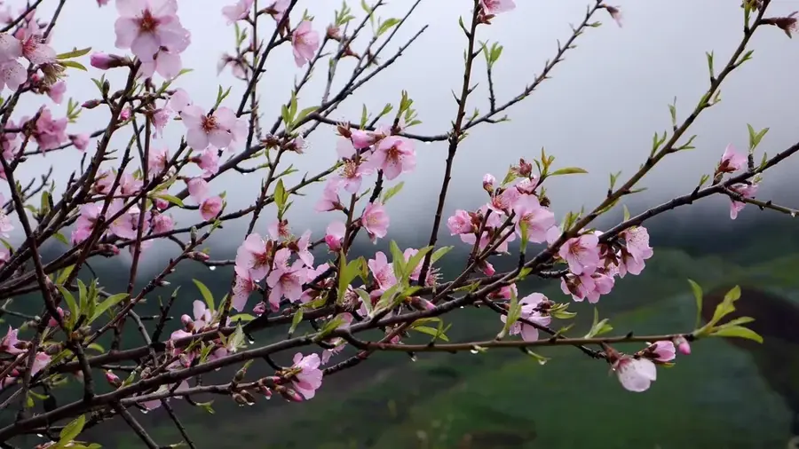
Nature
More places