Plizio Visual Lab
Pacific Coast
Weather…
Water temperature…
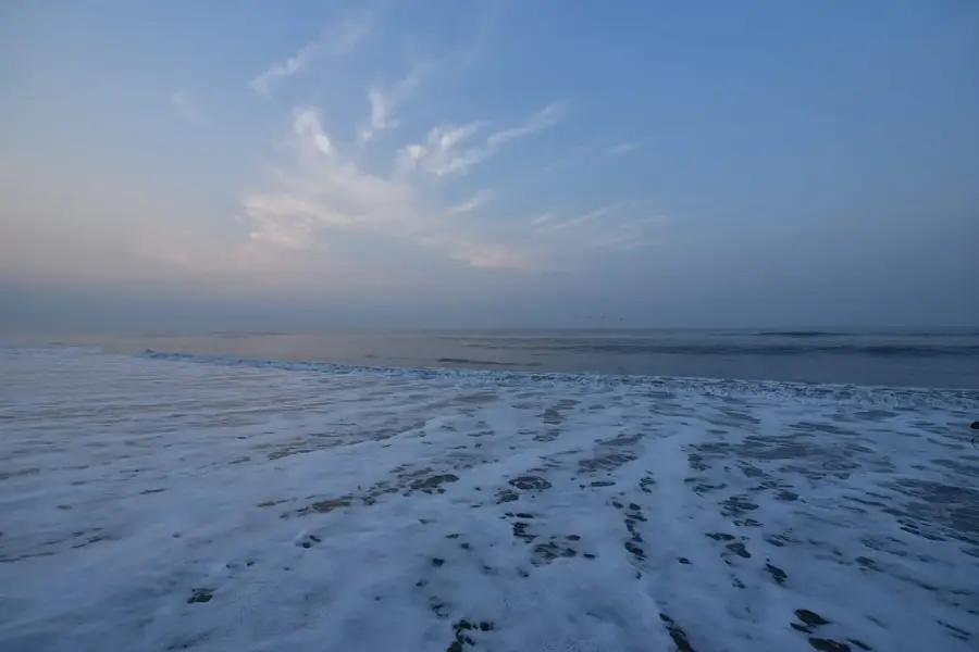
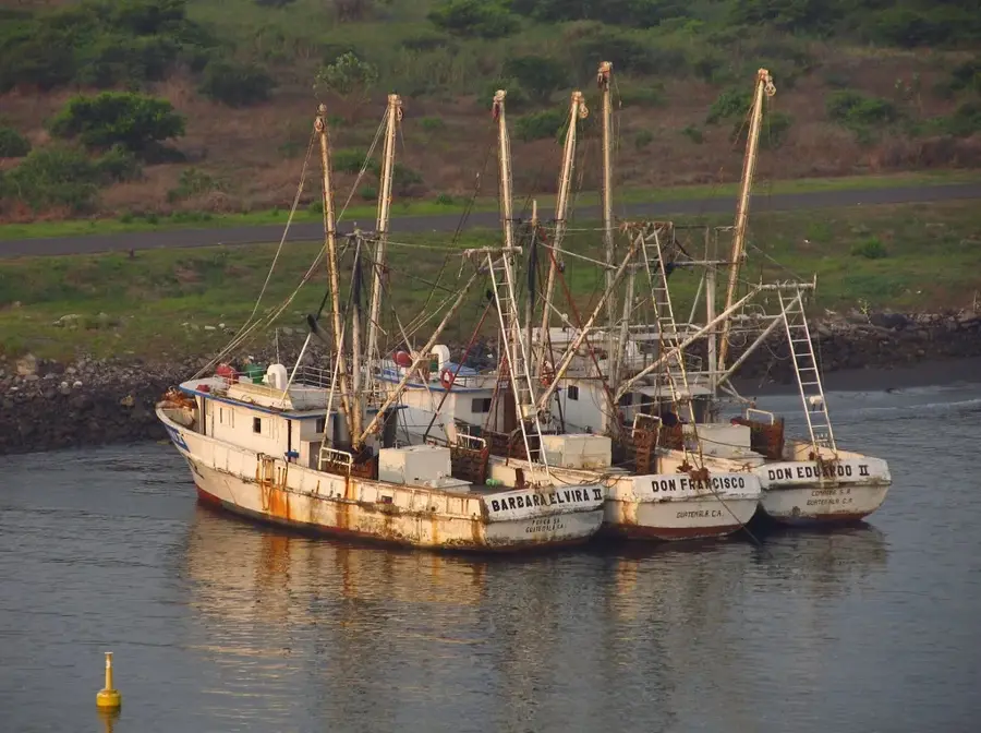
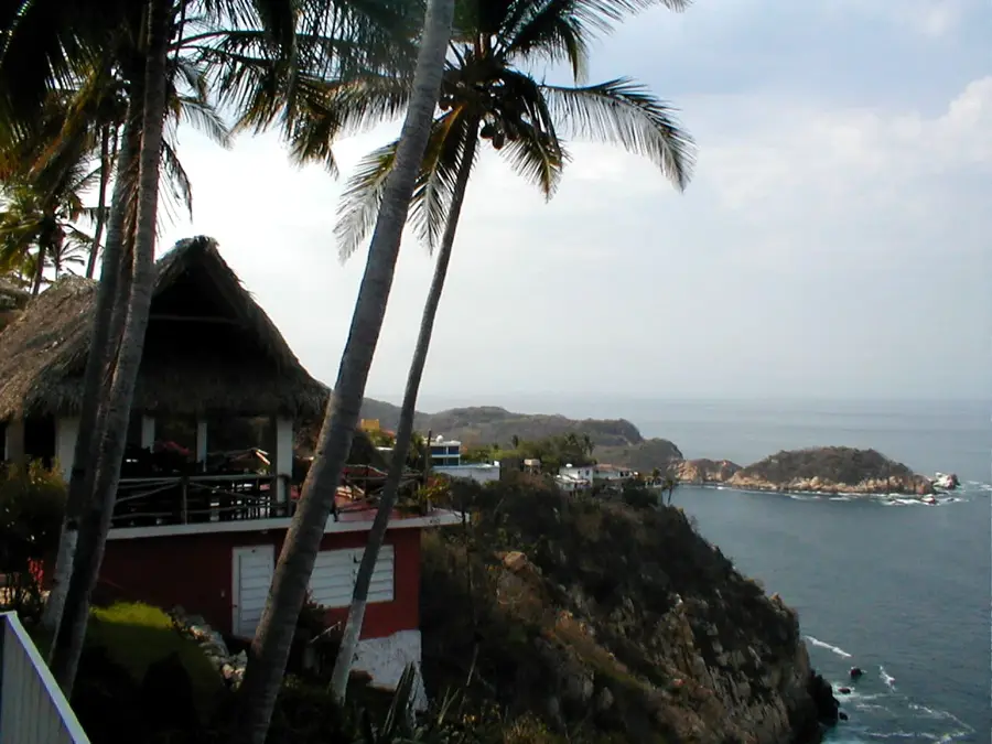
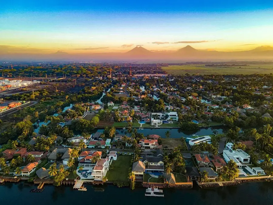
Guatemala's Pacific coast stretches for about 254 kilometers from the Mexican border to El Salvador. It is renowned for its vast beaches of black volcanic sand, created by the erosion of the nearby volcanic chain. Geographically, the hinterland is characterized by fertile coastal plains where sugarcane, bananas, and palm oil are intensively cultivated. Along the coast, extensive mangrove systems and lagoons, such as the Chiquimulilla Canal, serve as vital ecosystems for fish and migratory birds. Puerto Quetzal is the region's most significant port and a central hub for international trade. In terms of tourism, the coast is particularly popular with surfers and sport fishers, while locations like Monterrico and Sipacate are also famous for sea turtle conservation. The climate is tropically hot, with a pronounced rainy season from May to October. The Pacific coast also has spectacular sunsets and serves as an important habitat for dolphins and humpback whales during their migrations.
- Location: Guatemala
- Nearby: Cantel (6 km)
Best time to visit & climate
The most pleasant time to visit is Jan, Feb, Dec.
| Jan | Feb | Mar | Apr | May | Jun | Jul | Aug | Sep | Oct | Nov | Dec | |
|---|---|---|---|---|---|---|---|---|---|---|---|---|
| Avg °C | 26 | 27 | 28 | 29 | 28 | 27 | 28 | 28 | 27 | 27 | 27 | 26 |
| Rain mm | 4 | 6 | 15 | 61 | 252 | 326 | 251 | 305 | 339 | 297 | 65 | 8 |
📋 Practical info
Geography
Facts
- The Pacific coast of Guatemala spans a length of approximately 254 kilometers.
- The black sand is primarily composed of basalt and other volcanic minerals.
- Puerto Quetzal is the country's largest Pacific port, having opened in 1983.
- Over 80% of Guatemalan sugar is produced in the coastal plains.
- Monterrico is home to one of the country's oldest turtle conservation stations.
- The region is globally recognized as one of the best spots for sailfish fishing.
Explore nearby
Notable places around
Route planner — Car & Motorhome
Where do you start? We build the route here, with stops and country notes along the way.
© OpenStreetMap contributors · OpenRouteService
Sights nearby
Frequently asked questions
Is the Pacific coast suitable for swimming?
What is the best time for turtle watching?
Are there fishing villages there?
Is the area good for surfers?
Do you need a rental car?
Pacific Coast: where is it located?
Pacific Coast: when is the best time to visit?
Pacific Coast: why is it worth visiting?

Nearby cities
History & landmarks
More places