Plizio Visual Lab
Großer Inselsberg
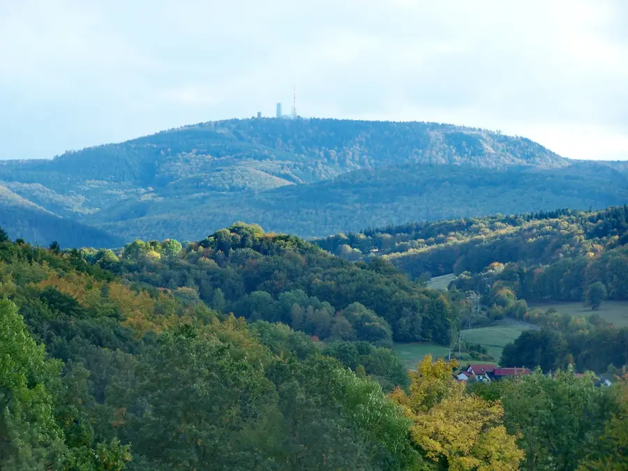
The Großer Inselsberg, standing at 916.5 meters, is one of the most famous and prominent mountains in the Thuringian Forest. Located on the border between the districts of Gotha and Schmalkalden-Meiningen, its exposed position makes it visible from great distances. The summit features several transmission towers, an observation tower, and mountain inns, making it one of the region's most popular excursion destinations. Historically, the border between the Duchy of Saxe-Gotha and the Landgraviate of Hesse-Kassel ran across the summit, a fact still marked today by boundary stones. The vegetation is characterized by spruce forests, which are currently under pressure due to climate change. For hikers, the mountain is a central node on the Rennsteig trail, while in winter, the slopes are used for skiing. On clear days, the view from the summit extends as far as the Brocken in the Harz Mountains and the Rhön, making the Inselsberg one of Central Germany's finest vantage points.
- Location: Thuringia, Germany
- Top sights: Großer Inselsberg · Kleiner Inselsberg · Wartburgblick
- Nearby: Friedrichroda (6 km)
Best time to visit & climate
The most pleasant time to visit is Jun–Aug.
| Jan | Feb | Mar | Apr | May | Jun | Jul | Aug | Sep | Oct | Nov | Dec | |
|---|---|---|---|---|---|---|---|---|---|---|---|---|
| Avg °C | -1 | 0 | 3 | 8 | 12 | 16 | 19 | 18 | 14 | 9 | 4 | 0 |
| Rain mm | 62 | 44 | 50 | 39 | 74 | 64 | 81 | 66 | 58 | 54 | 61 | 65 |
📋 Practical info
Geography
Facts
- The mountain's official elevation is 916.5 meters above sea level.
- The observation tower on the summit was erected in 1936.
- The transmission facility on the mountain was planned as early as 1939 for the first TV network.
- The mountain was first climbed in 1649 to determine the border line.
- The Rennsteig trail runs across the mountain for approximately 1.5 kilometers.
- Geologically, the mountain consists primarily of quartz porphyry.
Explore nearby
Notable places around
Route planner — Car & Motorhome
Where do you start? We build the route here, with stops and country notes along the way.
© OpenStreetMap contributors · OpenRouteService
Sights in the town Großer Inselsberg (10)
Kleiner Inselsberg
Mountain in Germany.
Wartburgblick
Viewpoint overlooking Wartburg castle.
Schöneleite
Mountain in Germany.
Funpark Inselsberg
Amusement park on the Großer Inselsberg.
Venetianerstein
Viewpoint on the Inselsberg.
Kleiner Wagenberg
Nature reserve.
Torstein
Rock formation on the Inselsberg.
Bärenbruchstein
Viewpoint on the Inselsberg.
Backofenloch
Rock cave or crevice on the Inselsberg.
Sights nearby
Frequently asked questions
How high is the Großer Inselsberg?
Are there activities for families at Inselsberg?
Does the Rennsteig trail pass over the mountain?
Is there an observation tower on the summit?
Where can you park at Inselsberg?
Großer Inselsberg: where is it located?
Großer Inselsberg: what is there to see?
Großer Inselsberg: when is the best time to visit?
Großer Inselsberg: why is it worth visiting?

Nearby cities