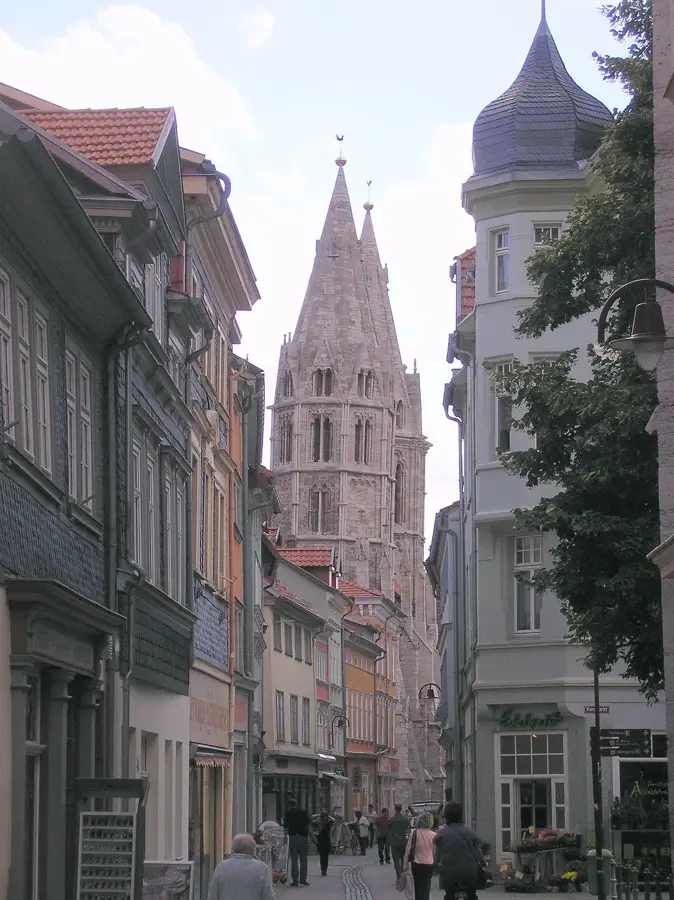
Plizio Visual Lab
Großer Inselsberg
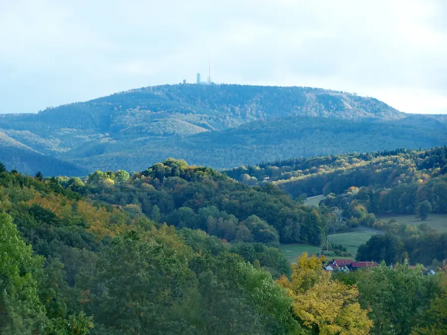
Großer Inselsberg, 916,5 metre ile Thüringer Wald'ın en tanınmış ve belirgin dağlarından biridir. Gotha ve Schmalkalden-Meiningen ilçeleri arasındaki sınırda yer alır ve açık konumu nedeniyle uzak mesafelerden görülebilir. Zirvede bulunan verici tesisleri, bir seyir kulesi ve dağ restoranları, burayı bölgenin en çok ziyaret edilen gezi noktalarından biri yapar. Tarihsel olarak zirve üzerinden Sachsen-Gotha dükalığı ile Hessen-Kassel landgraflığı arasındaki sınır geçerdi; bugün hala sınır taşları buna tanıklık eder. Bitki örtüsü ladin ormanlarıyla şekillenmiştir ancak bunlar iklim değişikliği nedeniyle baskı altındadır. Yürüyüşçüler için dağ, Rennsteig yolunda merkezi bir düğüm noktasıdır; kışın ise yamaçlar kayak sporu için kullanılır. Zirveden manzara açık havada Harz'daki Brocken'e ve Rhön'e kadar ulaşır; bu da Inselsberg'i Orta Almanya'nın en iyi manzara noktalarından biri yapar.
Haritada keşfet
Almanya hakkında ne kadar bilgilisin?
Etkileşimli haritada 10 çeşitli zorlukta şehirleri, manzaraları ve bölgeleri bul.
Seyahatin, senin anın
Großer Inselsberg’den bir kartpostal
Kendi fotoğrafını yerel posta puluyla kişisel bir kartpostala çevir. Ücretsiz ve kayıt gerektirmez.
Kartpostal oluştur- Konum: Thüringen, Almanya
- Öne çıkanlar: Großer Inselsberg · Kleiner Inselsberg · Wartburgblick
- Yakınlar: Friedrichroda (6 km)
En iyi ziyaret zamanı & iklim
En keyifli dönem: Haz–Ağu.
| Oca | Şub | Mar | Nis | May | Haz | Tem | Ağu | Eyl | Eki | Kas | Ara | |
|---|---|---|---|---|---|---|---|---|---|---|---|---|
| Ort. °C | -1 | 0 | 3 | 8 | 12 | 16 | 19 | 18 | 14 | 9 | 4 | 0 |
| Yağmur mm | 62 | 44 | 50 | 39 | 74 | 64 | 81 | 66 | 58 | 54 | 61 | 65 |
📋 Pratik bilgiler
Coğrafya
Gerçekler
- Dağın yüksekliği resmi olarak deniz seviyesinden 916,5 metredir.
- Zirvedeki seyir kulesi 1936 yılında inşa edilmiştir.
- Dağdaki verici tesisi 1939 gibi erken bir tarihte ilk televizyon ağı için planlanmıştı.
- 1649 yılında sınır hattını belirlemek amacıyla dağa ilk kez tırmanılmıştır.
- Rennsteig yolu yaklaşık 1,5 kilometre boyunca dağın üzerinden geçer.
- Dağ jeolojik olarak esas olarak kuvars porfirden oluşmaktadır.
Yakınları keşfet
Çevredeki dikkat çekici yerler
Rota planlayıcı — Araba & Karavan
Nereden başlıyorsunuz? Burada rota oluşturuyoruz, yol boyunca duraklar ve ülke notları ile.
© OpenStreetMap contributors · OpenRouteService
Kasabadaki görülecek yerler Großer Inselsberg (10)
Kleiner Inselsberg
Almanya'da bir dağ.
Wartburgblick
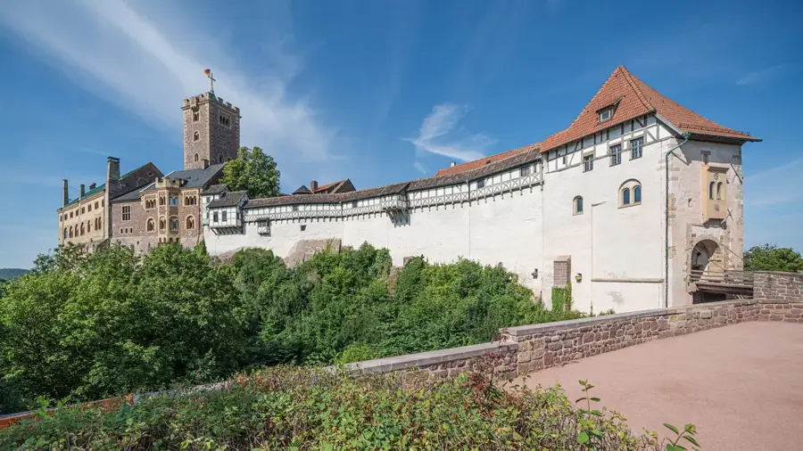
Wartburg kalesini gören bir seyir noktası.
Schöneleite
Almanya'da bir dağ.
Funpark Inselsberg
Großer Inselsberg'de bir lunapark/ eğlence parkı.
Venetianerstein
Inselsberg'de bir seyir noktası.
Kleiner Wagenberg
Doğa rezervi.
Torstein
Inselsberg'de bir kaya oluşumu.
Bärenbruchstein
Inselsberg'de bir seyir noktası.
Backofenloch
Inselsberg'de bir kaya mağarası veya yarığı.
Çevredeki gezilecek yerler
Sıkça sorulan sorular
Großer Inselsberg ne kadar yüksek?
Inselsberg'de aileler için etkinlikler var mı?
Rennsteig patikası dağın üzerinden mi geçer?
Zirvede bir seyir kulesi var mı?
Inselsberg'de nerede park edilebilir?
Großer Inselsberg: nerede yer alıyor?
Großer Inselsberg: gezilecek yerler neler?
Großer Inselsberg: en iyi ziyaret zamanı ne zaman?
Großer Inselsberg: neden ziyaret edilmeye değer?

Yakındaki şehirler