Plizio Visual Lab
Steinhuder Meer
Weather…
Water temperature…
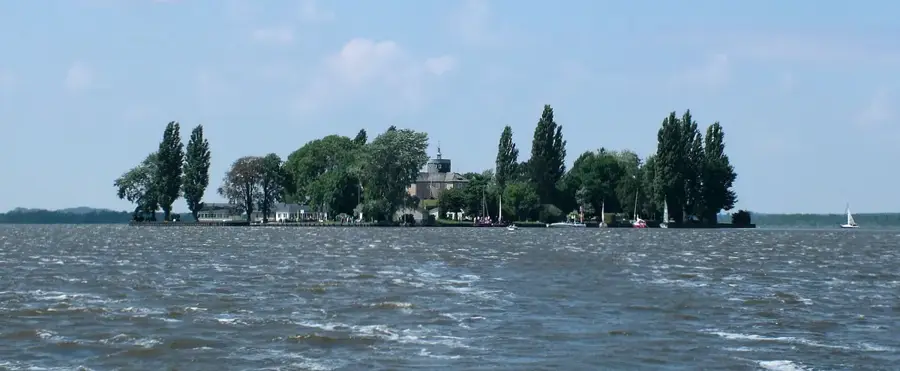
Steinhuder Meer, covering an area of approximately 29.1 square kilometers, is the largest lake in northwestern Germany, located at the heart of an extensive nature park in Lower Saxony. Geographically, the lake is notable for its extreme shallowness, with an average depth of just 1.35 meters and a maximum depth barely reaching 3 meters. The body of water formed at the end of the Weichselian glaciation about 30,000 years ago in a shallow basin. In the middle of the lake lies the artificial island of Wilhelmstein, constructed in the 18th century as a fortress and now serving as a popular excursion destination. The surrounding landscape is characterized by vast peat bogs and wet meadows, which act as vital breeding and resting grounds for numerous species of waterfowl. For tourists, Steinhuder Meer provides excellent opportunities for sailing, surfing, and hiking, while maintaining a strong focus on preserving its sensitive ecosystems. The region is also famous for its fishing heritage, particularly for smoked eel, a renowned local specialty.
- Location: Lower Saxony, Germany
- Top sights: Fischer- und Webermuseum · Wilhelmstein · Festung Wilhelmstein
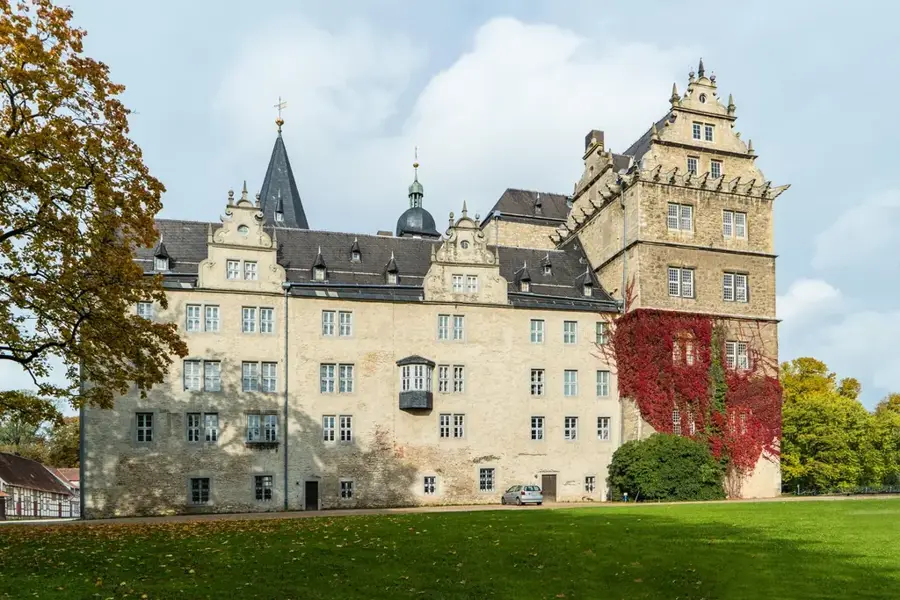
- Nearby: Wunstorf (8 km)
Best time to visit & climate
The most pleasant time to visit is Jun–Aug.
| Jan | Feb | Mar | Apr | May | Jun | Jul | Aug | Sep | Oct | Nov | Dec | |
|---|---|---|---|---|---|---|---|---|---|---|---|---|
| Avg °C | 1 | 1 | 4 | 9 | 13 | 17 | 19 | 18 | 15 | 10 | 5 | 2 |
| Rain mm | 69 | 50 | 50 | 38 | 60 | 62 | 78 | 69 | 55 | 59 | 62 | 68 |
📋 Practical info
Geography
Facts
- The lake's surface area is approximately 29.1 square kilometers.
- The average water depth is only 1.35 meters.
- The Wilhelmstein fortress island was built between 1761 and 1767.
- The lake was formed approximately 30,000 years ago.
- The entire area has been a nature park since 1974.
- There are two artificial islands in the lake: Wilhelmstein and Badeinsel.
Explore nearby
Notable places around
Route planner — Car & Motorhome
Where do you start? We build the route here, with stops and country notes along the way.
© OpenStreetMap contributors · OpenRouteService
Sights in the town Steinhuder Meer (10)
Wilhelmstein🌳 park
Artificial island in Steinhuder Meer, Lower Saxony.
Festung Wilhelmstein
Fortress on the Wilhelmstein island in Steinhuder Meer.
Sonnenuhr
Sundial at Steinhuder Meer.
Insektenmuseum und Schmetterlingsfarm
Insect museum and butterfly farm.
Petruskirche
Church in Steinhude, Hanover region.
Freilichtmuseum Steinhuder Meer-Bahn e.V.🏛 museum
Open-air museum with a historic railway.
Aussicht Sehsteg "Lüttjen Mardorf"
Viewing pier at Steinhuder Meer near Mardorf.
Sankt Hedwig
Church in Steinhude.
Sights nearby
Frequently asked questions
How large is Steinhuder Meer?
Can you visit Wilhelmstein Island?
Is the lake suitable for swimming?
Can you cycle around the lake?
What is the culinary specialty of the region?
Steinhuder Meer: where is it located?
Steinhuder Meer: what is there to see?
Steinhuder Meer: when is the best time to visit?
Steinhuder Meer: why is it worth visiting?

Nearby cities