Plizio Visual Lab
Sierra del Rosario Mountains
Weather…
Water temperature…
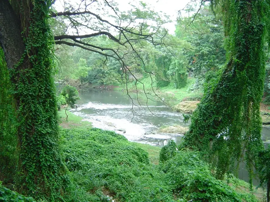
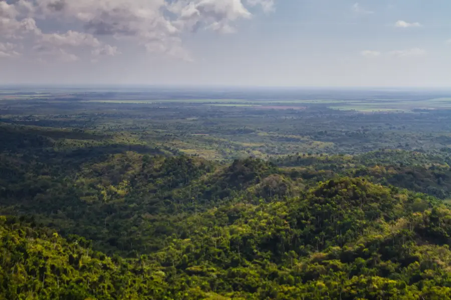
Sierra del Rosario is a mountain range in western Cuba, comprising the eastern portion of the Cordillera de Guaniguanico. In 1985, it was designated by UNESCO as Cuba's first Biosphere Reserve, highlighting its exceptional ecological importance. The relief features rounded peaks and steep-sided valleys covered in lush evergreen forests. A unique aspect of the region is the Las Terrazas ecological project, launched in the 1960s to promote reforestation and sustainable rural development. The range is home to over 800 species of plants, many of which are endemic, and supports a diverse population of tropical birds. Beyond its natural beauty, the area contains historical treasures, including the ruins of 19th-century coffee plantations established by French settlers fleeing the Haitian Revolution. Today, Sierra del Rosario serves as a flagship model for ecotourism and environmental education within the Caribbean region.
- Location: Cuba
- Nearby: Las Terrazas (5 km)
Best time to visit & climate
The most pleasant time to visit is Jan, Feb, Dec.
| Jan | Feb | Mar | Apr | May | Jun | Jul | Aug | Sep | Oct | Nov | Dec | |
|---|---|---|---|---|---|---|---|---|---|---|---|---|
| Avg °C | 23 | 24 | 25 | 26 | 28 | 29 | 29 | 29 | 29 | 28 | 25 | 24 |
| Rain mm | 38 | 32 | 25 | 38 | 70 | 117 | 86 | 118 | 117 | 98 | 49 | 32 |
📋 Practical info
Geography
Facts
- The highest elevation in the range is El Taburete at approximately 452 meters.
- It was officially recognized as a UNESCO Biosphere Reserve on February 15, 1985.
- More than 34% of the plant species found here are endemic to Cuba.
- The ruins of the Buenavista coffee plantation date back to the year 1801.
- Soroa features one of the largest and most diverse orchid gardens in the world.
- Thousands of birds of prey pass over the range annually during migration seasons.
Explore nearby
Notable places around
Route planner — Car & Motorhome
Where do you start? We build the route here, with stops and country notes along the way.
© OpenStreetMap contributors · OpenRouteService
Sights nearby
Frequently asked questions
What is Sierra del Rosario?
Where is Las Terrazas located?
What activities are offered?
How far is it from Havana?
What flora can be found here?
Sierra del Rosario Mountains: where is it located?
Sierra del Rosario Mountains: when is the best time to visit?
Sierra del Rosario Mountains: why is it worth visiting?

Nearby cities


History & landmarks
More places