Plizio Visual Lab
Mount Robson
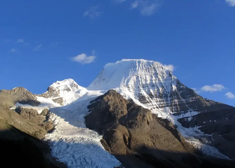
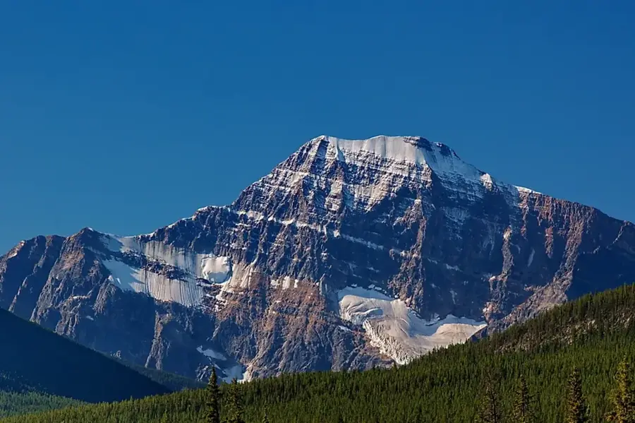
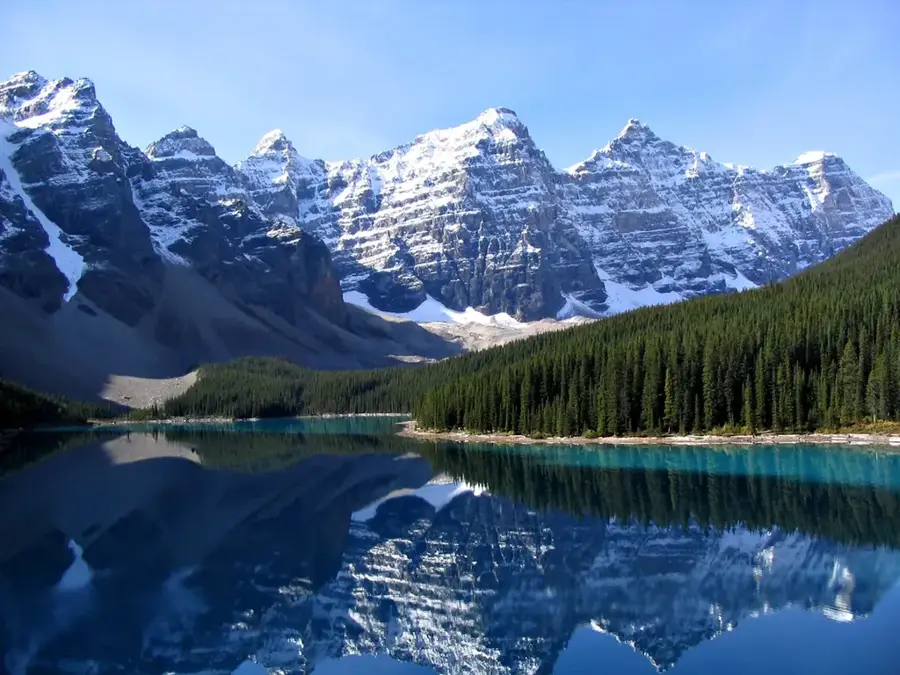
Mount Robson stands as the preeminent peak of the Canadian Rockies, dominating the landscape of eastern British Columbia with its 3,954-meter summit. Its iconic pyramid shape and the massive glaciers clinging to its slopes make it one of Canada's most recognizable natural landmarks. Geomorphologically, the mountain is notable for its exceptional prominence, rising far above any neighboring peaks and creating a dramatic visual impact. The weather patterns around the summit are notoriously unpredictable, often shrouding the mountain in clouds for weeks at a time. The Robson Glacier on the northeast face is one of the largest in the area and serves as the primary source for the Robson River. Historically, the mountain was a major milestone for explorers and railway surveyors navigating the nearby Yellowhead Pass. As a centerpiece of a UNESCO World Heritage Site, Mount Robson protects a pristine alpine wilderness that is home to grizzlies, mountain goats, and ptarmigans.
- Location: Canada
- Top sights: Rearguard Mountain · Helipad · Campion Mountain
Best time to visit & climate
The most pleasant time to visit is Jun–Aug.
| Jan | Feb | Mar | Apr | May | Jun | Jul | Aug | Sep | Oct | Nov | Dec | |
|---|---|---|---|---|---|---|---|---|---|---|---|---|
| Avg °C | -13 | -13 | -9 | -4 | 3 | 8 | 11 | 10 | 5 | -2 | -9 | -14 |
| Rain mm | 42 | 35 | 54 | 52 | 67 | 100 | 98 | 71 | 61 | 56 | 52 | 35 |
📋 Practical info
History & landmarks
Modern Alpine Era
1913
Geography
Facts
- The summit of Mount Robson reaches an elevation of 3,954 meters.
- It features a topographic prominence of 2,829 meters, ranking high in North America.
- The Robson Glacier is a major contributor to the regional watershed.
- Severe weather conditions often prevent climbers from reaching the summit for entire seasons.
- The nearby Yellowhead Pass is one of the lowest crossings of the Continental Divide.
- The rock layers forming the mountain date back over 500 million years to the Cambrian.
Explore nearby
Notable places around
Route planner — Car & Motorhome
Where do you start? We build the route here, with stops and country notes along the way.
© OpenStreetMap contributors · OpenRouteService
Sights in the town Mount Robson (4)
Sights nearby
Frequently asked questions
How high is Mount Robson?
What is the Berg Lake Trail?
Can you see the mountain year-round?
Are there campgrounds?
Is the park suitable for beginners?
Mount Robson: where is it located?
Mount Robson: what is there to see?
Mount Robson: when is the best time to visit?
Mount Robson: why is it worth visiting?

History & landmarks

Nature
More places