Plizio Visual Lab
Maya Mountains Foothills
Weather…
Water temperature…
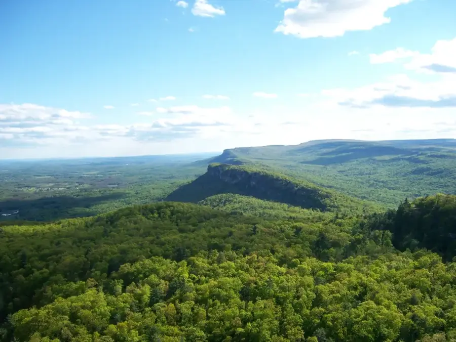
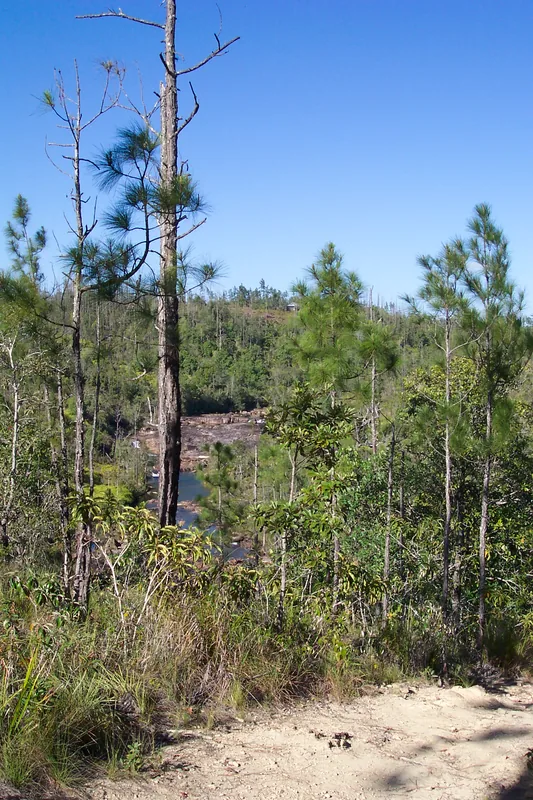
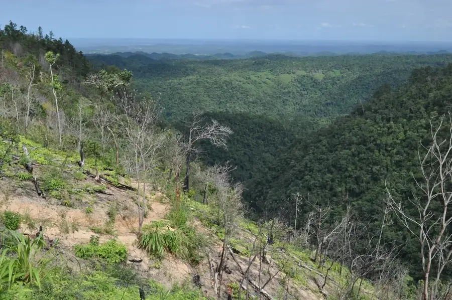
The Maya Mountains Foothills are a wide, transitional zone of rolling hills that gently descend from the main mountain range to the coastal plains of Belize. This region is characterized by a complex mix of limestone hills and valleys interspersed with alluvial plains created by the numerous rivers flowing out of the mountains. The foothills are an ecological mosaic, where remnants of dense rainforest meet agricultural lands, citrus groves, and small rural communities. This blend of habitats supports a rich variety of wildlife that moves between the protected mountain core and the coastal lowlands. Historically, the foothills were heavily populated by the ancient Maya, who found the fertile valleys handy for farming, and the area is rich in small to medium-sized archaeological sites. The foothills are the gateway to the rugged interior of the Maya Mountains.
- Location: Belize
- Nearby: Indian Church (4 km)
Best time to visit & climate
The most pleasant time to visit is Jan–Mar.
| Jan | Feb | Mar | Apr | May | Jun | Jul | Aug | Sep | Oct | Nov | Dec | |
|---|---|---|---|---|---|---|---|---|---|---|---|---|
| Avg °C | 21 | 22 | 24 | 26 | 26 | 25 | 25 | 25 | 25 | 24 | 22 | 22 |
| Rain mm | 110 | 66 | 58 | 40 | 127 | 240 | 175 | 197 | 225 | 251 | 200 | 137 |
📋 Practical info
Geography
Explore nearby
Notable places around
Route planner — Car & Motorhome
Where do you start? We build the route here, with stops and country notes along the way.
© OpenStreetMap contributors · OpenRouteService
Sights nearby
Frequently asked questions
What are the Maya Mountains foothills?
What role do they play in ecology?
Are there settlements there?
What is the terrain like for hikers?
Are there rivers there?
Maya Mountains Foothills: where is it located?
Maya Mountains Foothills: when is the best time to visit?
Maya Mountains Foothills: why is it worth visiting?

More places