Plizio Visual Lab
Icacos
ℹ️Practical info — Icacos
▾
🌤 Weather — 5 days
📍 Nearby
Sights nearby
💡 Tips
- Apply heavy-duty insect repellent, as the wetlands and beaches are notorious for aggressive sandflies.
- Check the tide charts before heading out; during exceptionally high tides, parts of the main road can become submerged.
- Pack plenty of drinking water and snacks, as there are very few public facilities or shops in the village.
- On clear days, look across the Gulf of Paria to see the Venezuelan coastline, which is only about 7 miles away.
- Drive carefully through the Constance Estate coconut plantations and watch out for falling nuts or workers.
🍽 Food
Look for the white fruit of the Ikako shrub, which has a mild, sweet flavor and gives the village its name.
Buy it directly from the workers at the coconut estates for the freshest possible drink.
Stop at Vee Vault in nearby Cedros on your way back for local BBQ chicken and cassava fries.
🛍 Shopping · 🧘 Quiet spots
Buy fresh ground provisions like dasheen and cassava directly from farmers at small roadside stalls.
Look for high-quality, traditionally produced coconut oil sold directly by the local estates.
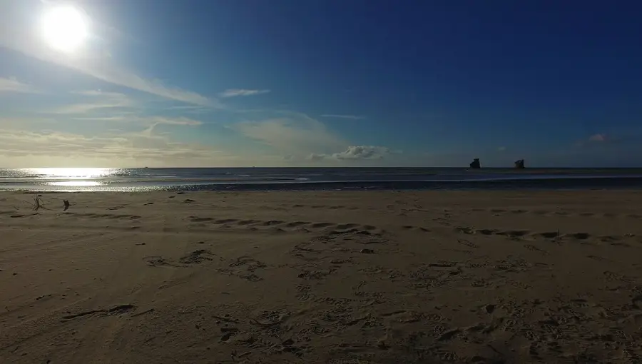
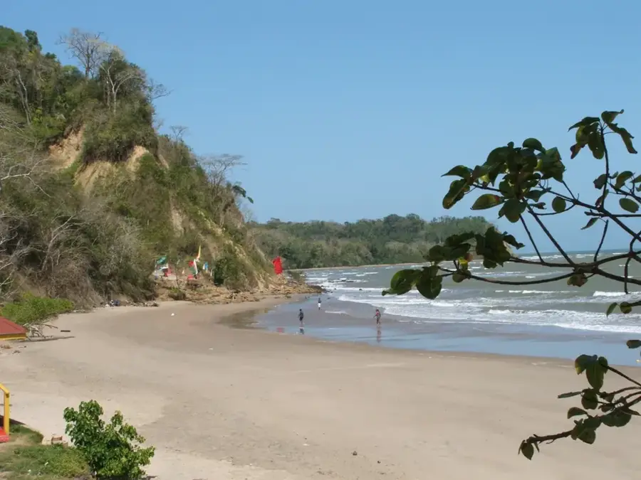
A secluded beach featuring the iconic Three Sisters Rocks, well-suited for a peaceful afternoon by the sea.
A silent mangrove area excellent for birdwatching; keep an eye out for the Scarlet Ibis.
Water temperature…
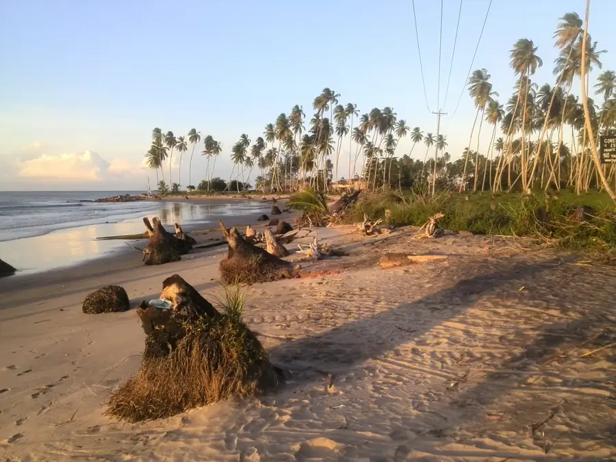
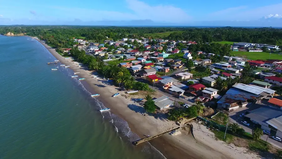
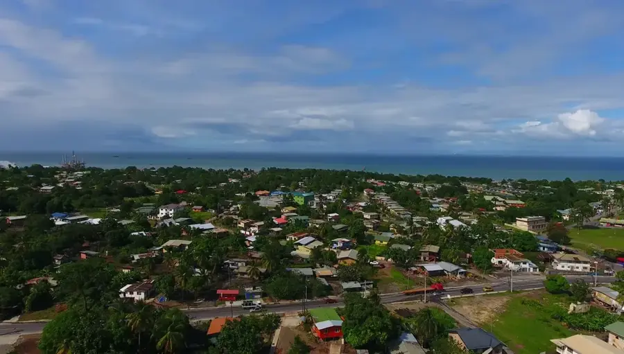
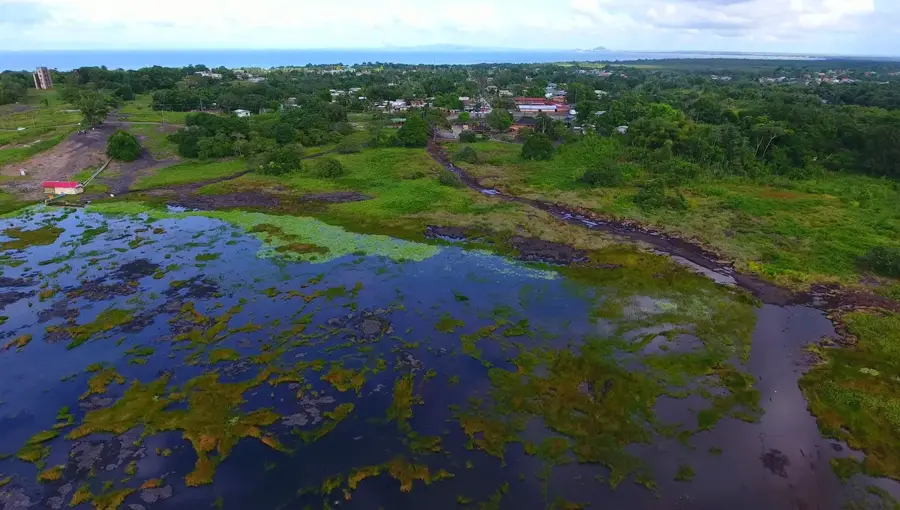
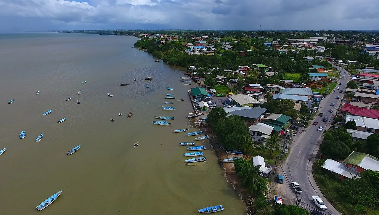
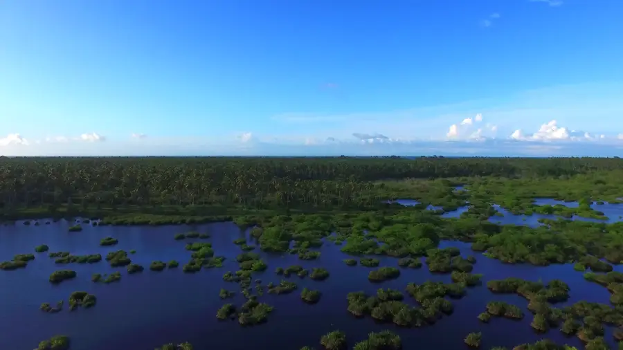
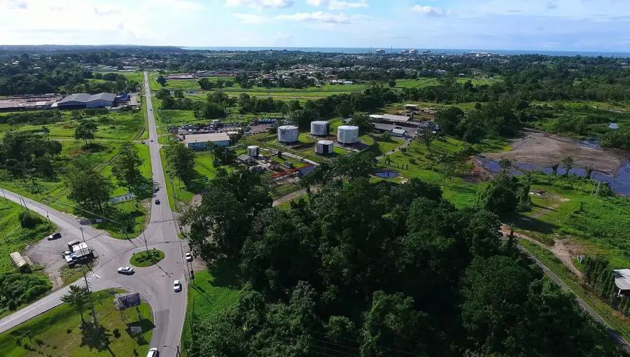
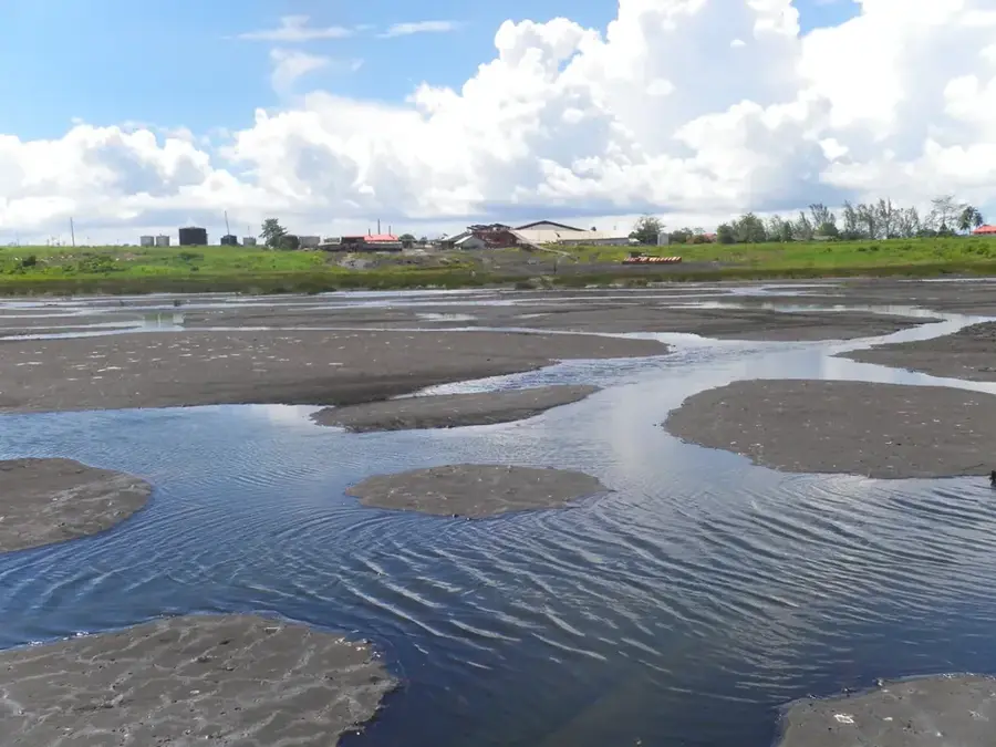
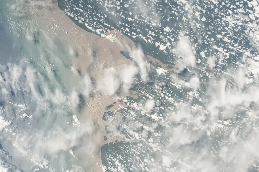
Icacos is a remote village located at the extreme southwestern tip of Trinidad, renowned for its sprawling coconut plantations and its direct proximity to the Venezuelan coastline. Geographically situated at the end of the Cedros Peninsula, it marks the confluence of the Caribbean Sea and the Gulf of Paria, resulting in unique maritime conditions. The history of the village is deeply rooted in agriculture, with the cultivation of coconuts for copra production serving as the primary economic driver for many generations. Being only about 11 kilometers away from the South American mainland, Icacos is a strategic point for border monitoring and regional trade activities. However, the region faces significant environmental challenges, most notably severe coastal erosion that consistently reclaims land from the historic estates. The terrain is largely flat and swampy, featuring the Icacos Wetlands which provide an essential habitat for diverse bird species and caimans. The journey to Icacos involves navigating winding roads through dense tropical greenery, highlighting the isolated and serene character of this southwestern outpost.
- Location: Trinidad and Tobago
- Nearby: Cedros (15 km)
Best time to visit & climate
The most pleasant time to visit is Jan–Mar.
| Jan | Feb | Mar | Apr | May | Jun | Jul | Aug | Sep | Oct | Nov | Dec | |
|---|---|---|---|---|---|---|---|---|---|---|---|---|
| Avg °C | 26 | 27 | 27 | 28 | 28 | 27 | 27 | 28 | 28 | 28 | 27 | 27 |
| Rain mm | 71 | 42 | 39 | 44 | 100 | 192 | 183 | 185 | 126 | 146 | 148 | 128 |
Geography
Facts
- The southwesternmost point of the island of Trinidad.
- Located only about 11 kilometers from the coast of Venezuela.
- Historically the heart of Trinidad's coconut and copra industry.
- The Icacos Swamps are a critical wetland for migratory birds.
- Faces some of the most severe coastal erosion in the Caribbean.
- Situated at the very end of the Cedros Peninsula.
Explore nearby
Notable places around
Route planner — Car & Motorhome
Where do you start? We build the route here, with stops and country notes along the way.
© OpenStreetMap contributors · OpenRouteService
Frequently asked questions
What is special about Icacos?
Best time for a trip?
How long does the travel take?
Are there accommodations there?
What can you do in Icacos?
Icacos: where is it located?
Icacos: when is the best time to visit?
Icacos: why is it worth visiting?
Nearby cities
Nature
More places