Plizio Visual Lab
Pico do Fogo
Weather…
Water temperature…
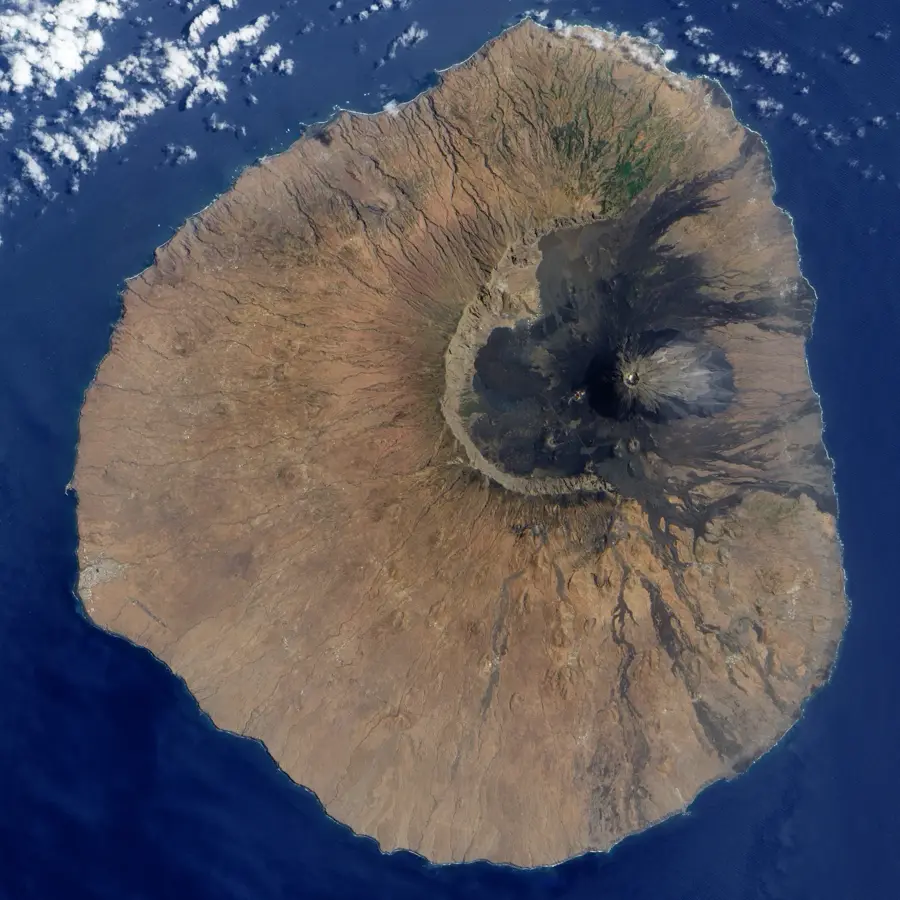
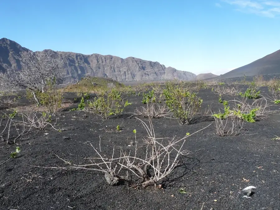
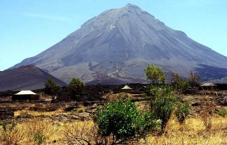
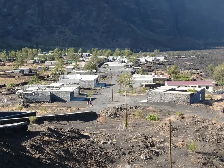
Pico do Fogo is an active stratovolcano on the island of Fogo, standing at 2829 meters as the highest point in Cape Verde and the Macaronesian region south of the Canaries. It rises from within a massive, nine-kilometer-wide caldera known as Chã das Caldeiras. The main cone was formed by volcanic activity following the collapse of the original volcano, with slopes reaching inclinations of up to 45 degrees. Geologically, it is highly active, with numerous eruptions recorded in historical times, the most recent spanning from late 2014 to early 2015. The surrounding terrain is a dramatic display of fresh lava flows and volcanic ash, yet it supports unique high-altitude agriculture. Climbing to the summit is recognized as one of the most challenging and rewarding treks in the Central Atlantic, offering panoramic views of the entire archipelago.
- Location: Cape Verde
- Top sights: Crater Pico de Fogo · Espigão · Fogo Natural Park
- Nearby: Cova Figueira (7 km)
Best time to visit & climate
The most pleasant time to visit is Mar–May.
| Jan | Feb | Mar | Apr | May | Jun | Jul | Aug | Sep | Oct | Nov | Dec | |
|---|---|---|---|---|---|---|---|---|---|---|---|---|
| Avg °C | 23 | 22 | 22 | 22 | 23 | 24 | 25 | 26 | 27 | 27 | 26 | 24 |
| Rain mm | 23 | 29 | 11 | 8 | 6 | 5 | 13 | 56 | 83 | 47 | 47 | 41 |
📋 Practical info
Geography
Facts
- Highest peak in Cape Verde (2829m)
- Active stratovolcano within a 9km-wide caldera
- Most recent eruption occurred in 2014-2015
- Conal slopes reach an inclination of 45 degrees
- The caldera floor sits at 1700m above sea level
- Primary destination for mountaineering in the region
Explore nearby
Notable places around
Route planner — Car & Motorhome
Where do you start? We build the route here, with stops and country notes along the way.
© OpenStreetMap contributors · OpenRouteService
Sights in the town Pico do Fogo (3)
Sights nearby
Frequently asked questions
How high is Pico do Fogo?
Is the climb difficult?
Is a guide mandatory?
How long does the hike take?
When is the best time to start?
Pico do Fogo: where is it located?
Pico do Fogo: what is there to see?
Pico do Fogo: when is the best time to visit?
Pico do Fogo: why is it worth visiting?

Nearby cities

History & landmarks
More places