Plizio Visual Lab
Bordeira do Fogo

Weather…
Water temperature…
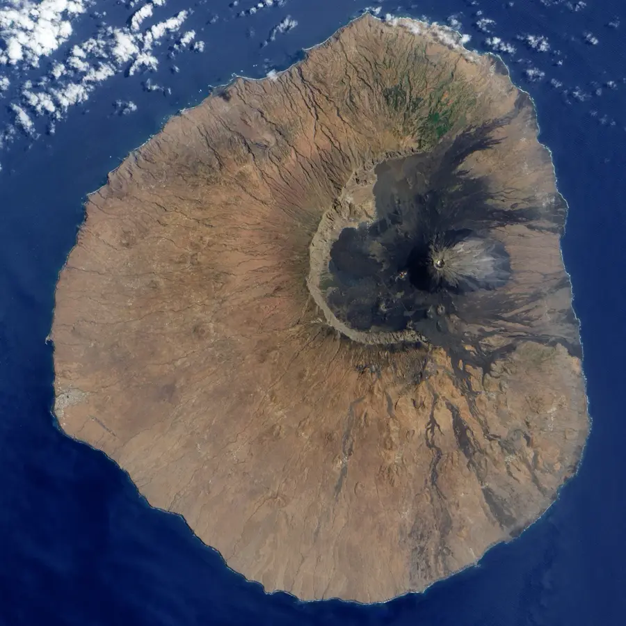
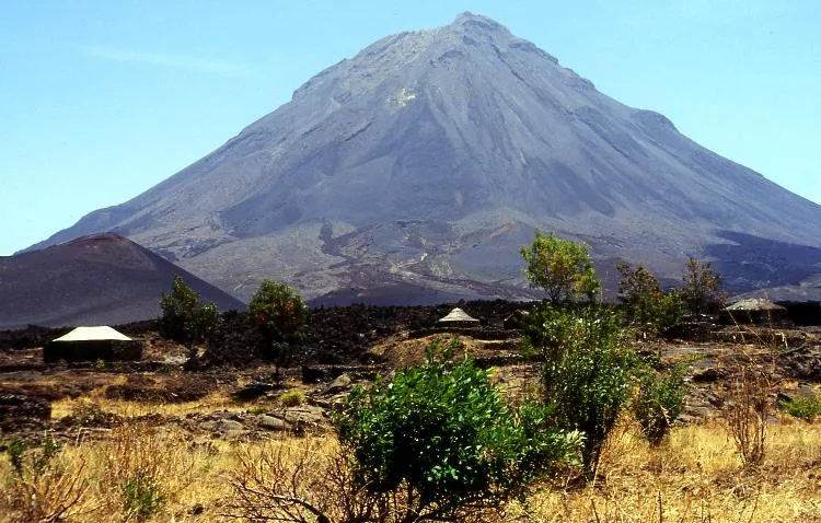
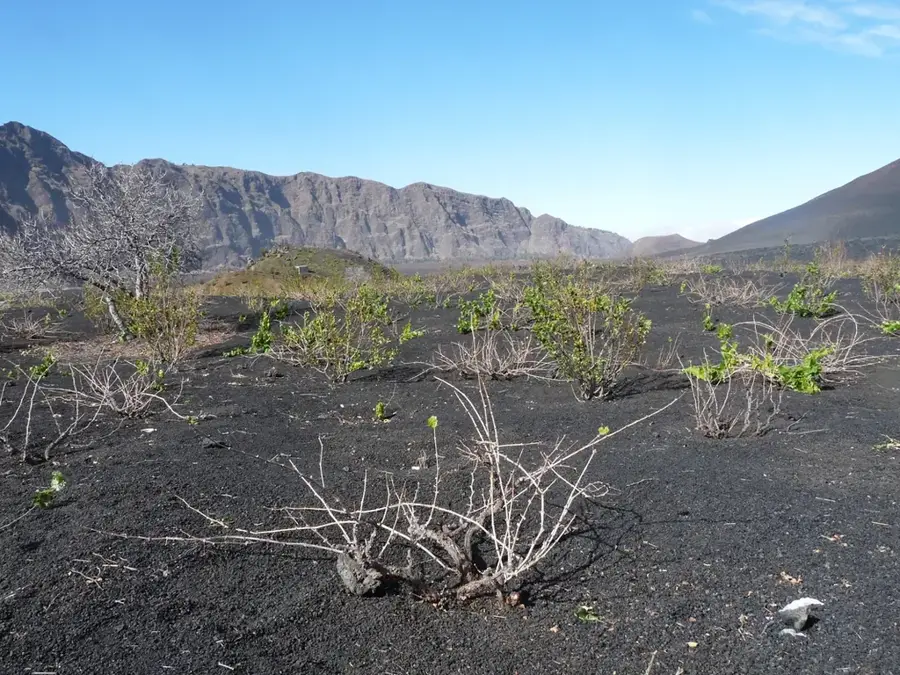
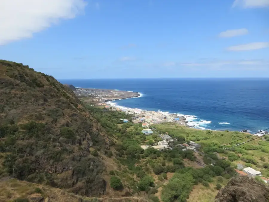
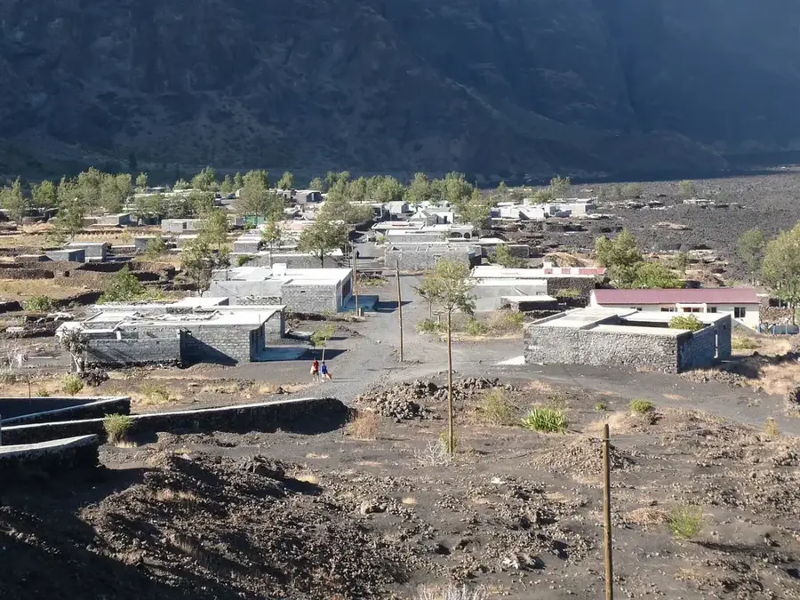
Bordeira do Fogo is a monumental rock wall on Fogo Island that defines the western rim of the massive Chã das Caldeiras caldera. This semi-circular cliff rises up to 1,000 meters above the caldera floor, with its highest points reaching an elevation of approximately 2,700 meters above sea level. It is the remnant of a colossal volcanic landslide that occurred hundreds of thousands of years ago, when the ancient summit of the volcano collapsed into the ocean. The cliff face displays distinct geological layers of solidified lava and tephra, serving as a vertical record of the island's eruptive history. Within the basin enclosed by the Bordeira, the settlements of Portela and Bangaeira thrive, with residents cultivating vineyards in the fertile volcanic soil despite the shadow of the active Pico do Fogo. While the wall provides some shelter from trade winds, it also generates powerful downdrafts during severe weather events. Walking along the crest of the Bordeira features hikers some of the most dramatic and expansive views of the volcanic landscape found anywhere in the Atlantic.
- Location: Cape Verde
- Top sights: Pico de Caldeira · Arche · Monte Fontainhas
- Nearby: Cova Figueira (9 km)
Best time to visit & climate
The most pleasant time to visit is Mar–May.
| Jan | Feb | Mar | Apr | May | Jun | Jul | Aug | Sep | Oct | Nov | Dec | |
|---|---|---|---|---|---|---|---|---|---|---|---|---|
| Avg °C | 23 | 22 | 22 | 22 | 23 | 24 | 25 | 26 | 27 | 27 | 26 | 24 |
| Rain mm | 23 | 29 | 11 | 8 | 6 | 5 | 13 | 56 | 83 | 47 | 47 | 41 |
📋 Practical info
Geography
Facts
- The highest point of the Bordeira rim reaches an elevation of approximately 2,692 meters.
- The cliff wall stretches for a total distance of roughly 9 kilometers.
- The formation's age is estimated to be between 73,000 and 100,000 years old.
- The vertical drop from the rim to the caldera floor can be as much as 1,000 meters.
- Marine sediments found on the wall provide evidence of a prehistoric megatsunami.
- The wall consists primarily of phonolitic and basaltic volcanic rock layers.
Explore nearby
Notable places around
Route planner — Car & Motorhome
Where do you start? We build the route here, with stops and country notes along the way.
© OpenStreetMap contributors · OpenRouteService
Sights in the town Bordeira do Fogo (4)
Sights nearby
Frequently asked questions
What is Bordeira?
How high is the wall?
Can you hike on the Bordeira?
Does it provide protection during volcanic eruptions?
What is the best photo subject?
Bordeira do Fogo: where is it located?
Bordeira do Fogo: what is there to see?
Bordeira do Fogo: when is the best time to visit?
Bordeira do Fogo: why is it worth visiting?

Nearby cities

History & landmarks
More places