Plizio Visual Lab
Tanéka Villages

Weather…
Water temperature…
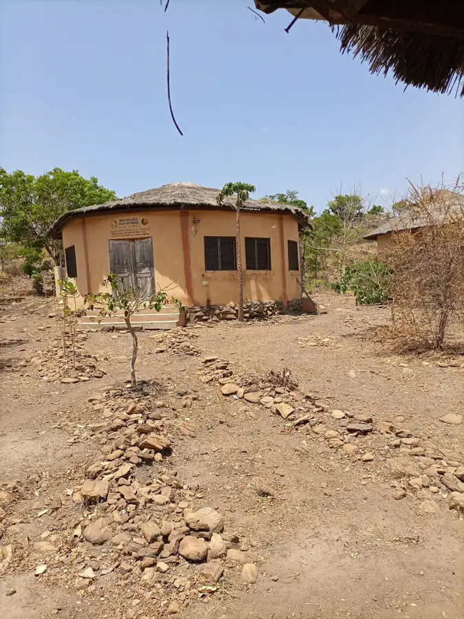
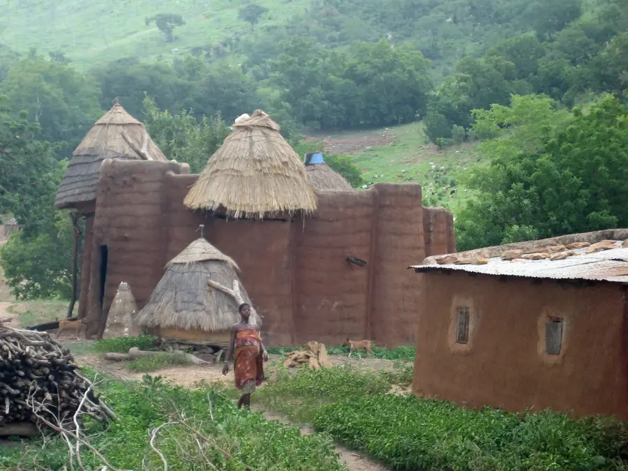
The Tanéka villages are picturesquely situated on the slopes of the Atakora Mountains, offering a fascinating glimpse into Benin's traditional way of life. The residents, known as the Tangba people, live in characteristic round houses with conical thatched roofs, often arranged in terraces along the hillside. These villages are famous for their rigid social structures and the influential role of traditional healers and spiritual leaders, known as Sassa. Visitors can explore sacred sites where rituals have remained unchanged for centuries. The architecture is perfectly adapted to the climate and geography, utilizing stone and mud as primary building materials. In the Tanéka villages, time seems to have stood still, as the community places immense value on preserving its ancestral customs. The hike to the villages also provides spectacular views of the surrounding savanna. It is a place of deep spirituality, tranquility, and profound respect for the ancestors.
Best time to visit & climate
The most pleasant time to visit is Jan, Nov, Dec.
| Jan | Feb | Mar | Apr | May | Jun | Jul | Aug | Sep | Oct | Nov | Dec | |
|---|---|---|---|---|---|---|---|---|---|---|---|---|
| Avg °C | 24 | 27 | 30 | 29 | 28 | 26 | 25 | 25 | 25 | 26 | 25 | 24 |
| Rain mm | 2 | 7 | 25 | 83 | 142 | 173 | 236 | 274 | 219 | 107 | 9 | 1 |
📋 Practical info
Geography
Facts
- Located in the Atakora Mountains of northwestern Benin
- Consists of two main settlements: Tanéka-Béri and Tanéka-Koko
- Famous for their spiritual leaders known as Sassa
- Traditional round dwellings with conical thatched roofs
- Inhabited by the Tangba (Tanéka) ethnic group
- Maintains ancestral rites documented since the 9th century
Explore nearby
Notable places around
Route planner — Car & Motorhome
Where do you start? We build the route here, with stops and country notes along the way.
© OpenStreetMap contributors · OpenRouteService
Sights nearby
Frequently asked questions
How do you reach the Tanéka villages?
Can you walk around freely?
What is unique about the architecture?
When is the best time to travel?
Should we bring gifts?
Tanéka Villages: where is it located?
Tanéka Villages: when is the best time to visit?
Tanéka Villages: why is it worth visiting?

Nearby cities


History & landmarks


Nature

More places