Plizio Visual Lab
Galleons Passage

Weather…
Water temperature…
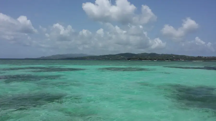
The Galleons Passage is the strategically vital stretch of water separating the islands of Trinidad and Tobago. Spanning approximately 32 kilometers in width, this passage connects the Gulf of Paria to the open Atlantic Ocean. Its name is derived from the Spanish galleons that frequently navigated these waters during the 16th and 17th centuries, transporting wealth between Europe and the Americas. The passage is characterized by powerful and complex currents, driven by the meeting of the South Equatorial Current and the outflow from the Orinoco River. Today, it serves as the primary maritime corridor for the inter-island ferry service, facilitating the movement of thousands of passengers and tons of cargo between Port of Spain and Scarborough. Environmentally, the area is a significant migratory path for marine megafauna, such as dolphins and whales, and supports a diverse array of deep-sea marine life.
Explore on the map
How well do you know Trinidad and Tobago?
Find cities, landscapes and regions in 10 varied challenges on the interactive map.
Your journey, your memory
A postcard from Galleons Passage
Turn your own photo into a personal postcard with a local stamp. Free and no sign-up required.
Create a postcard- Location: Trinidad and Tobago
- Nearby: Bon Accord (23 km)
Best time to visit & climate
The most pleasant time to visit is Feb–Apr.
| Jan | Feb | Mar | Apr | May | Jun | Jul | Aug | Sep | Oct | Nov | Dec | |
|---|---|---|---|---|---|---|---|---|---|---|---|---|
| Avg °C | 27 | 26 | 27 | 27 | 28 | 28 | 28 | 28 | 29 | 28 | 28 | 27 |
| Rain mm | 82 | 43 | 37 | 42 | 89 | 161 | 165 | 170 | 138 | 179 | 189 | 148 |
📋 Practical info
Geography
Facts
- The passage is roughly 32 kilometers wide at its narrowest point.
- It was named after the Spanish galleons that sailed here in the 1500s.
- The water depth in the passage can exceed 400 meters in certain areas.
- Powerful currents are caused by the convergence of oceanic and riverine waters.
- Modern fast ferries transit the passage in approximately 2.5 hours.
- The area is a known habitat for various species of sharks and rays.
Explore nearby
Notable places around
Route planner — Car & Motorhome
Where do you start? We build the route here, with stops and country notes along the way.
© OpenStreetMap contributors · OpenRouteService
Sights nearby
Frequently asked questions
Can you visit Galleons Passage?
Are there good dive spots there?
What are the waves like?
Is it interesting for sailors?
What do you often see here?
Galleons Passage: where is it located?
Galleons Passage: when is the best time to visit?
Galleons Passage: why is it worth visiting?
Nearby cities

History & landmarks
More places