Plizio Visual Lab
Yaxchilán
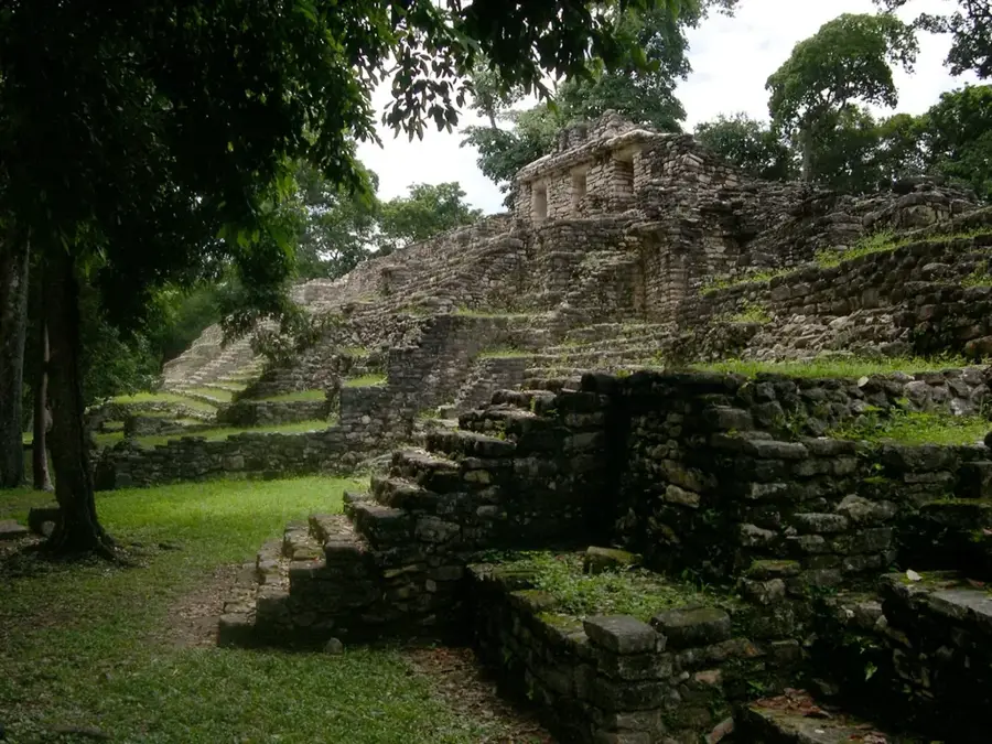
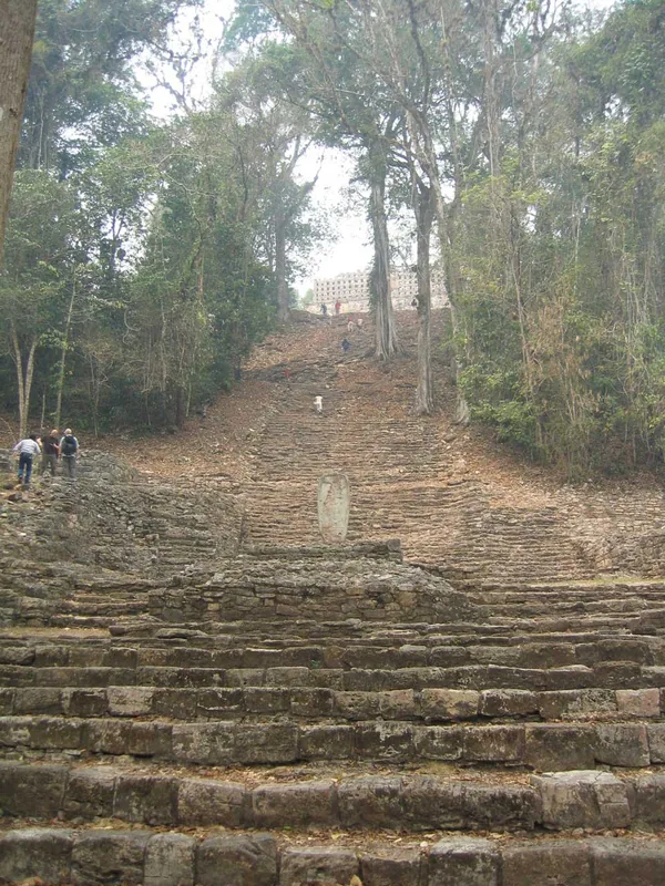
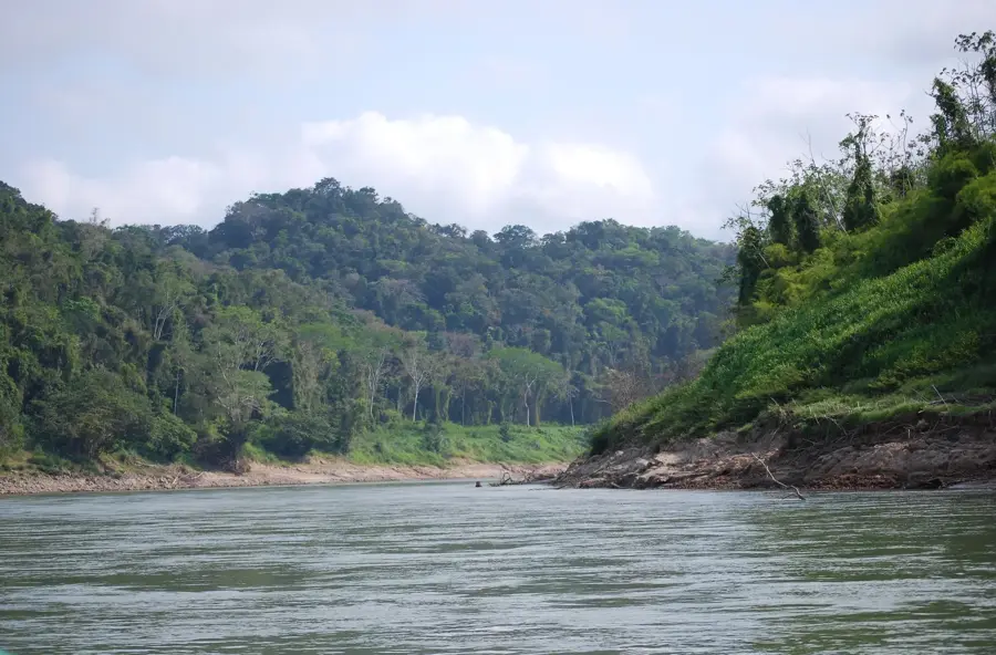
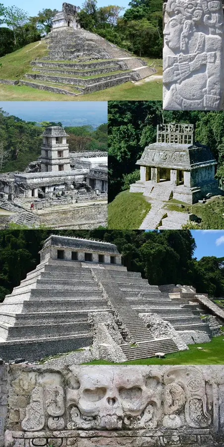
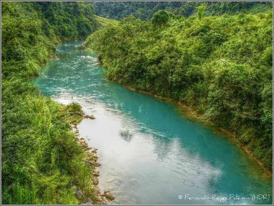
Yaxchilán is a majestic Maya city situated on the banks of the Usumacinta River in present-day Chiapas, accessible only by boat. During the Classic period, it was a powerful city-state that controlled river trade and frequently competed with nearby Piedras Negras. The site is famous for its extraordinary wealth of stone sculptures, particularly the intricately carved lintels placed above the entrances of the main temples. These reliefs document in great detail the rituals, warfare, and genealogies of the ruling dynasty, with the rulers Shield Jaguar II and Bird Jaguar IV being particularly prominent. The architecture is defined by its adaptation to the steep terrain above the river bend, requiring monumental staircases and terraces. The Labyrinth (Structure 19) is a complex building with numerous dark passages likely used for ritual purposes. Yaxchilán reached its political zenith between 600 and 800 AD before being abandoned in the 9th century.
- Location: Mexico
- Top sights: Zona Arqueológica de Yaxchilán · Pequeña Acrópolis · La Gran Plaza
- Nearby: Sabancuy (24 km)
Best time to visit & climate
The most pleasant time to visit is Feb, Mar, Dec.
| Jan | Feb | Mar | Apr | May | Jun | Jul | Aug | Sep | Oct | Nov | Dec | |
|---|---|---|---|---|---|---|---|---|---|---|---|---|
| Avg °C | 20 | 22 | 24 | 27 | 27 | 25 | 25 | 25 | 24 | 23 | 21 | 21 |
| Rain mm | 100 | 60 | 43 | 57 | 162 | 297 | 191 | 269 | 341 | 268 | 150 | 90 |
📋 Practical info
Geography
Facts
- Accessible only by boat via the Usumacinta River
- Famous for its finely carved stone lintels
- Reached its peak under the ruler Shield Jaguar II
- Structure 19 is known as the Labyrinth due to its passages
- Maintained strategic control over Maya river trade
- Contains the largest number of inscribed monuments in the region
Explore nearby
Notable places around
Route planner — Car & Motorhome
Where do you start? We build the route here, with stops and country notes along the way.
© OpenStreetMap contributors · OpenRouteService
Sights in the town Yaxchilán (4)
Sights nearby
Frequently asked questions
How do you reach Yaxchilán?
Is it safe for tourists?
Are there monkeys there?
How much time should you plan?
What is special?
Yaxchilán: where is it located?
Yaxchilán: what is there to see?
Yaxchilán: when is the best time to visit?
Yaxchilán: why is it worth visiting?

Nearby cities

History & landmarks


Nature
More places