Plizio Visual Lab
Salluit
ℹ️Practical info — Salluit
▾
🌤 Weather — 5 days
📍 Nearby
Sights nearby
💡 Tips
- Salluit is only accessible by air, plan your trip carefully with Air Inuit.
- Respect the local Inuit culture and always ask permission before taking photos.
- Weather conditions can delay flights, so bring patience.
- In summer, insect repellent is an absolute must.
🍽 Food
Arctic char is a local specialty; try it fresh or smoked if offered.
This traditional flatbread is a staple in many northern communities.
Occasionally, traditionally prepared caribou meat is shared at local gatherings.
🛍 Shopping · 🧘 Quiet spots
The main store in town for groceries, but also for authentic Inuit carvings and art.
Look for locally handmade warm mittens or hats.
The shores of the inlet offer panoramic, sweeping views and incredible silence.
Take a walk on the tundra (with a local guide) to see the unique northern flora.
Water temperature…
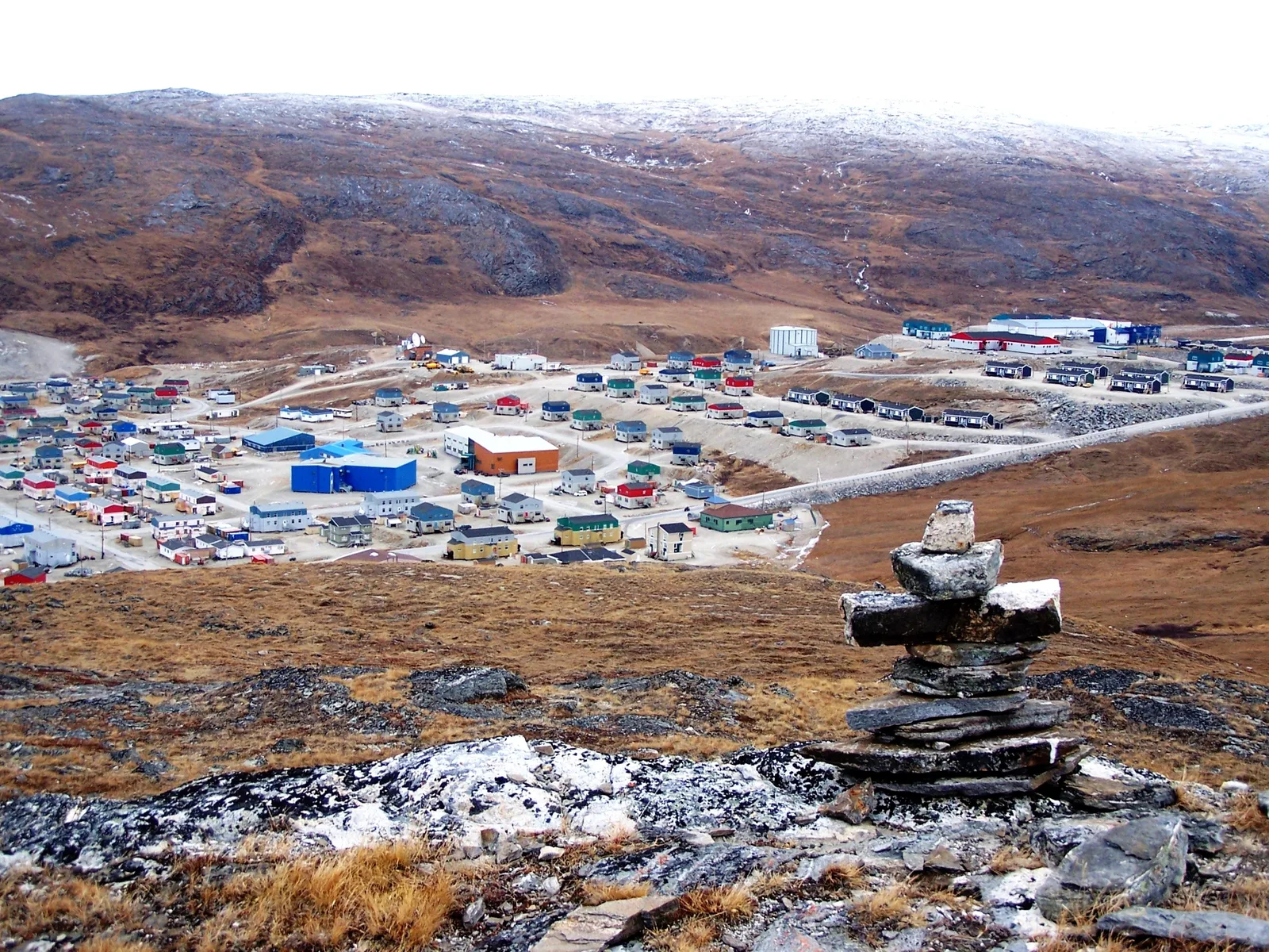
Salluit is located deep within a fjord in northern Quebec, offering rugged and spectacular Arctic beauty. The settlement is known for its strong Inuit culture and the dramatic landscapes of the tundra. Local shorelines include Grève Sajjugittuq and Grève Qairtuinaq, which are essential spots for residents for traditional activities. Grève Qilalukkisiivikallak is also a distinctive point on the shoreline where the power of nature is palpable. The region features rich wildlife; beluga whales and seals are often spotted in the icy waters. Gastronomy is based on local resources such as Arctic char and caribou. As there are no road connections, access is only possible via Salluit Airport, ensuring the location's untouched and unique atmosphere.
Explore on the map
How well do you know Canada?
Find cities, landscapes and regions in 10 varied challenges on the interactive map.
Your journey, your memory
A postcard from Salluit
Turn your own photo into a personal postcard with a local stamp. Free and no sign-up required.
Create a postcard- Location: Canada
- Population: ~1.075 (2022)
Geography
Facts
- Inuit community
- Nunavik region
- Sugluk Inlet
- Air access only
- Arctic climate
- Grève Sajjugittuq shore
- Beluga sightings
- Traditional hunting
Route planner — Car & Motorhome
Where do you start? We build the route here, with stops and country notes along the way.
© OpenStreetMap contributors · OpenRouteService
Frequently asked questions
How do you get to Salluit?
What is the weather like in Salluit?
What is the main language in Salluit?
Are there hotels for tourists?
What can a visitor experience there?
Salluit: where is it located?
Salluit: why is it worth visiting?
Nearby cities