Plizio Visual Lab
Big Bend
Weather…
Water temperature…
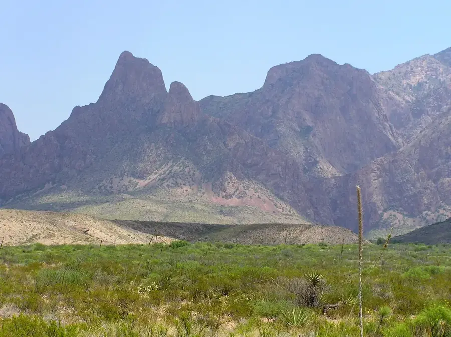
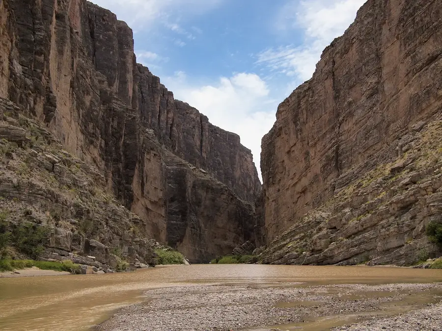
Big Bend refers to a region in Southwest Texas where the Rio Grande makes a sharp turn, forming the international border between the United States and Mexico. The area is anchored by Big Bend National Park, which protects the Chihuahuan Desert, the volcanic Chisos Mountains, and the deep limestone canyons carved by the river. Geologically, it is a significant site for paleontologists and geologists, featuring dinosaur fossil beds and evidence of historical tectonic and volcanic events. The landscape's elevation changes support a range of biodiversity, from desert scrubland to high-altitude forests, providing habitat for hundreds of bird species. Historically a frontier for Native American tribes and later for ranchers, it is now prized for its remote wilderness. It is also famous for having some of the darkest night skies in North America, making it a premier location for astronomical observation and research.
- Location: United States
- Top sights: Animal Highways · LM Peak · Chisos Mountains Tree Zone
Best time to visit & climate
The most pleasant time to visit is Mar, Apr, Oct.
| Jan | Feb | Mar | Apr | May | Jun | Jul | Aug | Sep | Oct | Nov | Dec | |
|---|---|---|---|---|---|---|---|---|---|---|---|---|
| Avg °C | 9 | 12 | 17 | 22 | 26 | 29 | 29 | 28 | 25 | 21 | 14 | 10 |
| Rain mm | 15 | 9 | 14 | 14 | 34 | 43 | 49 | 47 | 46 | 29 | 16 | 14 |
📋 Practical info
Geography
Facts
- The Rio Grande forms an international border of over 1,600 km here.
- Big Bend National Park covers approximately 3,242 square kilometers.
- Emory Peak is the highest point in the park at 2,385 meters.
- Santa Elena Canyon features limestone walls up to 450 meters high.
- Home to fossils of Quetzalcoatlus, one of the largest flying creatures.
- Designated as an International Dark Sky Park for its exceptional stargazing.
Explore nearby
Notable places around
Route planner — Car & Motorhome
Where do you start? We build the route here, with stops and country notes along the way.
© OpenStreetMap contributors · OpenRouteService
Sights in the town Big Bend (3)
Sights nearby
Frequently asked questions
How is the heat?
Is there drinking water?
Is a 4WD needed?
Can you see stars here?
Are there accommodations in the park?
Big Bend: where is it located?
Big Bend: what is there to see?
Big Bend: when is the best time to visit?
Big Bend: why is it worth visiting?

Nearby cities


Nature
More places