Plizio Visual Lab
Tuti Island
Weather…
Water temperature…
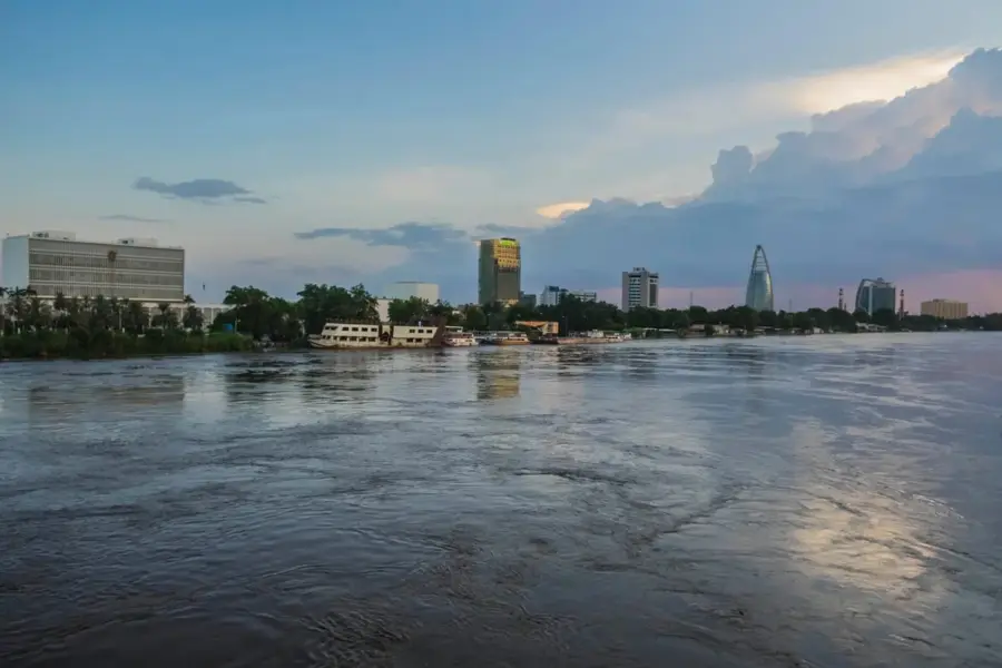
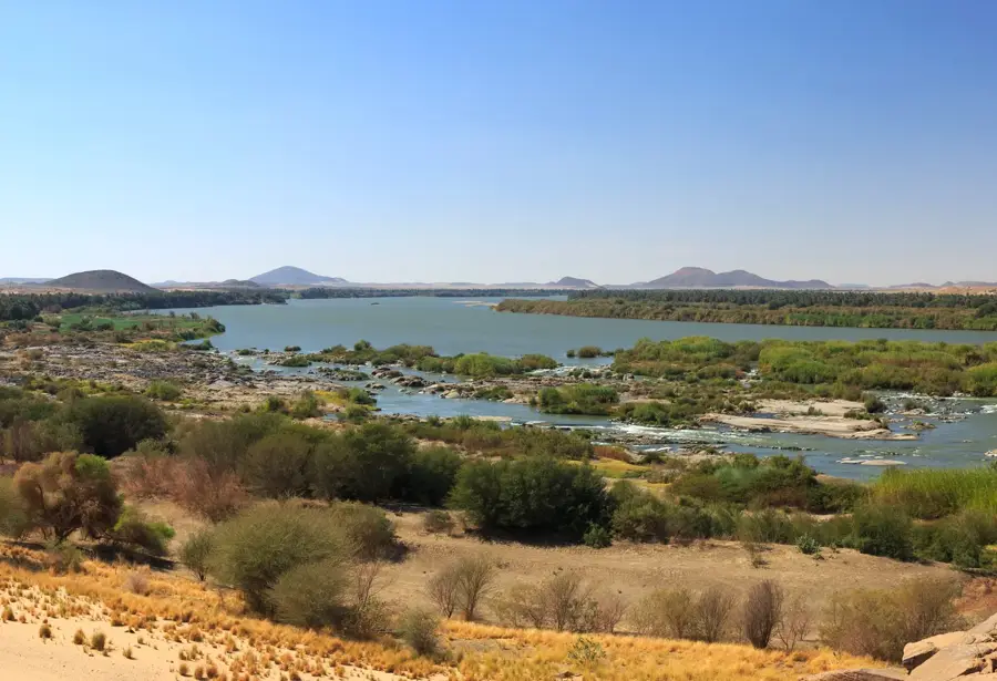
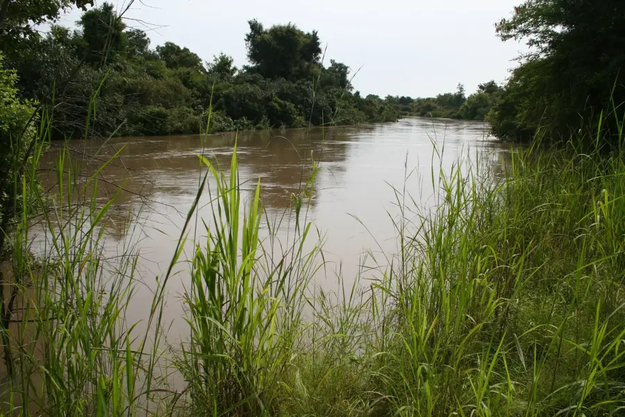
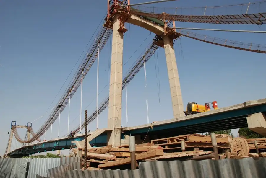
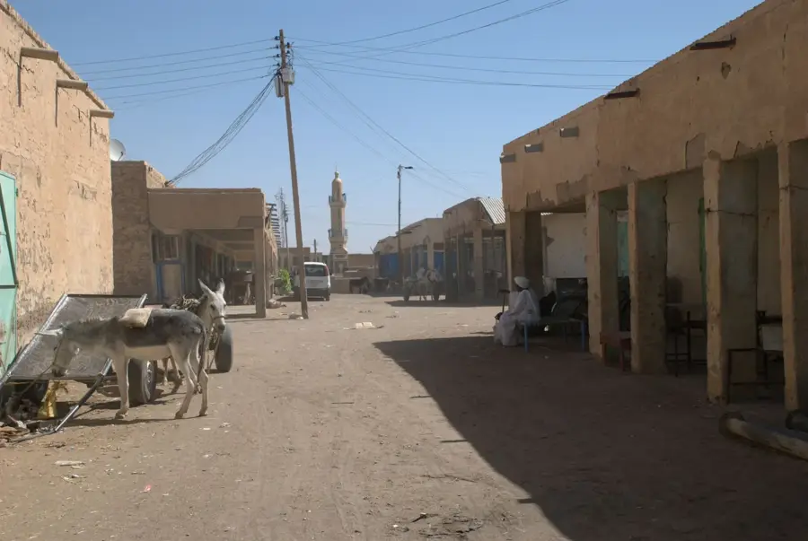
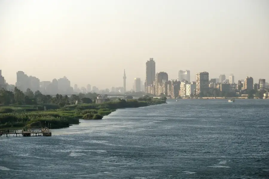
Tuti Island is located at the confluence of the White and Blue Nile rivers in the Sudanese capital, Khartoum, covering approximately 8 square kilometers. Despite its central location within a bustling metropolis, the island has largely preserved its rural character with traditional mud-brick houses and intensive agriculture. The fertile silt deposited by the Nile during the annual floods allows for the cultivation of fruits, vegetables, and fodder crops that supply the city's markets. The residents of Tuti are famous for their strong social cohesion and their historical resistance to urban relocation plans. Historically, the island was a significant center for religious education and Sufism in the Nile Valley. Since the completion of the Tuti Bridge in 2008, the island has become more directly connected to Khartoum, increasing the pressure on its traditional lifestyle. The island's shores are a popular gathering spot for city dwellers, especially during sunsets.
- Location: Sudan
- Top sights: Khaish Art Studio · United Nations Development Programme (UNDP) · Ethnological Museum
- Nearby: Omdurman (7 km)
Best time to visit & climate
The most pleasant time to visit is Jan, Feb, Dec.
| Jan | Feb | Mar | Apr | May | Jun | Jul | Aug | Sep | Oct | Nov | Dec | |
|---|---|---|---|---|---|---|---|---|---|---|---|---|
| Avg °C | 22 | 25 | 28 | 31 | 34 | 35 | 33 | 31 | 32 | 32 | 27 | 23 |
| Rain mm | 0 | 0 | 0 | 1 | 3 | 5 | 44 | 58 | 20 | 9 | 0 | 0 |
📋 Practical info
Geography
Facts
- Tuti Island covers an area of about 800 hectares of highly fertile land.
- The island is situated precisely where the White and Blue Niles merge.
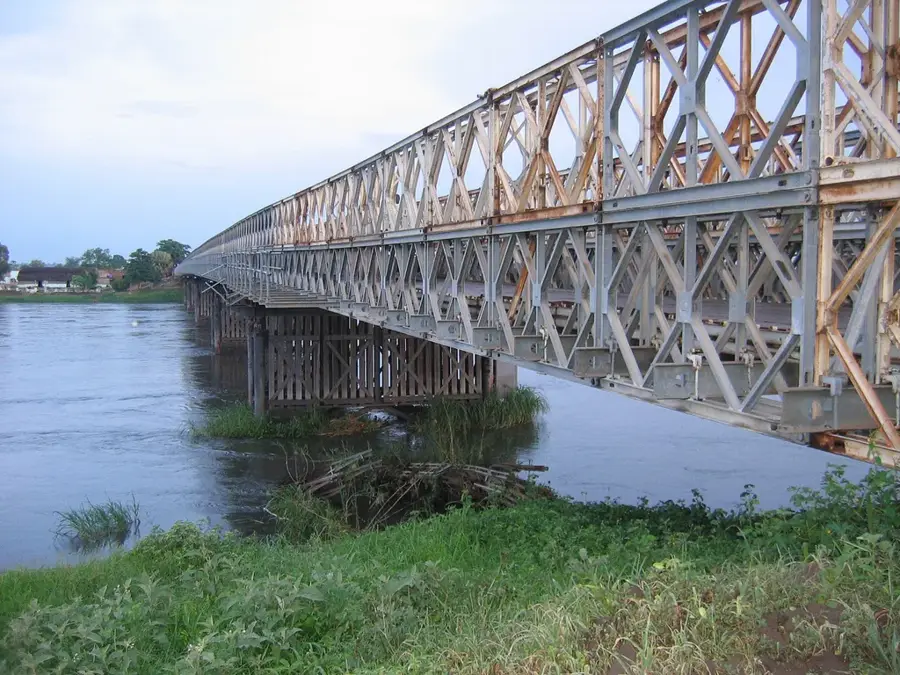
- The Tuti Bridge is Sudan's first suspension bridge, opened in 2008.
- Residents have used a traditional flood warning and defense system for centuries.
- Lemon and mango groves dominate much of the island's agricultural landscape.
- During the dry season, wide sandy beaches emerge along the island's banks.
Explore nearby
Notable places around
Route planner — Car & Motorhome
Where do you start? We build the route here, with stops and country notes along the way.
© OpenStreetMap contributors · OpenRouteService
Sights in the town Tuti Island (6)
Ethnological Museum🏛 museum
The Ethnological Museum on Tuti Island displays cultural objects.
Military Museum🏛 museum
The Military Museum on Tuti Island exhibits military items.
Palace Museum🏛 museum
The Palace Museum on Tuti Island shows historical rooms.
Atanye
Atanye is a gallery on Tuti Island presenting local art.
Sights nearby
Frequently asked questions
Why is Tuti Island so popular?
Is there a bridge to the island?
Is it suitable for a picnic?
When is the best time to visit?
Are there museums there?
Tuti Island: where is it located?
Tuti Island: what is there to see?
Tuti Island: when is the best time to visit?
Tuti Island: why is it worth visiting?

Nearby cities

History & landmarks

Nature

More places