Plizio Visual Lab
Gaya irrigated land
Weather…
Water temperature…
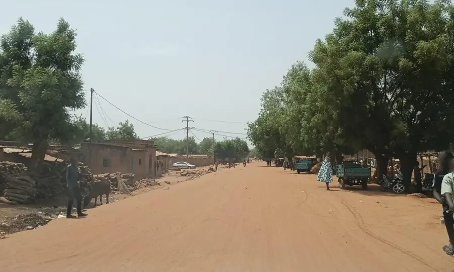
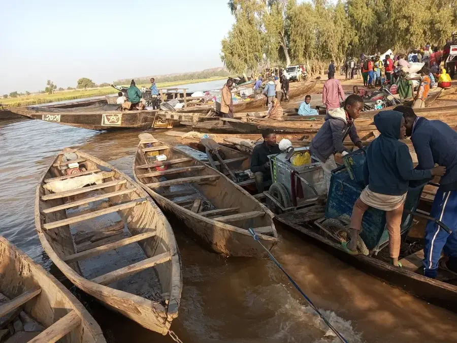
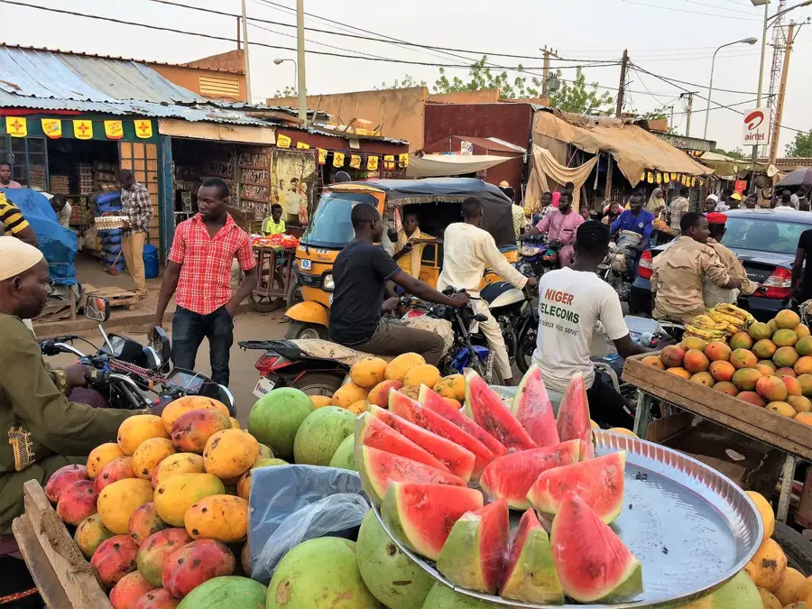
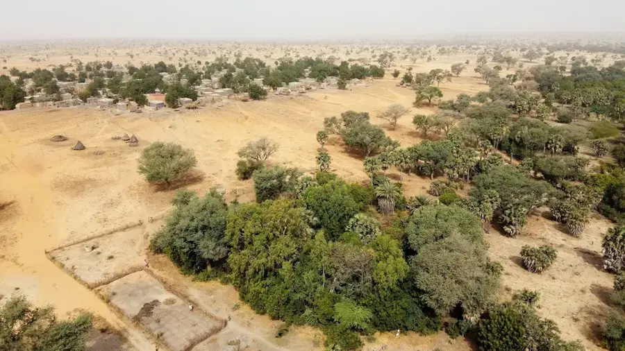
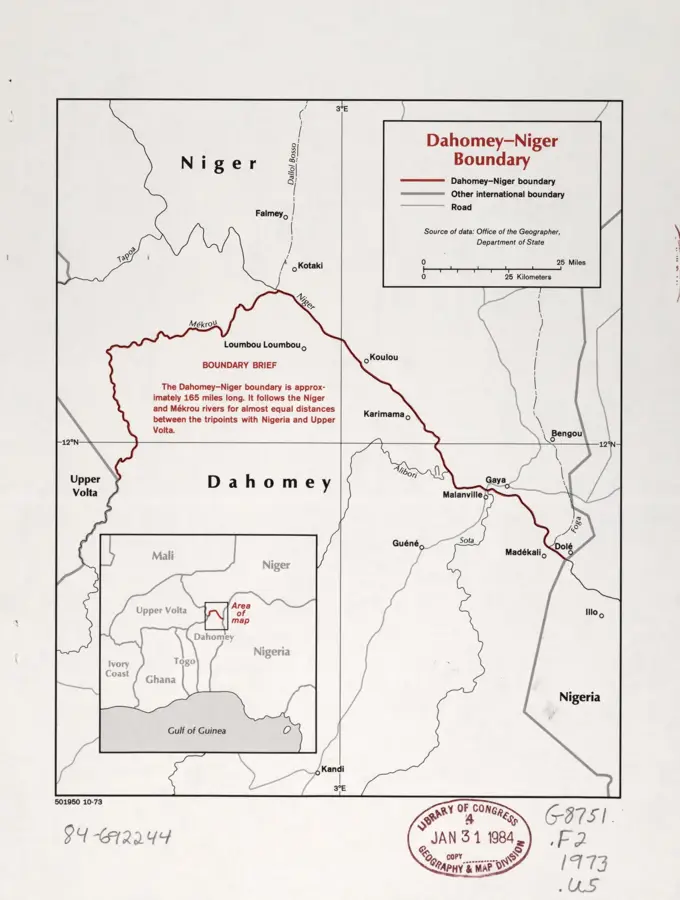
The irrigated lands of Gaya are located in the far southwest of Niger, at the border junction with Benin and Nigeria, where the Niger River exits the country. This region is the wettest in Niger, which combined with its proximity to the river, allows for intensive year-round agriculture. The primary crop in Gaya is rice, grown in extensive irrigated perimeters within the river's floodplains. In addition to rice, farmers cultivate maize, sugarcane, and various vegetables such as onions and tomatoes. The town of Gaya serves as a critical border post and commercial hub, facilitating the export of agricultural produce to neighboring countries. Irrigation systems draw water from the Niger River through a network of canals and pumps, making farmers less vulnerable to erratic rainfall. The region is also well-known for its fruit orchards, producing large quantities of mangoes and citrus fruits. Due to its strategic location on international trade routes and abundant water supply, Gaya is a major driver of regional economic development. Agriculture here exemplifies the effective utilization of river resources for sustainable food production in the Sahel.
Best time to visit & climate
The most pleasant time to visit is Jan, Nov, Dec.
| Jan | Feb | Mar | Apr | May | Jun | Jul | Aug | Sep | Oct | Nov | Dec | |
|---|---|---|---|---|---|---|---|---|---|---|---|---|
| Avg °C | 24 | 28 | 31 | 33 | 32 | 30 | 28 | 27 | 27 | 27 | 26 | 24 |
| Rain mm | 0 | 1 | 5 | 17 | 59 | 96 | 153 | 225 | 145 | 44 | 1 | 0 |
📋 Practical info
Geography
Facts
- Gaya is often cited as the wettest location in Niger.
- The Niger River serves as the natural border with Benin in this area.
- Rice is the dominant agricultural commodity produced here.
- The town is a major gateway for trade coming from the Port of Cotonou.
- Mangoes from Gaya are highly prized and sold throughout Niger.
- Annual rainfall in Gaya can reach more than 800 mm.
Explore nearby
Notable places around
Route planner — Car & Motorhome
Where do you start? We build the route here, with stops and country notes along the way.
© OpenStreetMap contributors · OpenRouteService
Sights in the town Gaya irrigated land (1)
Sights nearby
Frequently asked questions
What does Gaya irrigation land mean?
Can one see the facilities?
What is grown there?
Is the area open to visitors?
Are there nearby cities?
Gaya irrigated land: where is it located?
Gaya irrigated land: when is the best time to visit?
Gaya irrigated land: why is it worth visiting?

Nature

More places