Plizio Visual Lab
Bemaraha National Park
Weather…
Water temperature…
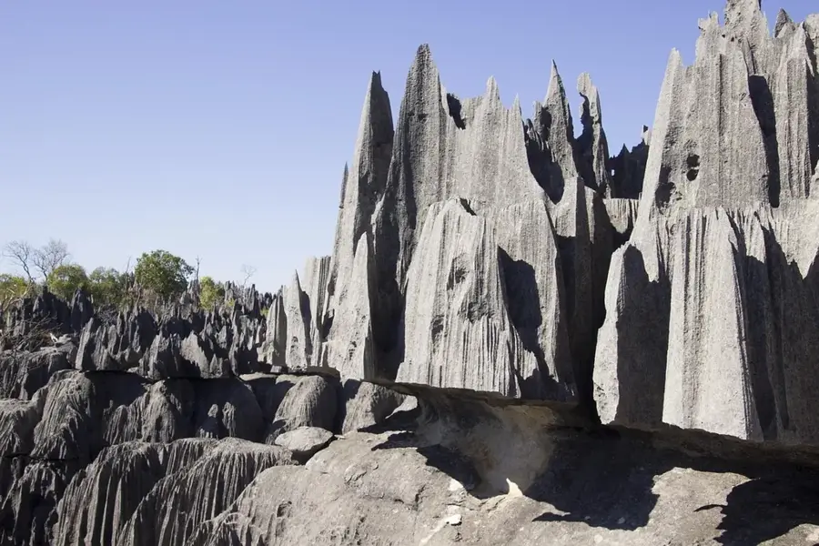
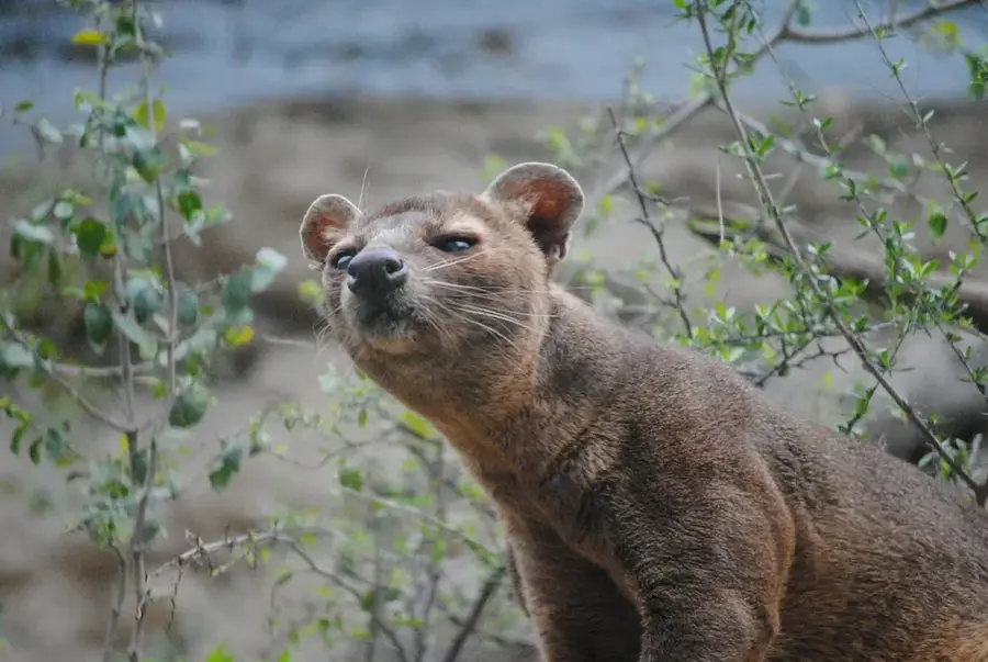
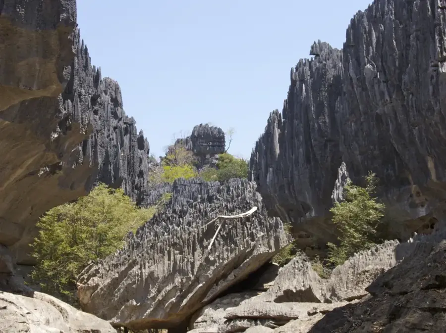
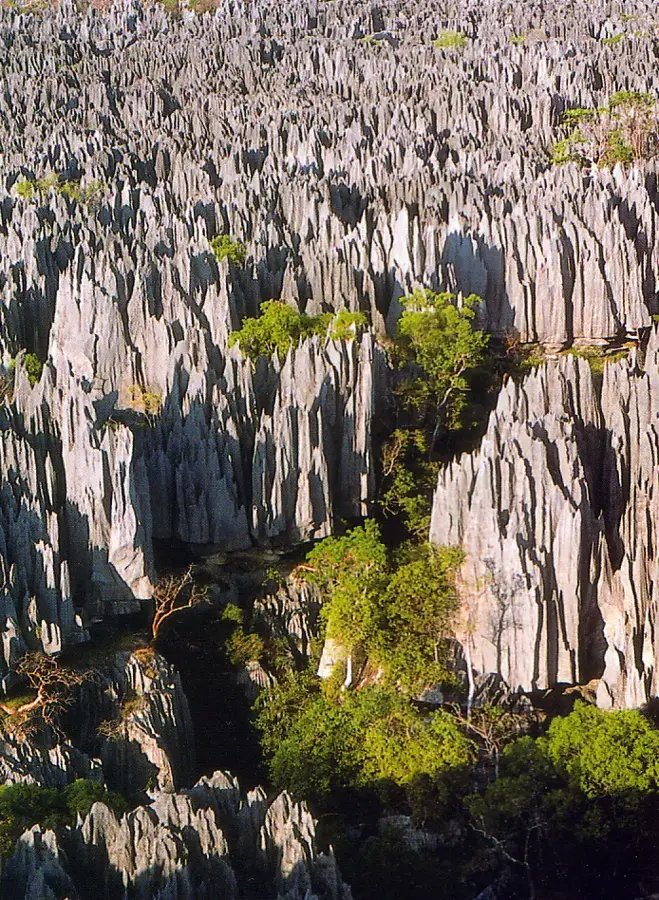
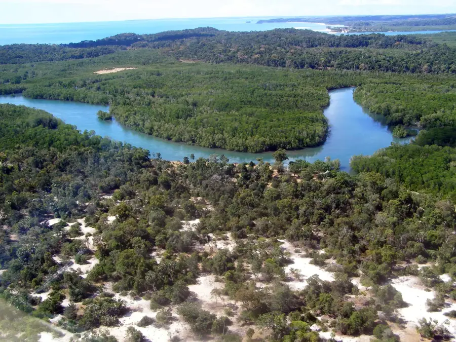
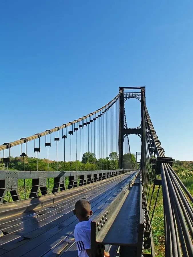
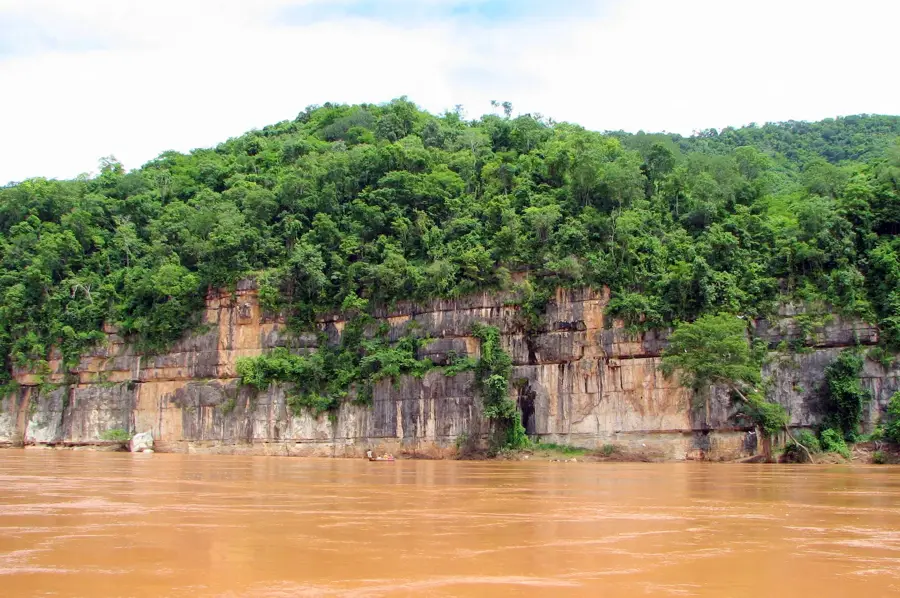
Tsingy de Bemaraha National Park in western Madagascar is a UNESCO World Heritage site renowned for its spectacular karst landscapes. The name 'Tsingy' refers to the razor-sharp limestone needles created by millennia of erosion and tectonic uplift. The park is divided into the Great Tsingy and the Little Tsingy, featuring a labyrinth of deep canyons, caves, and limestone plateaus. Despite its seemingly inhospitable rocky terrain, the park hosts remarkable biodiversity, including eleven lemur species and numerous endemic reptiles. The flora has adapted to these extreme conditions, with succulents and small trees growing directly out of rock crevices. The park is bordered by the Manambolo River, which has carved a dramatic gorge through the limestone. For visitors, spectacular hanging bridges and via ferrata climbing routes have been installed to allow passage over the sharp-edged rocks. Tsingy de Bemaraha is considered one of the most remote but visually striking places on Earth.
- Location: Madagascar
- Nearby: Antsalova (15 km)
Best time to visit & climate
The most pleasant time to visit is Jun–Aug.
| Jan | Feb | Mar | Apr | May | Jun | Jul | Aug | Sep | Oct | Nov | Dec | |
|---|---|---|---|---|---|---|---|---|---|---|---|---|
| Avg °C | 25 | 25 | 25 | 24 | 22 | 21 | 21 | 23 | 26 | 27 | 27 | 27 |
| Rain mm | 384 | 280 | 201 | 86 | 23 | 11 | 12 | 6 | 14 | 55 | 115 | 232 |
📋 Practical info
Geography
Facts
- UNESCO World Heritage site since 1990
- Composed of razor-sharp limestone needles
- Divided into Great and Little Tsingy
- Home to 11 species of lemurs
- Bordered by the Manambolo River
- Famous for its dramatic hanging bridges
Explore nearby
Notable places around
Route planner — Car & Motorhome
Where do you start? We build the route here, with stops and country notes along the way.
© OpenStreetMap contributors · OpenRouteService
Sights nearby
Frequently asked questions
Is the hike dangerous?
What makes the park unique?
Do I need a guide?
When is the best time?
Are there sanitary facilities?
Bemaraha National Park: where is it located?
Bemaraha National Park: when is the best time to visit?
Bemaraha National Park: why is it worth visiting?

Nearby cities
History & landmarks
Nature
More places