Plizio Visual Lab
Lover's Leap
Weather…
Water temperature…
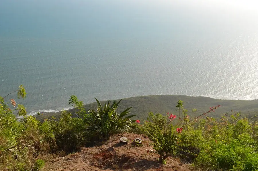
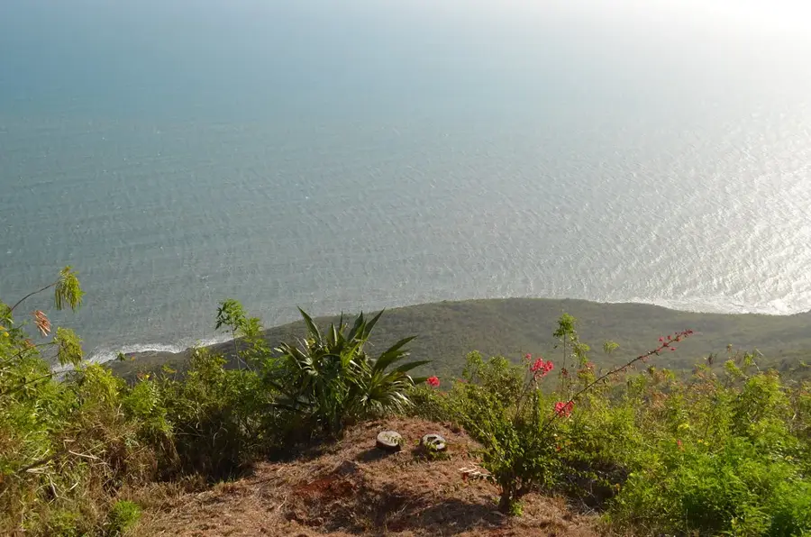
Lover's Leap is a spectacular 520-meter cliff located on the rugged south coast of St. Elizabeth, where the Santa Cruz Mountains meet the Caribbean Sea. The site is named after a poignant 18th-century legend involving two enslaved lovers, Mizpah and Eustace, who reportedly chose to jump to their deaths rather than be separated by their master. This story has become a central part of Jamaican folklore, symbolizing the ultimate sacrifice for love and freedom. Beyond its tragic legend, the site serves an important practical purpose as a navigation point. It is home to a solar-powered lighthouse that stands at an elevation of 518 meters, making it the highest lighthouse in the Western Hemisphere. On a clear day, the view from the observation deck extends far across the ocean, sometimes reaching as far as the coast of Panama. The site also features a small museum that details the local history of the parish and the specific details of the legend, making it a key stop for cultural tourism on the island's south coast.
Explore on the map
How well do you know Jamaica?
Find cities, landscapes and regions in 10 varied challenges on the interactive map.
Your journey, your memory
A postcard from Lover's Leap
Turn your own photo into a personal postcard with a local stamp. Free and no sign-up required.
Create a postcard- Location: Jamaica
- Highlights: Lover's Leap Lighthouse · Southfield, Jamaica
- Nearby: Bluefields (51 km)
Best time to visit & climate
The most pleasant time to visit is Jan–Mar.
| Jan | Feb | Mar | Apr | May | Jun | Jul | Aug | Sep | Oct | Nov | Dec | |
|---|---|---|---|---|---|---|---|---|---|---|---|---|
| Avg °C | 25 | 26 | 26 | 27 | 28 | 27 | 28 | 28 | 28 | 27 | 26 | 26 |
| Rain mm | 43 | 23 | 36 | 51 | 127 | 91 | 69 | 95 | 128 | 162 | 92 | 49 |
📋 Practical info
Geography
Facts
- The cliff rises 1,700 feet (520 meters) almost vertically from the sea.
- Home to the highest lighthouse in the Western Hemisphere, standing at 518 meters elevation.
- Named after the 18th-century legend of enslaved lovers Mizpah and Eustace.
- The lighthouse was built in 1954 and currently operates on solar power.
- Located at the southernmost point of the Santa Cruz Mountains in St. Elizabeth.
- Provides a view of the coastline that can extend up to 50 miles on clear days.
- The site includes a restaurant and a museum dedicated to local history.
- A designated heritage site managed by the Jamaica National Heritage Trust.
Explore nearby
Notable places around
Route planner — Car & Motorhome
Where do you start? We build the route here, with stops and country notes along the way.
© OpenStreetMap contributors · OpenRouteService
Sights in the town Lover's Leap (2)
Sights nearby
Frequently asked questions
How high is the cliff at Lover's Leap?
What is the legend of Lover's Leap?
Is there a restaurant there?
Are tickets needed for the viewpoint?
When is the best time to visit?
Lover's Leap: where is it located?
Lover's Leap: what is there to see?
Lover's Leap: when is the best time to visit?
Lover's Leap: why is it worth visiting?

History & landmarks

Nature
More places