Plizio Visual Lab
San Andrés
ℹ️Practical info — San Andrés
▾
🌤 Weather — 5 days
📍 Nearby
Sights nearby
💡 Tips
- Rent a golf cart to explore the island, but be sure to book it well in advance.
- Remember that you must purchase a tourist card (Tarjeta de Turismo) before your flight to the island.
- Bring plenty of cash, as card machines often fail due to poor internet connectivity.
- Head to the west coast for snorkeling early in the morning to avoid the crowds.
🍽 Food
A traditional seafood and coconut stew, best tried in authentic islander restaurants in the San Luis neighborhood.
Fried whole red snapper served with coconut rice. Found at almost all beachside eateries on the main beach.
A great quick snack often sold by local vendors along the beach promenade.
🛍 Shopping · 🧘 Quiet spots
The island is a tax-free zone; you can find perfumes and liquor at good prices along Avenida Costa Rica.
Jewelry and small bowls carved from coconut shells, available at small stalls near Spratt Bight.
A peaceful spot inland to observe local flora away from the beach parties.
The highest point on the island gives a calm atmosphere and a great panoramic view.
Water temperature…
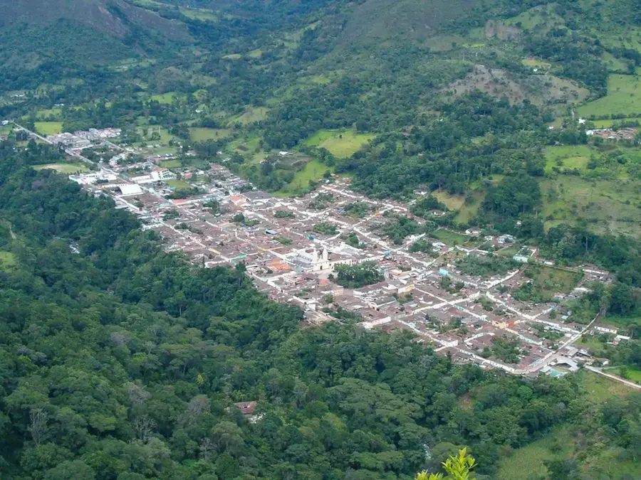
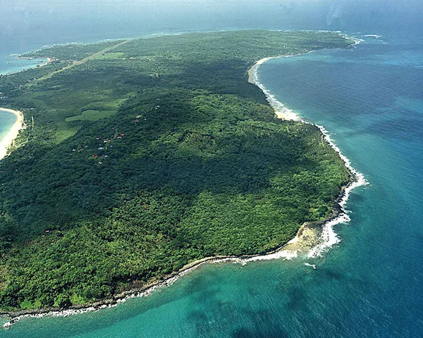
San Andres is the capital of the Colombian department of the Archipelago of San Andres, Providencia and Santa Catalina, serving as the northernmost urban center of the country in the Caribbean Sea. Located on the northern tip of San Andres Island, the city is a lively cultural crossroads where Hispanic, English, and African influences converge. Historically, the area was settled by English Puritans in the early 17th century and later became a haven for privateers, most notably Henry Morgan, before transitioning to Spanish control. This complex history has left an indelible mark on the local Raizal population, who are predominantly Protestant and speak San Andres-Providencia Creole. Today, the city is a major tourism and commercial hub, bolstered by its status as a special economic zone and free port. The urban landscape is characterized by the bustling 'North End' district, which hosts numerous duty-free shops, upscale hotels, and the popular Spratt Bight beach. Beyond its economic role, San Andres is the gateway to the Seaflower Biosphere Reserve, one of the world's most extensive marine ecosystems, protecting significant coral reefs and mangroves. The local government faces the daunting task of balancing intensive tourism development with environmental conservation and the basic needs of its high-density population, such as fresh water and waste management. Culturally, the city is famous for its music, ranging from traditional mento and polka to modern reggae and soca, celebrated during the annual Green Moon Festival. Gastronomy is another highlight, with dishes like 'Rondon' reflecting the island's maritime heritage. Educational institutions like the National University of Colombia have campuses here, focusing on Caribbean studies and marine biology. Despite its remote location from the mainland, San Andres remains a critical strategic point for Colombia's maritime sovereignty and international relations in the Caribbean basin. The city's infrastructure continues to evolve, with improvements to the Gustavo Rojas Pinilla International Airport and public spaces designed to enhance the experience for both residents and the millions of tourists who visit annually to see the legendary 'Sea of Seven Colors'.
Explore on the map
How well do you know Colombia?
Find cities, landscapes and regions in 10 varied challenges on the interactive map.
Your journey, your memory
A postcard from San Andrés
Turn your own photo into a personal postcard with a local stamp. Free and no sign-up required.
Create a postcard- Location: Colombia
- Highlights: Vicariato Apostolico de San Andrés · Bahía Sardina · Crucero riviel
- Population: ~58.257 (2026)
Best time to visit & climate
The most pleasant time to visit is Feb–Apr.
| Jan | Feb | Mar | Apr | May | Jun | Jul | Aug | Sep | Oct | Nov | Dec | |
|---|---|---|---|---|---|---|---|---|---|---|---|---|
| Avg °C | 27 | 27 | 27 | 27 | 28 | 28 | 28 | 28 | 28 | 28 | 28 | 28 |
| Rain mm | 32 | 10 | 7 | 20 | 112 | 162 | 150 | 144 | 162 | 229 | 221 | 79 |
Geography
Facts
- San Andres is the capital of Colombia's only oceanic department.
- The city operates as a duty-free port since the mid-20th century.
- The local Raizal people are of Afro-Caribbean and British descent.
- Gustavo Rojas Pinilla Airport is within walking distance of downtown.
- San Andres is located 480 miles northwest of mainland Colombia.
- The Seaflower Biosphere Reserve was established in 2000.
- Tourism accounts for over 90% of the city's economic activity.
- The island has a maximum length of 12 km and width of 3 km.
Explore nearby
Notable places around
Route planner — Car & Motorhome
Where do you start? We build the route here, with stops and country notes along the way.
© OpenStreetMap contributors · OpenRouteService
Sights in the town San Andrés (9)
Frequently asked questions
Why is the sea special here?
How do you get around the island?
Do you need to pay an entry fee?
What is Johnny Cay?
Is English spoken there?
San Andrés: where is it located?
San Andrés: what is there to see?
San Andrés: when is the best time to visit?
San Andrés: why is it worth visiting?