Plizio Visual Lab
Port of Porto Inglês

Weather…
Water temperature…
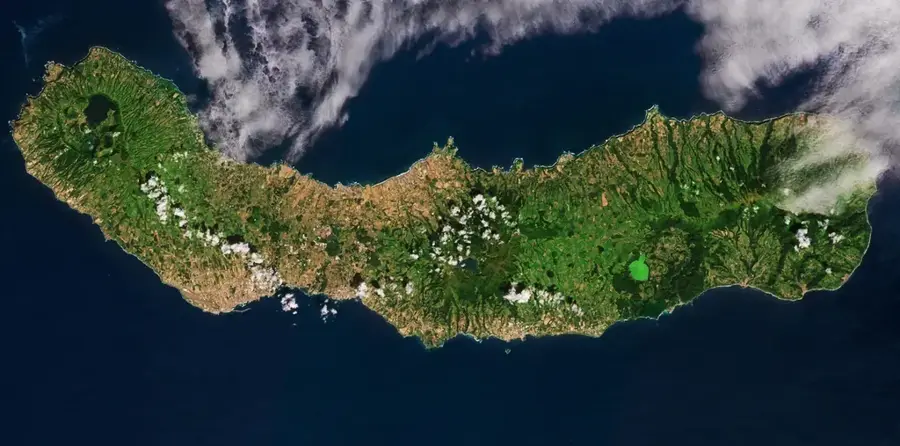
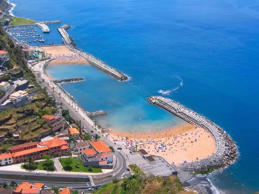
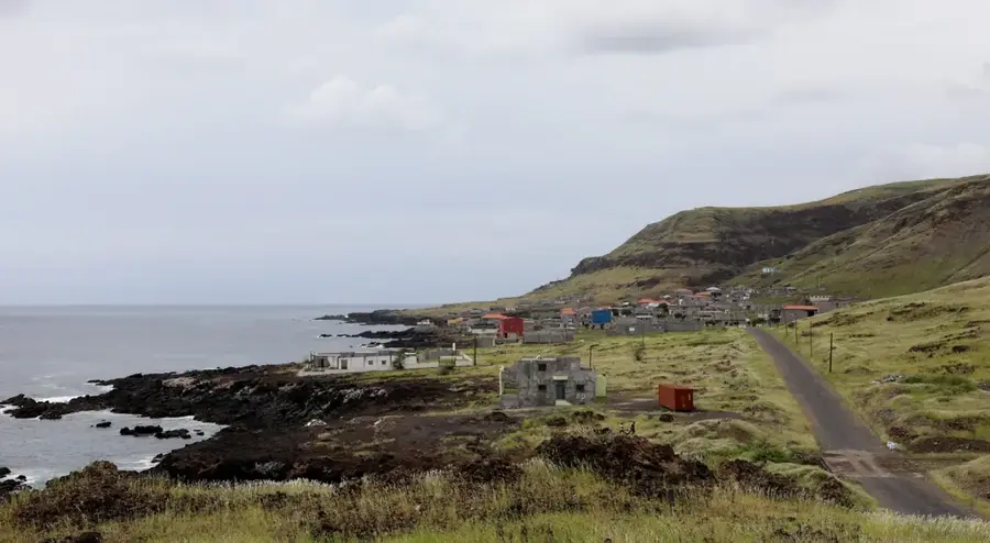
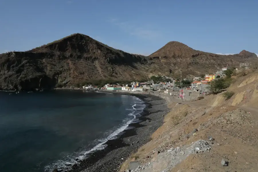
The Port of Porto Inglês on Maio Island is a central pillar for the island's economic development and has undergone a profound transformation in recent years. Long known as a simple anchorage with limited capacity, the port was comprehensively rehabilitated and modernized between 2019 and 2022. This ambitious project included the extension of the pier and the installation of Roll-on/Roll-off ramps to improve connectivity with the capital, Praia, on Santiago. These measures are critical for unlocking Maio's tourism potential and for the efficient transport of agricultural goods and traditional salt production. Located on the southwest coast, the port is now capable of safely handling larger cargo and passenger vessels. In addition to its commercial significance, it serves as a base for local artisanal fishing, which is the primary source of income for many families on the island. The modernization of Porto Inglês is seen as a turning point for the local economy, as it reduces transport costs and increases the availability of goods on the island.
- Location: Cape Verde
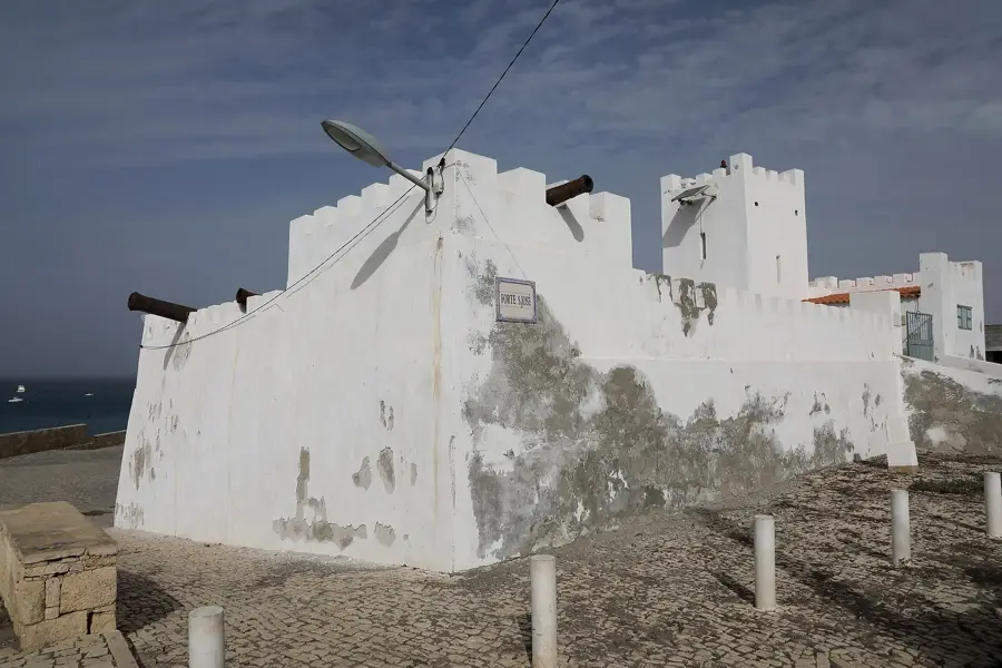
- Top sights: Forte de São José · Sóis sete luas · Casa L. A. Cardoso
- Nearby: Figueira da Horta (8 km)
Best time to visit & climate
The most pleasant time to visit is Feb–Apr.
| Jan | Feb | Mar | Apr | May | Jun | Jul | Aug | Sep | Oct | Nov | Dec | |
|---|---|---|---|---|---|---|---|---|---|---|---|---|
| Avg °C | 23 | 22 | 22 | 22 | 23 | 24 | 25 | 27 | 27 | 27 | 26 | 24 |
| Rain mm | 25 | 17 | 12 | 4 | 3 | 4 | 13 | 59 | 85 | 49 | 36 | 29 |
📋 Practical info
Geography
Facts
- Modernized between 2019 and 2022 for approximately 40 million euros.
- The new quay facility has a length of about 150 meters.
- Features modern ramps for efficient Roll-on/Roll-off traffic.
- Primary port for the export of the island's salt and agricultural goods.
- Reduced ferry travel time to Praia through more efficient handling.
- Water depth at the new pier is approximately 8 to 10 meters.
Explore nearby
Notable places around
Route planner — Car & Motorhome
Where do you start? We build the route here, with stops and country notes along the way.
© OpenStreetMap contributors · OpenRouteService
Sights in the town Port of Porto Inglês (8)
Praia da Vila
Town beach of Porto Inglês with fine sand.
Miradouro de Praia de Ponta Preta
Viewpoint overlooking Ponta Preta beach.
Montinho de Lume
Hill offering views of the coast and surroundings.
Praia de Ponta Preta
Long sandy beach south of Porto Inglês.
Sights nearby
Frequently asked questions
What is the capacity of the Port of Porto Inglês?
Are there direct connections to Praia?
Why was the port expanded?
Is there a freight station there?
Is the port lit at night?
Port of Porto Inglês: where is it located?
Port of Porto Inglês: what is there to see?
Port of Porto Inglês: when is the best time to visit?
Port of Porto Inglês: why is it worth visiting?

Nearby cities


History & landmarks
More places