Plizio Visual Lab
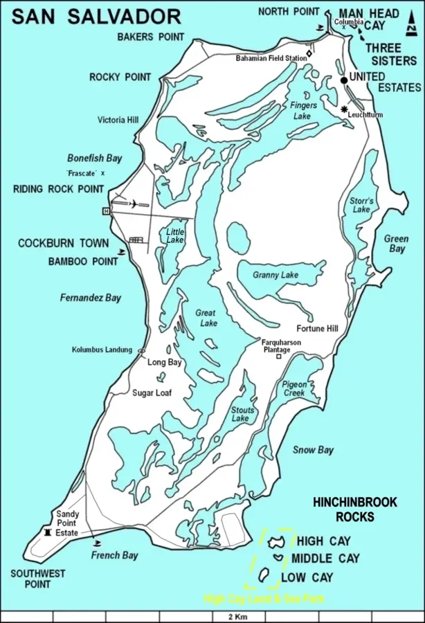
High Cay (Acklins) Relief
Weather…
Water temperature…
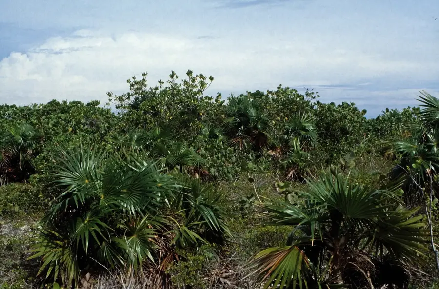
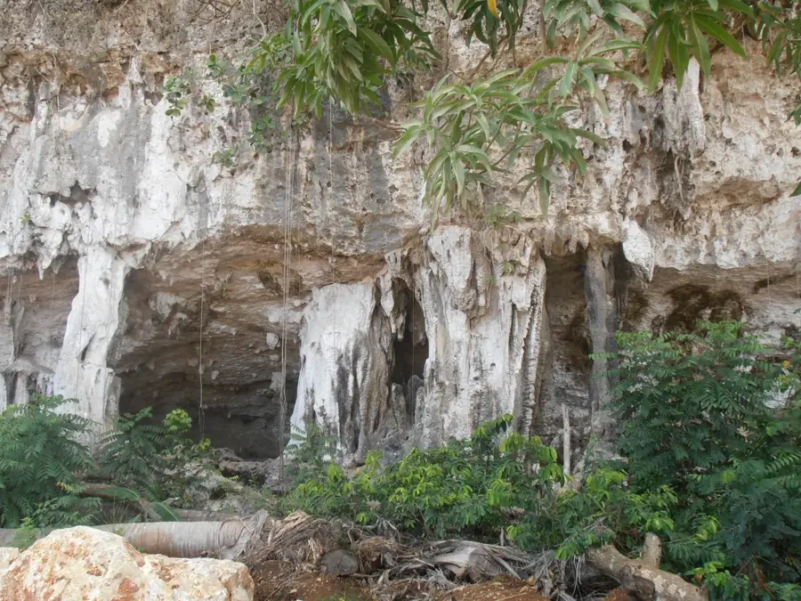
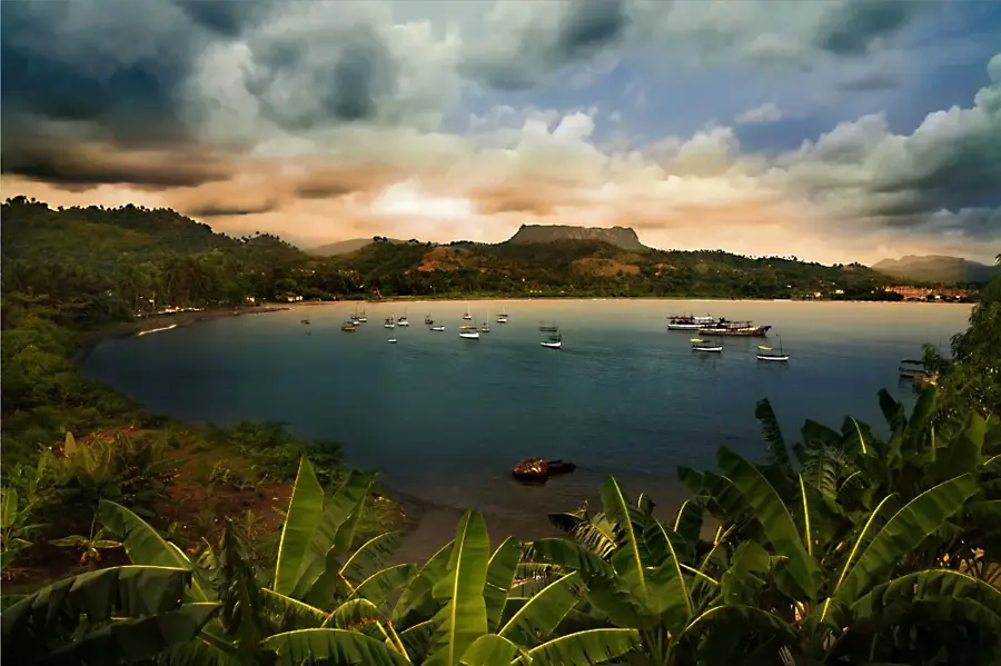
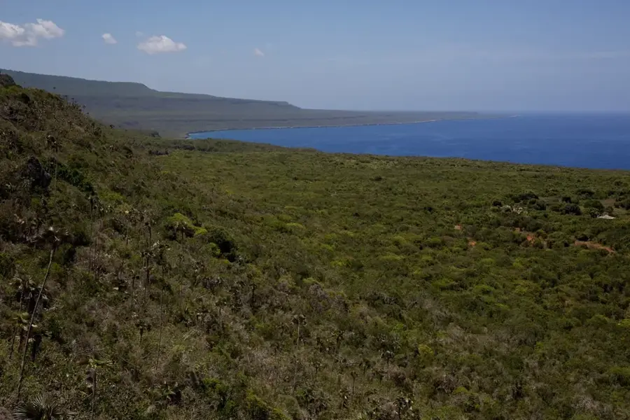
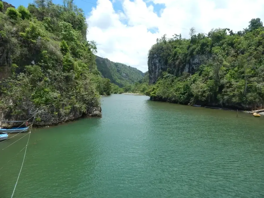
High Cay on Acklins is a distinctive topographical relief in the Acklins Bight, known for its unusual height and steep limestone cliffs. This relief stands out clearly from the otherwise flat neighboring islands and features a wide panoramic view over the shallow, turquoise waters of the bight. Geologically, High Cay consists of hardened dune deposits exposed by tectonic uplifts and sea-level fluctuations. The history of Acklins and its cays is closely linked to Lucayan settlements, who valued the relief for its strategic overview and protection from storms. Vegetation on the cay is robust, including rare Bahamian plant species that thrive in the rock crevices. Today, High Cay is an important retreat for seabirds, particularly pelicans and frigatebirds that nest in the cliffs. Geographically, the relief forms a natural barrier influencing current conditions in the bight and contributing to coral reef formation. The isolation of the Acklins island group has allowed this relief to preserve its original ecological integrity. For adventurers and nature photographers, High Cay represents a unique motif within the flat Bahamian archipelago due to its dramatic vertical structures.
- Location: Bahamas
- Nearby: Albert Town (8 km)
Best time to visit & climate
The most pleasant time to visit is Jan–Mar.
| Jan | Feb | Mar | Apr | May | Jun | Jul | Aug | Sep | Oct | Nov | Dec | |
|---|---|---|---|---|---|---|---|---|---|---|---|---|
| Avg °C | 25 | 25 | 25 | 26 | 27 | 28 | 29 | 29 | 29 | 28 | 27 | 26 |
| Rain mm | 29 | 21 | 22 | 37 | 69 | 50 | 35 | 49 | 60 | 116 | 73 | 37 |
📋 Practical info
Geography
Facts
- Acklins covers a total area of approximately 389 square kilometers.
- High Cay is among the highest elevations in the Acklins region.
- The Acklins Bight is a vast, extremely shallow marine bay.
- Lucayan settlement traces have been found on the heights.
- The relief serves as an important breeding ground for Magnificent Frigatebirds.
- The cliffs are composed of oolitic limestone.
Explore nearby
Notable places around
Route planner — Car & Motorhome
Where do you start? We build the route here, with stops and country notes along the way.
© OpenStreetMap contributors · OpenRouteService
Sights nearby
Frequently asked questions
What distinguishes High Cay?
Is the place suitable for hiking?
Are there beaches there?
Is the location family-friendly?
What should you bring?
High Cay (Acklins) Relief: where is it located?
High Cay (Acklins) Relief: when is the best time to visit?
High Cay (Acklins) Relief: why is it worth visiting?

Nearby cities


History & landmarks

Nature
More places