Plizio Visual Lab
Huíla Plateau

Weather…
Water temperature…
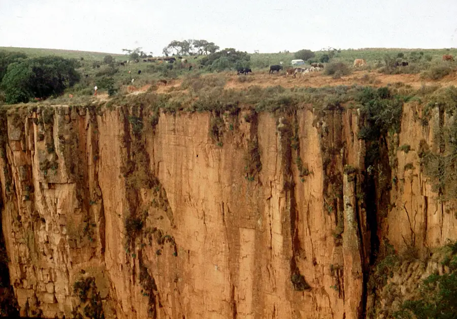
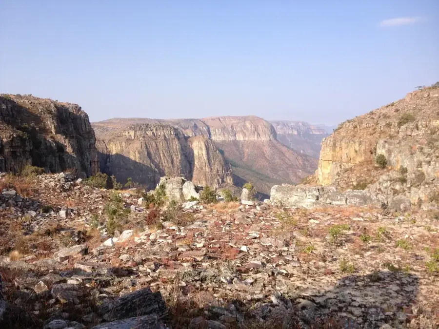
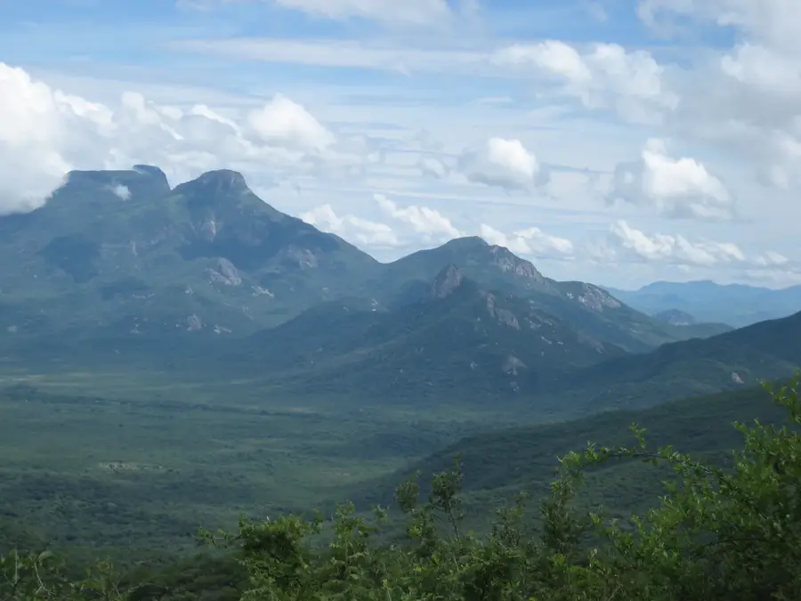
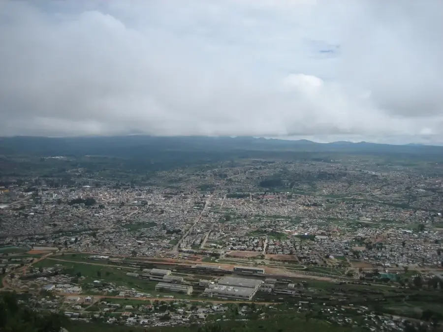
The Huíla Plateau in southwestern Angola is one of the country's most prominent highland regions, distinguished by its cool, temperate climate and fertile soils. Averaging an elevation of approximately 1,700 meters, the plateau is bounded to the west by the massive Serra da Chela escarpment, which drops dramatically over 1,000 meters toward the coastal plain. Geologically, the area is founded on ancient Precambrian basement rocks, contributing to a diverse landscape of rolling hills and rugged canyons. Historically, the plateau became a center for European settlement in the late 19th century, including Portuguese farmers and Boer trekkers, who established extensive agricultural estates. Today, the Huíla Plateau remains a critical economic engine for Angola, excelling in livestock production and diverse crop cultivation. The provincial capital, Lubango, acts as a major transport hub, while natural landmarks like the Tundavala Gap attract visitors from around the world to witness the plateau's spectacular geological formations.
- Location: Angola
- Nearby: Tundavala Gap (72 km)
Best time to visit & climate
The most pleasant time to visit is May, Aug, Sep.
| Jan | Feb | Mar | Apr | May | Jun | Jul | Aug | Sep | Oct | Nov | Dec | |
|---|---|---|---|---|---|---|---|---|---|---|---|---|
| Avg °C | 21 | 21 | 21 | 21 | 19 | 17 | 18 | 20 | 23 | 24 | 23 | 22 |
| Rain mm | 131 | 137 | 207 | 49 | 6 | 0 | 0 | 1 | 5 | 38 | 166 | 120 |
📋 Practical info
Geography
Facts
- The Huíla Plateau reaches elevations exceeding 2,300 meters at its highest points.
- The city of Lubango was officially founded in 1885 by Portuguese settlers from Madeira.
- The Tundavala Gap features a near-vertical drop of approximately 1,200 meters.
- Average annual temperatures on the plateau range between a mild 18°C and 20°C.
- Geologically, the region is part of the stable Precambrian African Shield.
- Approximately 60% of Angola's total cattle population is concentrated on this plateau.
Explore nearby
Notable places around
Route planner — Car & Motorhome
Where do you start? We build the route here, with stops and country notes along the way.
© OpenStreetMap contributors · OpenRouteService
Sights nearby
Frequently asked questions
What is the climate like in Huíla-Hochland?
When is the best time to travel here?
Is the highland suitable for hiking?
Are there many places to stay?
Is the area good for landscape photography?
Huíla Plateau: where is it located?
Huíla Plateau: when is the best time to visit?
Huíla Plateau: why is it worth visiting?

Nearby cities


More places