Plizio Visual Lab

Fichtelberg
Plizio editör ekibiVeri Kaynakları
Berg
—°5
Fichtelberg (Almanya)

Hava durumu…

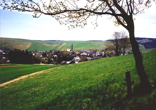
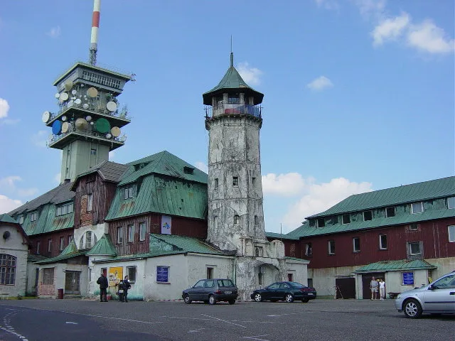
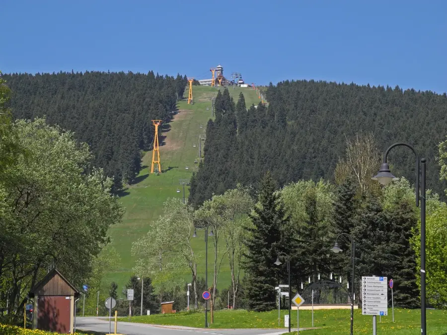
Fichtelberg, 1215 metre yüksekliği ile Saksonya'nın en yüksek dağı ve Erzgebirge'nin Alman kısmının en önemli yükseltisidir. Çek Cumhuriyeti sınırının hemen üzerinde, Almanya'nın en yüksek rakımlı şehri olan Oberwiesenthal'ın tepesinde yer alır. Fichtelberg kütlesi, komşu Çek tarafındaki Keilberg (Klínovec) ile birlikte bölgenin en önemli kış sporları merkezini oluşturur. Zirveye, 1924 yılında işletmeye alınan ve böylece Almanya'nın en eski asılı teleferiği olan Fichtelberg-Schwebebahn ile erişilir. Zirve platosunda gözetleme kuleli Fichtelberghaus, bir meteoroloji gözlemevi ve belirgin bir barış çan kulesi bulunmaktadır. Bölge, madencilikle şekillenmiş tarihi ve geleneksel Erzgebirge ahşap sanatıyla tanınır. Yürüyüşçüler ve bisikletçiler, yazın dağı Kammweg Erzgebirge-Vogtland rotasındaki turlar için başlangıç noktası olarak kullanırlar.

Yolculuğun, hatıran

Fichtelberg hatırası bir kartpostal

Kendi fotoğrafını yer damgalı kişisel bir kartpostala dönüştür. Ücretsiz ve kayıt gerektirmez.

Kartpostal oluştur

En iyi ziyaret zamanı & iklim

En keyifli dönem: Haz–Ağu.

OcaŞubMarNisMayHazTemAğuEylEkiKasAra
Ort. °C-3-227121618181383-1
Yağmur mm584148406975847862535758

📋 Pratik bilgiler

🧭
Ulaşım
The highest mountain in Saxony is most conveniently reached via the town of Oberwiesenthal, which serves as the primary gateway. Visitors often use the historic narrow-gauge railway or local bus connections to arrive comfortably.
📅
En iyi mevsim
Summer is excellent for expansive hikes and cycling across the high-altitude trails, while winter transforms the region into a major hub for alpine and Nordic skiing. Autumn offers stunning colors but much cooler winds.
⛰️
Arazi ve yollar
The environment features robust uphill climbs through dense spruce forests that eventually open up to a flat, windswept summit plateau. The trails are generally well-graded, combining gravel roads with some rocky sections.
🎒
Ekipman
Proper trekking boots with good ankle support are heavily advised for traversing the uneven forest sections safely. Because the summit is completely exposed, carrying a reliable windbreaker is a must in any season.
🅿️
Otopark
Extensive parking lots are situated directly in Oberwiesenthal and near the base stations of the cable cars. During peak winter season, it is strongly recommended to arrive very early to secure a convenient spot.
⚠️
Güvenlik
Extreme wind speeds and sudden drops in temperature are commonplace at the summit, so careful preparation is required. Always adhere to marked trails to avoid getting lost in dense fogs that frequently engulf the peak.
⏱️
Gerekli süre
A hike from the valley to the summit and back usually occupies at least half a day for average walkers. Many tourists prefer to make it a full weekend trip to explore the neighboring Czech peaks across the border.

Geographie

Koordinaten
50.42860, 12.95470

Fakten

  • Fichtelberg teleferiği 303 metrelik bir yükseklik farkını aşar.
  • Fichtelberghaus, 1963 yılındaki bir yangından sonra yeniden inşa edildi.
  • Dağ jeolojik olarak esas olarak mika şistinden oluşmaktadır.
  • Dağın eteğindeki Oberwiesenthal şehri 914 metre yükseklikte yer alır.
  • Zirvedeki Barış Çanı 2010 yılında takdis edilerek açılmıştır.
  • Fichtelberg, Almanya'da kuzey disiplini kış sporları için resmi bir üstür.

Çevreyi keşfet

Yakındaki ilgi çekici yerler

Route planner — Car & Motorhome

Where do you start? We build the route here, with stops and country notes along the way.

Vehicle
Only stops with (optional):
Motorhome dimensions

© OpenStreetMap contributors · OpenRouteService

Sehenswürdigkeiten in der Stadt Fichtelberg (5)

Wiesenthaler K3🏛 müze

Ein Museum und Gästeinformationszentrum im Kurort Oberwiesenthal.

🕒 PH,Mo-Su 09:30-17:00💶

Moor am Pfahlberg🌿 doğa

Ein geschütztes Moorgebiet zur Erhaltung des natürlichen Ökosystems am Fichtelberg.

Meeresaquarium am Fichtelberg🎡 eğlence

Ein Meeresaquarium in Oberwiesenthal, das verschiedene Meeresbewohner und Korallenriffe zeigt.

🕒 10:00-17:00 open "letzter Einlass 16:30"; Dec 24,Dec 31 off

Fichtelberg (Südosthang Süd)🌿 doğa

Naturschutzgebiet zur Erhaltung der alpinen Flora am Südhang des Fichtelbergs.

Fichtelberg (Zechengrund nördlich)🌿 doğa

Geschütztes Naturareal im nördlichen Teil des Zechengrund-Tals.

Çevredeki gezilecek yerler

Sıkça sorulan sorular

How high is the Fichtelberg and where is it located?
At 1,215 meters, the Fichtelberg is the highest mountain in Saxony. It is located in the Ore Mountains, right on the border with the Czech Republic near Oberwiesenthal.
Is there a cable car to the summit?
Yes, the Fichtelberg-Schwebebahn is Germany's oldest cable car (opened 1924) and takes visitors from Oberwiesenthal to the plateau in about 4 minutes.
Can you go skiing on the Fichtelberg?
The Fichtelberg ski area offers around 15 kilometers of slopes for all levels and is the most significant winter sports center in eastern Germany.
What is the Fichtelbergbahn?
It is a historic steam-powered narrow-gauge railway connecting Cranzahl with the resort town of Oberwiesenthal. The journey takes about one hour.
Is it worth visiting in summer too?
Absolutely. There is a wide network of hiking and mountain bike trails, and the summer toboggan run in Oberwiesenthal provides family fun.
Fichtelberg: nerede yer alıyor?
Fichtelberg, Sachsen, Almanya bölgesinde yer alır.
Fichtelberg: nereler gezilir?
Öne çıkanlar: Wiesenthaler K3, Moor am Pfahlberg, Meeresaquarium am Fichtelberg.
Fichtelberg: en iyi ziyaret zamanı nedir?
En keyifli dönem: Haz, Ağu.
Fichtelberg: neden ziyaret edilmeli?
Fichtelberg, 1215 metre yüksekliği ile Saksonya'nın en yüksek dağı ve Erzgebirge'nin Alman kısmının en önemli yükseltisidir.
Auf der Karte ansehen → En güzel plajlar → OpenStreetMap →
Avrupa
Plizio ile keşfet Avrupa'da daha fazla yer keşfedin
Almanya içinde daha fazla yer →

Städte in der Nähe