Plizio Visual Lab
Mayom
ℹ️Practical info — Mayom
▾
🌤 Weather — 5 days
📍 Nearby
Sights nearby
💡 Tips
- Mayom is a strategic but remote town; ensure you are self-sufficient with basic supplies.
- The climate is very hot and dry; protection from the sun is critical for any outdoor activity.
- The town is a gateway between Warrap and Unity states; expect diverse cattle-trading communities.
- Dirt roads are the norm; travel during the dry season (December-March) is much easier.
- Respect local protocols and greet community elders if you are staying for more than a day.
🍽 Food
Hearty and simple, usually using fresh beef from the local herds.
Known as 'laban', it is a staple energy drink for the local pastoralists.
The primary starch here, often served with a side of local greens or meat.
🛍 Shopping · 🧘 Quiet spots
Handcrafted metal bells used by herders, available in the market stalls.
Traditional colorful fabrics worn by the local women.
Woven from local plant fibers, essential for the livestock lifestyle.
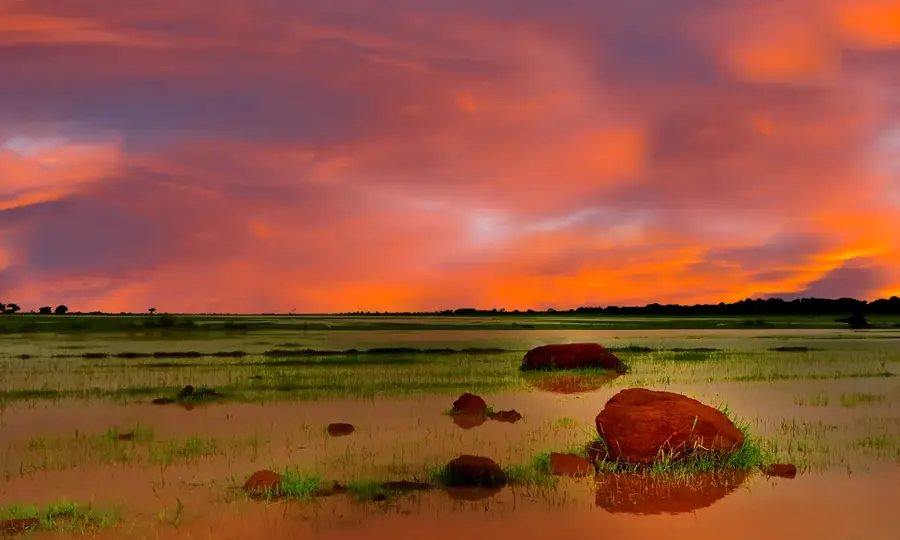
The vast, flat landscape outside town is great for a peaceful evening walk.
Gathering spots under large trees where life slows down in the afternoon.
A quiet place to observe the traditional lifestyle from a distance.
Water temperature…
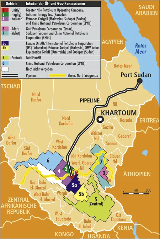
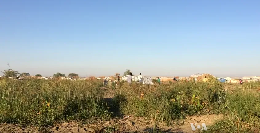
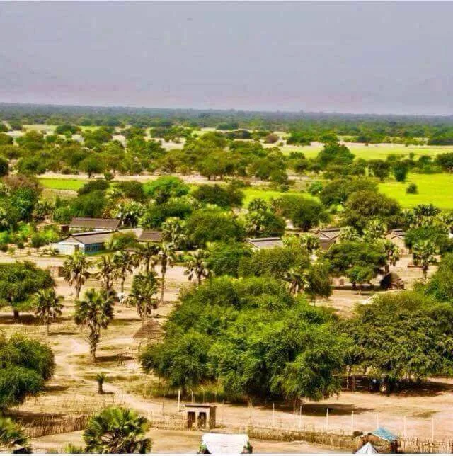
Mayom is a strategic town and the administrative headquarters of Mayom County in Unity State, South Sudan. It is primarily inhabited by the Bul Nuer community and has historically played a significant role in the regional dynamics of the Bahr el Ghazal and Upper Nile regions. Geographically, Mayom is situated on a key transit route connecting the oil-rich areas of Unity State with the neighboring Warrap State and the disputed Abyei region to the north. This location has made it a focal point of both commercial trade and military strategy during periods of civil unrest. The town's economy is centered on pastoralism, with cattle representing not only wealth but also the cultural heart of the community. In recent years, Mayom has undergone efforts at reconstruction and stabilization, aiming to improve infrastructure such as local markets, schools, and health facilities. The surrounding landscape consists of expansive grasslands and seasonal wetlands that support the migratory lifestyle of the Nuer pastoralists. Despite facing numerous challenges, Mayom continues to be a resilient urban center that serves as a vital link for the people of western Unity State.
- Location: South Sudan
- Nearby: Turalei (72 km)
Best time to visit & climate
The most pleasant time to visit is Jan, Nov, Dec.
| Jan | Feb | Mar | Apr | May | Jun | Jul | Aug | Sep | Oct | Nov | Dec | |
|---|---|---|---|---|---|---|---|---|---|---|---|---|
| Avg °C | 29 | 31 | 33 | 33 | 31 | 28 | 27 | 26 | 27 | 28 | 28 | 29 |
| Rain mm | 0 | 0 | 5 | 24 | 106 | 131 | 154 | 199 | 154 | 85 | 5 | 0 |
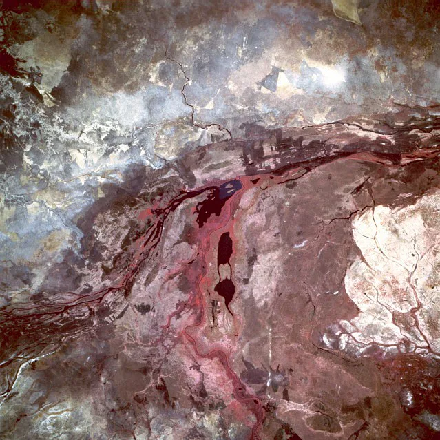
Geography
Facts
- Administrative capital of Mayom County in Unity State.
- Primarily inhabited by the Bul Nuer subgroup.
- Strategic junction on the border of Warrap and Abyei.
- Important center for traditional cattle-based economy.
- Historical site of significant regional conflicts.
- Located in a region with high agricultural potential.
Explore nearby
Notable places around
Route planner — Car & Motorhome
Where do you start? We build the route here, with stops and country notes along the way.
© OpenStreetMap contributors · OpenRouteService
Frequently asked questions
What is Mayom?
Are there attractions?
Is it safe?
How to travel there?
What is important?
Mayom: where is it located?
Mayom: when is the best time to visit?
Mayom: why is it worth visiting?

Nearby cities
History & landmarks

Nature
More places