Plizio Visual Lab
Koutous Massif Height
Weather…
Water temperature…
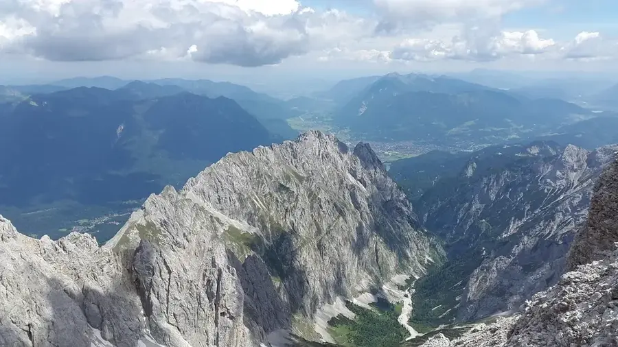
The Koutous Massif is a prominent sandstone plateau located in the Zinder region of eastern Niger. It rises abruptly from the surrounding plains, creating a rugged landscape characterized by mesas (flat-topped mountains) and deep valleys. Geologically, the massif is composed of continental sedimentary rocks from the Cretaceous period that were uplifted by tectonic activity. The region is historically significant for its strategic value, as the natural fortifications provided by the massif served as havens for local communities during times of conflict. The climate is semi-arid, though the higher elevations often support slightly denser vegetation than the adjacent lowlands. Erosion over millennia has sculpted spectacular rock formations and caves, some of which contain archaeological evidence of ancient human presence. Local inhabitants practice a combination of valley agriculture and highland pastoralism. Despite its harsh appearance, the Koutous Massif is an important part of the regional cultural heritage and holds potential for geological tourism.
Best time to visit & climate
The most pleasant time to visit is Jan, Feb, Dec.
| Jan | Feb | Mar | Apr | May | Jun | Jul | Aug | Sep | Oct | Nov | Dec | |
|---|---|---|---|---|---|---|---|---|---|---|---|---|
| Avg °C | 18 | 22 | 27 | 31 | 34 | 34 | 32 | 30 | 30 | 29 | 24 | 20 |
| Rain mm | 0 | 0 | 0 | 1 | 5 | 19 | 58 | 111 | 29 | 5 | 0 | 0 |
📋 Practical info
Geography
Facts
- The massif reaches elevations of up to 600 meters above sea level.
- It is located approximately 100 kilometers northeast of the city of Zinder.
- The geological formation is part of the Tegama sandstone series.
- The area served as a defensive refuge during various historical conflicts.
- Numerous natural springs are located along the slopes of the massif.
- The cliffs display distinct layers of light and reddish-colored sandstone.
Explore nearby
Notable places around
Route planner — Car & Motorhome
Where do you start? We build the route here, with stops and country notes along the way.
© OpenStreetMap contributors · OpenRouteService
Sights nearby
Frequently asked questions
What is the Koutous region like?
Is it suitable for trekking fans?
Are there accommodation options there?
Do you need a special vehicle?
Is photography good there?
Koutous Massif Height: where is it located?
Koutous Massif Height: when is the best time to visit?
Koutous Massif Height: why is it worth visiting?