Plizio Visual Lab
Potosí
ℹ️Practical info — Potosí
▾
🌤 Weather — 5 days
📍 Nearby
Sights nearby
💡 Tips
- Take a walk through the vast sugar cane fields surrounding the town, especially during the harvest season.
- Visit the historic parish church in the center, which is a lovely example of local colonial style.
- Use the town as a quiet base; it is very close to Rivas but has a much more relaxed, rural atmosphere.
- Keep an eye out for local patron saint festivals, which often feature traditional music and dancing.
- Look for local farms in the outskirts that often sell fresh 'cuajada' (local cheese) directly to visitors.
🍽 Food
Being an agricultural hub, the papayas and bananas here are exceptionally sweet and fresh.
Often prepared by local families on weekends; look for signs outside private homes.
A soft, salty artisanal cheese that is a staple of the local rural breakfast.
🛍 Shopping · 🧘 Quiet spots
Small neighborhood shops where you can find home-style sweets and local dairy products.
Farmers often sell sacks of seasonal vegetables and fruits along the main access roads.
The dirt paths winding through the sugar cane fields are first-rate for a quiet sunset walk.
A small, shaded park where you can sit and enjoy the gentle pace of local life.
Water temperature…
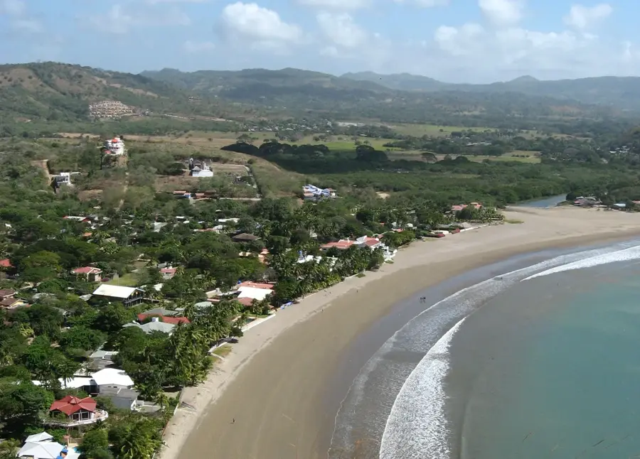
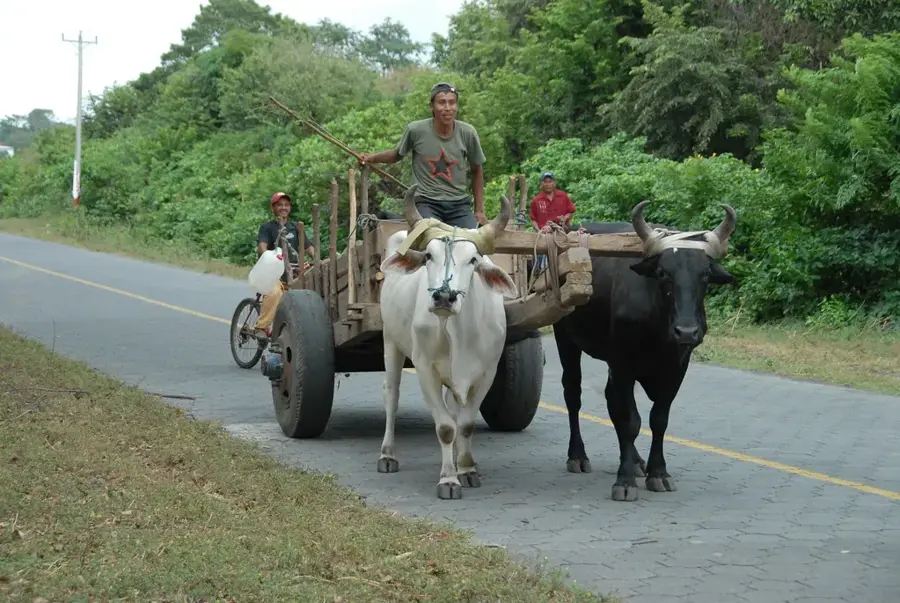
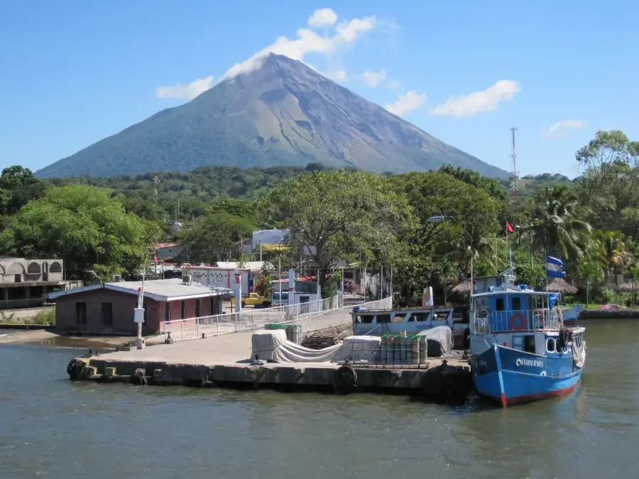
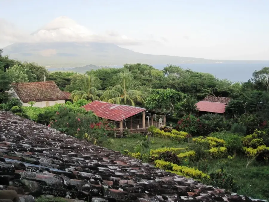
Potosí is a major agricultural municipality located in the department of Rivas, in southwestern Nicaragua, located within the fertile corridor between Lake Nicaragua and the Pacific Ocean. Established in the mid-19th century, the town was named after the famous Bolivian silver mining city, symbolizing the immense wealth of its productive soils. The geography is dominated by flat, volcanic plains that are among the most fertile in Central America. Economically, Potosí is a powerhouse of the Nicaraguan sugar industry, with vast tracts of land dedicated to sugarcane cultivation that supports nearby industrial mills. In addition to sugar, the area is a leading producer of bananas, plantains, and basic grains for the national market. Historically, the territory was a central hub for the Nicarao indigenous people, and the area remains a significant site for pre-Columbian archaeological discoveries. The town itself features a quiet, rural character with traditional Nicaraguan architecture and a well-maintained central plaza. Today, Potosí stands as a vital contributor to the regional economy through its industrial-scale agricultural output.
- Location: Nicaragua
- Nearby: Buenos Aires (4 km)
- Population: ~5.222 (2026)
Best time to visit & climate
The most pleasant time to visit is Jan, Feb, Dec.
| Jan | Feb | Mar | Apr | May | Jun | Jul | Aug | Sep | Oct | Nov | Dec | |
|---|---|---|---|---|---|---|---|---|---|---|---|---|
| Avg °C | 27 | 28 | 28 | 29 | 29 | 28 | 28 | 28 | 28 | 27 | 27 | 27 |
| Rain mm | 1 | 1 | 4 | 24 | 201 | 199 | 119 | 181 | 286 | 322 | 137 | 8 |
Geography
Facts
- Potosí was officially founded as a municipality in 1830.
- The total administrative area covers approximately 144 square kilometers.
- The town is home to one of Nicaragua's most important sugar refineries.
- Its name was chosen to highlight the richness of the local farmland.
- The municipality is a key site for pre-Columbian Nicarao archaeological finds.
- Agriculture employs over 70% of the local working population.
Explore nearby
Notable places around
Route planner — Car & Motorhome
Where do you start? We build the route here, with stops and country notes along the way.
© OpenStreetMap contributors · OpenRouteService
Frequently asked questions
How much time should I plan for Potosí?
When is the weather most pleasant in Potosí?
Are there good family-friendly accommodations?
What is the best transport option to the city?
What culinary specialties does Potosí offer?
Potosí: where is it located?
Potosí: when is the best time to visit?
Potosí: why is it worth visiting?

Nearby cities


History & landmarks
More places