Plizio Visual Lab
Nanyuki
ℹ️Practical info — Nanyuki
▾
🌤 Weather — 5 days
📍 Nearby
Sights nearby
💡 Tips
- Take a photo at the Equator sign just south of the town center.
- Altitude is high (around 2000m); nights can be surprisingly chilly, bring a warm jacket.
- Popular base for Mount Kenya climbs; rent gear or find guides in town.
- Look out for views of Mount Kenya early in the morning before clouds roll in.
🍽 Food
Freshly caught from mountain streams, served in nicer restaurants or lodges.
Popular due to the local Indian community.
Available at popular expat hangouts and specific local breweries.
🛍 Shopping · 🧘 Quiet spots
Beautiful handmade wool rugs and blankets.
For modern supplies, groceries, and ATM access before heading to the bush.
Nice spots for a walk or picnic near the town center.
Peaceful environment with rescued animals (requires entry).
Water temperature…
Nanyuki is a thriving town in Laikipia County, globally recognized for its unique position directly on the Equator line. Established in 1907 by British settlers, the town quickly evolved into a key agricultural and railway hub for the central highlands. Today, Nanyuki serves as the primary gateway for climbers and hikers tackling Mount Kenya, Africa's second-highest peak. Its strategic significance is bolstered by the presence of the Laikipia Air Base and the British Army Training Unit Kenya (BATUK), which maintains a permanent presence here. Geographically, the town is situated at an elevation of 1,950 meters at the foot of Mount Kenya, offering a temperate climate and impressive alpine views. Beyond its military and tourist roles, Nanyuki is a center for wildlife conservation, surrounded by world-renowned sanctuaries like Ol Pejeta. The town's diverse population of locals, expatriates, and military personnel creates a distinctive cosmopolitan atmosphere amidst the rugged Kenyan landscape.
Explore on the map
How well do you know Kenya?
Find cities, landscapes and regions in 10 varied challenges on the interactive map.
Your journey, your memory
A postcard from Nanyuki
Turn your own photo into a personal postcard with a local stamp. Free and no sign-up required.
Create a postcard- Location: Kenya
- Nearby: Mount Kenya (32 km)
- Population: ~72.813 (2023)
Best time to visit & climate
The most pleasant time to visit is Jan–Mar.
| Jan | Feb | Mar | Apr | May | Jun | Jul | Aug | Sep | Oct | Nov | Dec | |
|---|---|---|---|---|---|---|---|---|---|---|---|---|
| Avg °C | 18 | 19 | 20 | 19 | 18 | 18 | 17 | 17 | 18 | 19 | 18 | 17 |
| Rain mm | 46 | 33 | 87 | 207 | 120 | 69 | 73 | 85 | 68 | 113 | 139 | 85 |
Geography
Facts
- Nanyuki was founded in 1907 by British settlers as a supply post.
- The town is situated on the Equator at an altitude of 1,947 meters.
- It serves as the main base for expeditions to Mount Kenya's peaks.
- The Laikipia Air Base, a major Kenyan military facility, is located here.
- The British Army Training Unit Kenya (BATUK) is headquartered in Nanyuki.
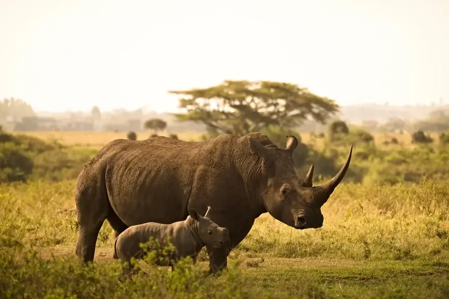
- Nearby Ol Pejeta Conservancy is home to the world's last northern white rhinos.
Explore nearby
Notable places around
Route planner — Car & Motorhome
Where do you start? We build the route here, with stops and country notes along the way.
© OpenStreetMap contributors · OpenRouteService
Frequently asked questions
Where is the Equator in Nanyuki?
What parks are nearby?
What is the weather like?
Is there an airport?
Can you go mountain climbing here?
Nanyuki: where is it located?
Nanyuki: when is the best time to visit?
Nanyuki: why is it worth visiting?

Nearby cities





History & landmarks
Nature
More places