Plizio Visual Lab
Semera
ℹ️Practical info — Semera
▾
🌤 Weather — 5 days
📍 Nearby
Sights nearby
💡 Tips
- Semera is extremely hot and dry year-round; always carry plenty of drinking water and wear adequate sun protection.
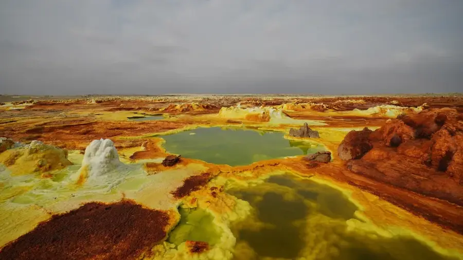
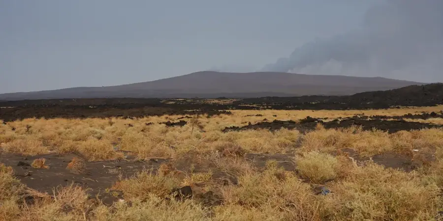
- This is the primary gateway for organizing tours and permits to the Danakil Depression and Erta Ale volcano.
- The city is newly built and spread out; rely on local three-wheeled 'bajaj' (tuk-tuks) to get around easily.
- ATMs can be unreliable; bring enough Ethiopian Birr in cash before arriving, especially if heading into the desert.
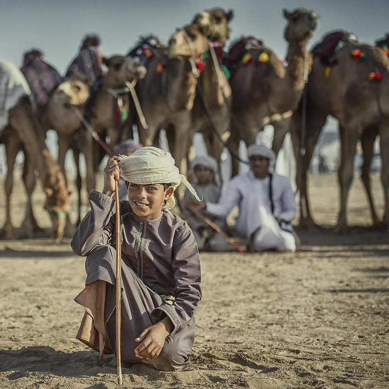
- Always ask for permission before photographing local Afar people or traditional structures.
🍽 Food
Ethiopian flatbread served with sautéed meat pieces, found in most local restaurants along the main road.
Traditionally prepared meat cooked over open fires, a specialty to try if invited to a local meal.
Even in this modern desert town, traditional coffee ceremonies are an essential and aromatic experience.
🛍 Shopping · 🧘 Quiet spots
A place to buy local Afar crafts, colorful woven goods, and everyday necessities.
Essential stops for stocking up on bottled water, snacks, and basic camping gear before Danakil expeditions.
The campus area is one of the more structured and relatively quiet spots in the developing city.
Venture slightly out of town at sunset to experience the stark, silent beauty of the surrounding desert landscape.
Water temperature…
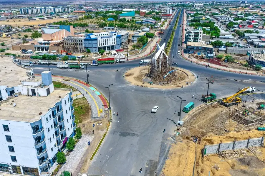
Semera is the purpose-built capital of the Afar Regional State in northeastern Ethiopia, established as a modern administrative hub to replace the former capital, Asayita. Its location was strategically selected along the critical highway connecting the landlocked nation of Ethiopia to the strategic ports of Djibouti, making it a vital node in the country's economic lifeline. Situated within the Afar Triangle, Semera lies in a geologically active region where the African and Arabian tectonic plates are gradually pulling apart. The city's layout is characterized by wide boulevards and contemporary government complexes designed to withstand the region's notoriously high temperatures, which frequently soar above 45 degrees Celsius. A cornerstone of the city is Semera University, an institution that has become a catalyst for regional development and social mobility for the traditionally nomadic Afar people. The local economy is driven by government administration, regional trade, and burgeoning logistical services. Infrastructure projects, including a dedicated airport and telecommunications networks, have integrated this remote desert outpost into the national grid. Beyond its political functions, Semera serves as a gateway for geologists and anthropologists exploring the nearby Danakil Depression and the Awash Valley, world-renowned sites for fossil discoveries and extreme landscapes. The transition of the regional capital to Semera reflects a broader national strategy of urbanization and the delivery of public services to Ethiopia's peripheral lowlands. Despite the challenging arid environment, the city continues to expand as irrigation projects from the Awash River allow for limited greenery and agricultural research, aiming to improve food security in one of the most inhospitable yet fascinating corners of the Horn of Africa.
- Location: Ethiopia
- Top sights: Lucy · ah House afar
- Population: ~50.000 (2025)
Best time to visit & climate
The most pleasant time to visit is Jan, Feb, Dec.
| Jan | Feb | Mar | Apr | May | Jun | Jul | Aug | Sep | Oct | Nov | Dec | |
|---|---|---|---|---|---|---|---|---|---|---|---|---|
| Avg °C | 25 | 27 | 29 | 30 | 33 | 35 | 34 | 32 | 32 | 30 | 27 | 25 |
| Rain mm | 5 | 8 | 26 | 49 | 22 | 8 | 69 | 90 | 51 | 12 | 4 | 7 |
Geography
Facts
- Semera was built specifically to serve as the new regional capital of Afar.
- The city is situated approximately 580 km from the national capital, Addis Ababa.
- Semera University provides higher education to thousands of students annually.
- It is located in one of the hottest inhabited places on the planet.
- The city acts as a major logistics hub for goods arriving from Djibouti ports.
- Semera Airport connects the arid lowlands with the Ethiopian highlands.
- The surrounding area is part of the Great Rift Valley system.
- Administrative buildings dominate the city's central planned district.
Explore nearby
Notable places around
Route planner — Car & Motorhome
Where do you start? We build the route here, with stops and country notes along the way.
© OpenStreetMap contributors · OpenRouteService
Sights in the town Semera (2)
Frequently asked questions
Why was Semera built?
How hot does it get in Semera?
What is the tourist significance of the city?
What can you see nearby?
Is there a university there?
Semera: where is it located?
Semera: what is there to see?
Semera: when is the best time to visit?
Semera: why is it worth visiting?

Nature
More places