Plizio Visual Lab
Birao
ℹ️Practical info — Birao
▾
🌤 Weather — 5 days
📍 Nearby
Sights nearby
💡 Tips
- Travel to this remote region requires strict security planning; always consult current travel advisories and travel with official guides.
- During the rainy season, roads become impassable, making air travel the only reliable method of access.
- Dress modestly and respectfully, as the local culture in this northern region is predominantly Muslim.
- Bring a comprehensive first-aid kit and all essential medications, as medical facilities are extremely limited.
🍽 Food
A staple millet porridge served with a savory local sauce in small canteens.
A flavorful and common daily dish found at the market food stalls.
A traditional, highly sweetened tea offered everywhere as a gesture of hospitality.
🛍 Shopping · 🧘 Quiet spots
Find aromatic local spice blends at the central market.
Light, often colorful cotton textiles sold by local merchants.
Observe the vast, dry Sahelian landscape (for safety, only go with a local guide).
A quiet area within the settlement; please view respectfully from the outside.
Water temperature…
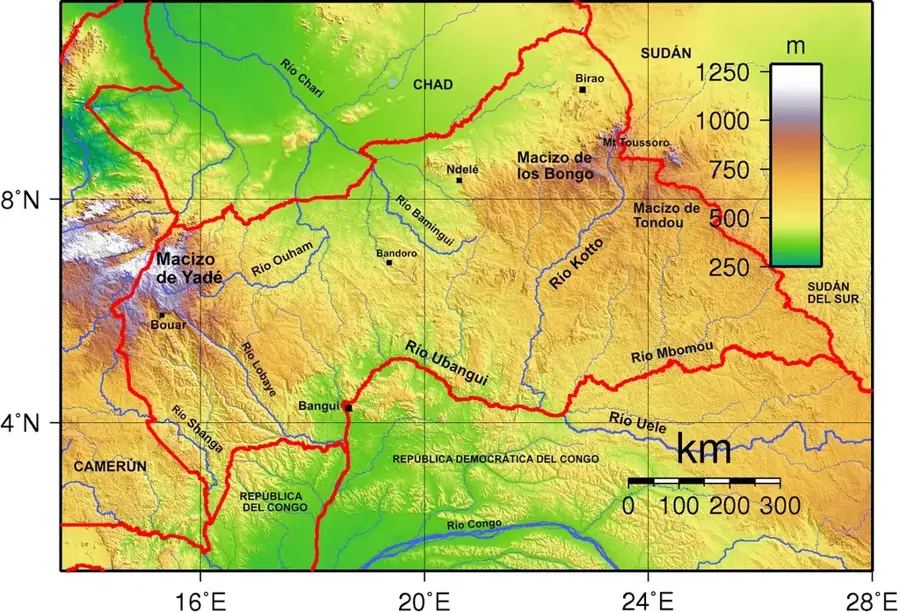
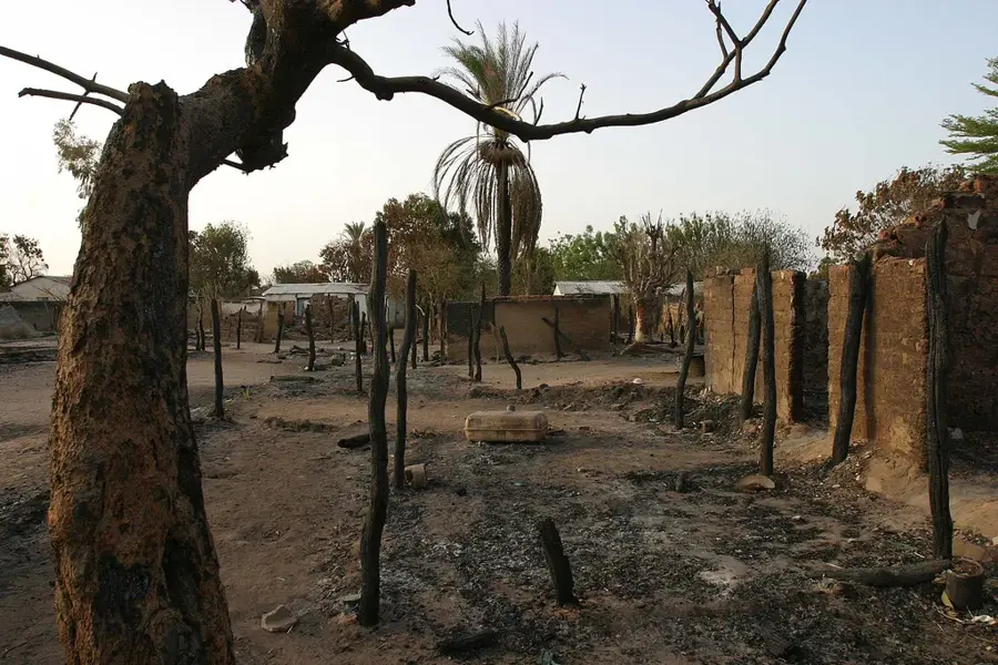
Birao is the northernmost prefecture capital in the Central African Republic, serving as the administrative center of the Vakaga prefecture. The town is situated in an extremely remote region near the borders with Sudan and Chad, giving it unique strategic and geopolitical significance. Established in 1918 as a military post, Birao was founded to consolidate government control over this distant territory. Geographically, the town lies in a Sahelian transitional zone characterized by savannahs and seasonal floodplains. During the rainy season, Birao is often cut off from the capital, Bangui, by road, complicating the supply of essential goods to the population. The local economy is based on nomadic livestock herding, subsistence farming, and local cross-border trade. The town features an airfield, which is critical for maintaining connections with the rest of the country. Due to its proximity to the borders, Birao has frequently been a site of regional conflict in the past, yet it remains the primary hub for state services in the Vakaga region. The architecture is modest and adapted to the hot, dry climate of the northern zone.
- Location: Central African Republic
- Population: ~8.457 (2026)
Best time to visit & climate
The most pleasant time to visit is Jan, Nov, Dec.
| Jan | Feb | Mar | Apr | May | Jun | Jul | Aug | Sep | Oct | Nov | Dec | |
|---|---|---|---|---|---|---|---|---|---|---|---|---|
| Avg °C | 26 | 29 | 31 | 33 | 32 | 30 | 27 | 26 | 26 | 27 | 27 | 26 |
| Rain mm | 0 | 0 | 1 | 6 | 36 | 82 | 175 | 180 | 122 | 44 | 1 | 0 |
Geography
Facts
- Capital city of the Vakaga prefecture in the far northeast.
- Founded in 1918 as a French colonial military outpost.
- Located in close proximity to the border with Sudan.
- Often isolated by road during the peak of the rainy season.
- Equipped with a strategically important local airfield.
- Principal center for nomadic cattle trade in the region.
Explore nearby
Notable places around
Route planner — Car & Motorhome
Where do you start? We build the route here, with stops and country notes along the way.
© OpenStreetMap contributors · OpenRouteService
Frequently asked questions
Where is Birao located?
What is the climate like in Birao?
Are there wild animals there?
How accessible is Birao?
Which ethnic groups live in Birao?
Birao: where is it located?
Birao: when is the best time to visit?
Birao: why is it worth visiting?

More places