Plizio Visual Lab
Nossob River
Weather…
Water temperature…
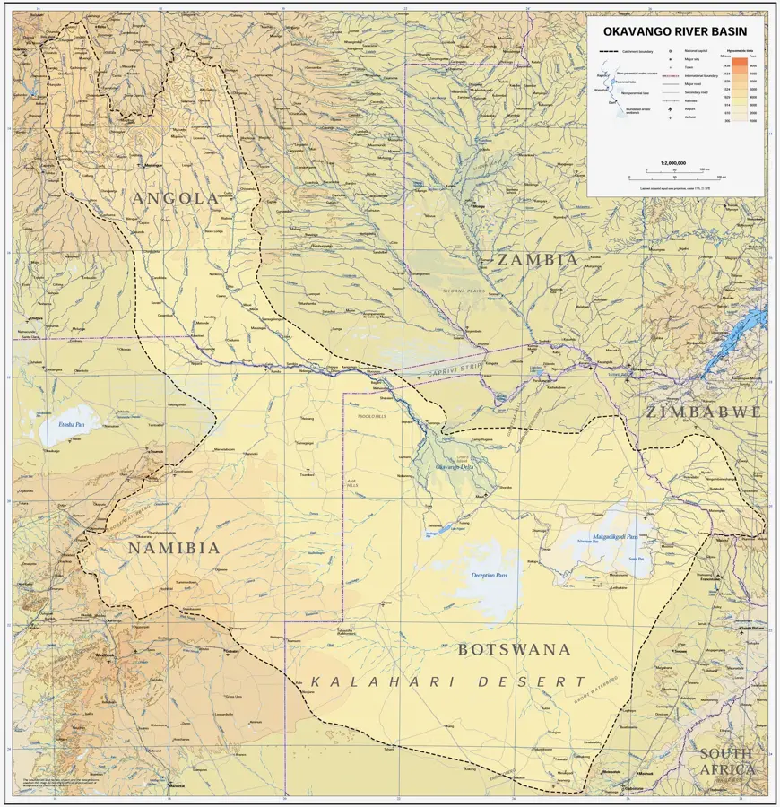
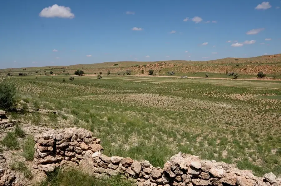
The Nossob River is a major dry river in southern Africa, forming the international border between Botswana and South Africa within the Kgalagadi Transfrontier Park. Spanning approximately 740 kilometers, it originates in Namibia and flows southeasterly to its confluence with the Auob River. Geomorphologically, the Nossob is famous for its wide, sandy bed that remains bone-dry most of the time; significant surface flow is recorded only about once a century, with the most recent occurrences in 1974 and 2000. Despite the lack of flowing water, the riverbed is ecologically vital as the deep root systems of Camel Thorn trees (Acacia erioloba) reach the groundwater, providing shade and sustenance. The valley acts as a natural corridor for predators such as lions and leopards, as well as vast herds of antelope. Historically, the river marked an important boundary in colonial history and is now a symbol of successful transboundary conservation efforts.
- Location: Botswana
- Top sights: Marie se Draai Waterhole · Kaspersdraai Waterhole
Best time to visit & climate
The most pleasant time to visit is Apr, May, Sep.
| Jan | Feb | Mar | Apr | May | Jun | Jul | Aug | Sep | Oct | Nov | Dec | |
|---|---|---|---|---|---|---|---|---|---|---|---|---|
| Avg °C | 29 | 28 | 26 | 22 | 18 | 13 | 13 | 15 | 20 | 24 | 26 | 28 |
| Rain mm | 46 | 40 | 36 | 30 | 7 | 2 | 0 | 0 | 2 | 13 | 22 | 33 |
📋 Practical info
Geography
Facts
- The total length of the Nossob is approximately 740 km.
- It defines the border between Botswana and South Africa.
- The riverbed is typically dry, with floods being centennial events.
- It is located within the Kgalagadi Transfrontier Park.
- Camel Thorn trees thrive along the bed by tapping into groundwater.
- The name originates from the Khoekhoe language, meaning 'black river.'
Explore nearby
Notable places around
Route planner — Car & Motorhome
Where do you start? We build the route here, with stops and country notes along the way.
© OpenStreetMap contributors · OpenRouteService
Sights in the town Nossob River (2)
Sights nearby
Frequently asked questions
Where does the Nossob River run?
When did the river last flow?
Which animals are often seen in the dry riverbed?
Are there camps along the Nossob?
What does the name Nossob mean?
Nossob River: where is it located?
Nossob River: what is there to see?
Nossob River: when is the best time to visit?
Nossob River: why is it worth visiting?

History & landmarks
More places