Plizio Visual Lab
Eleuthera's Rolling Hills

Weather…
Water temperature…
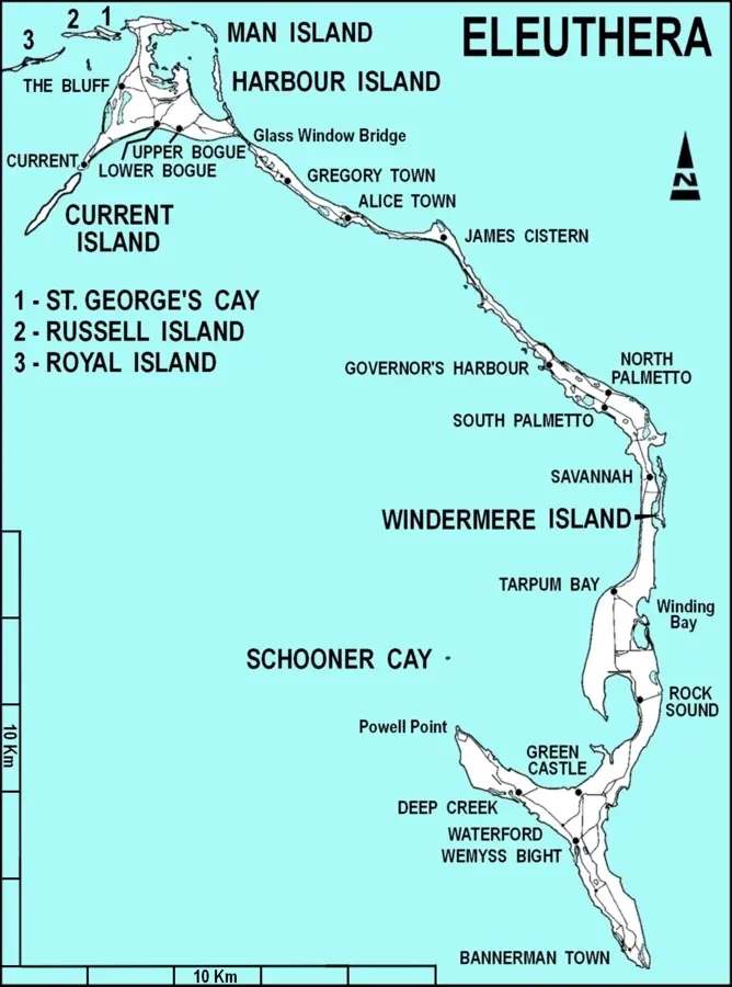
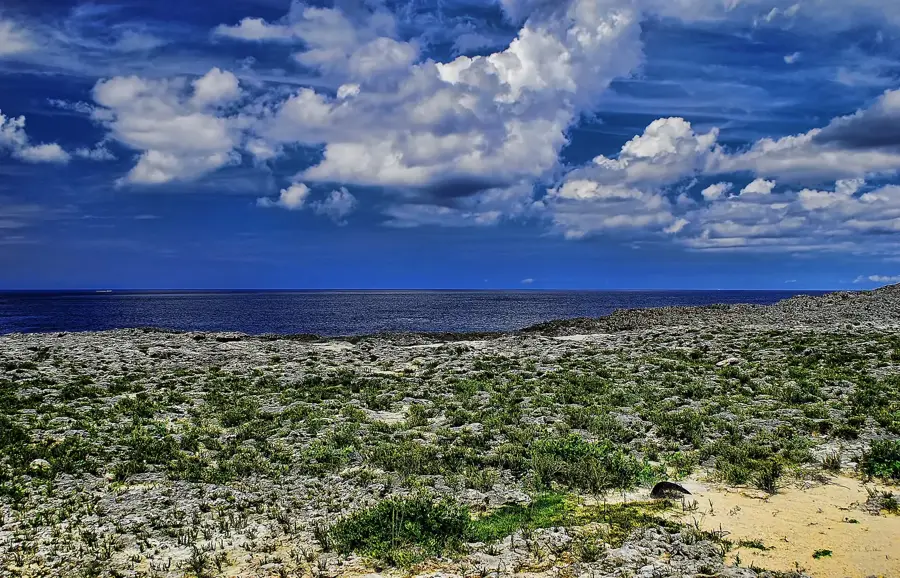
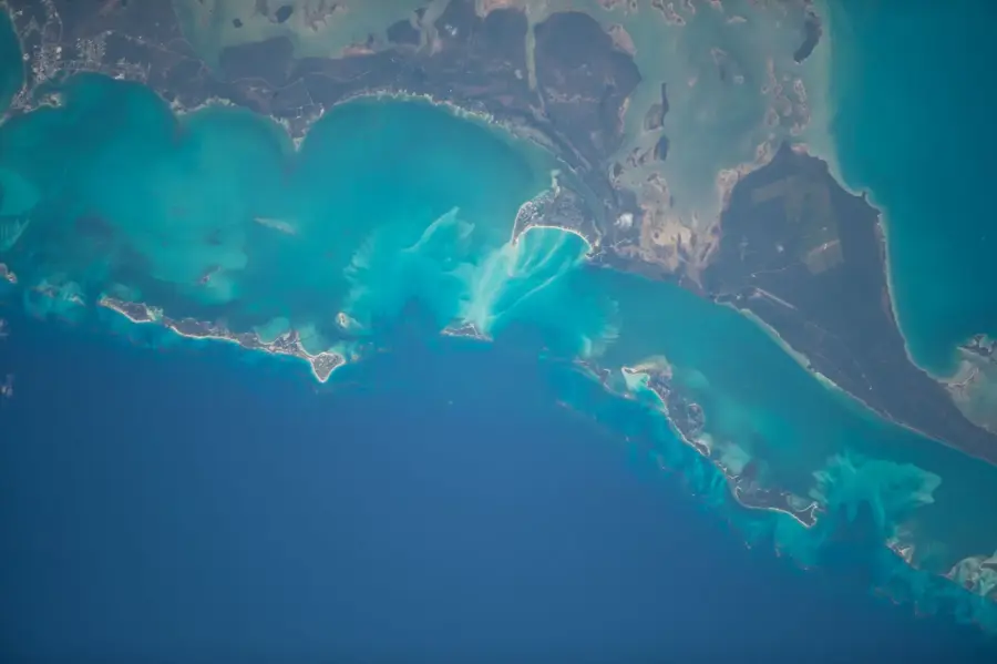
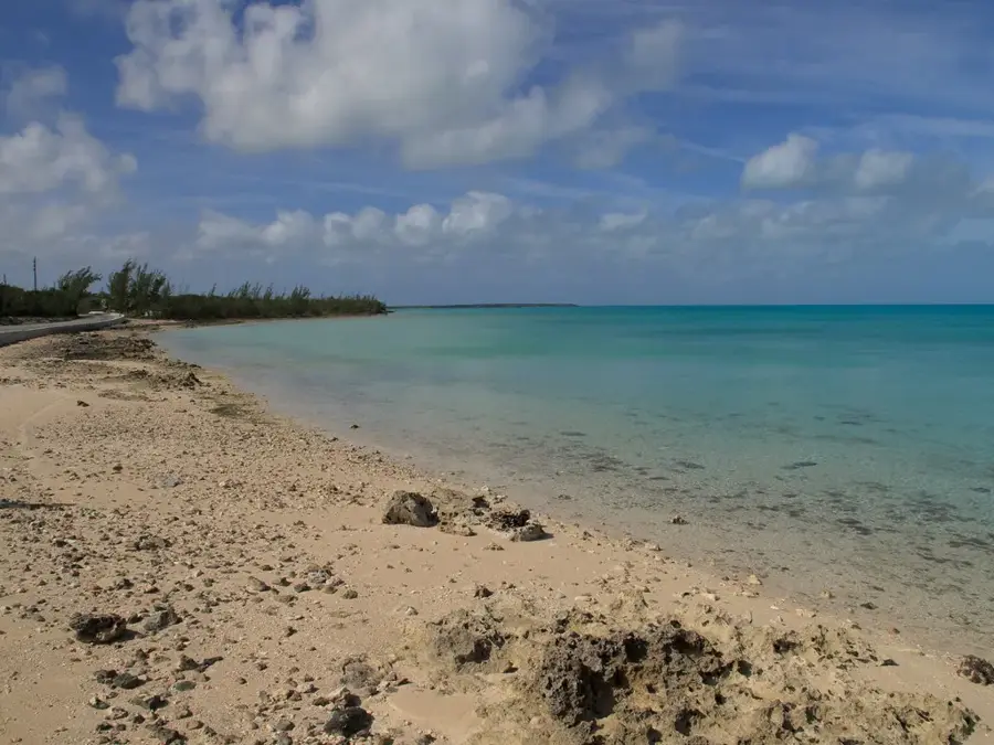
The island of Eleuthera is a long and remarkably thin landmass stretching approximately 180 kilometers from north to south. Its landscape is characterized by a series of fossilized sand dunes, known as eolianites, which create a distinctive rolling hill relief reaching elevations of up to 50 meters. These geological formations were shaped during the Pleistocene epoch when sea levels fluctuated significantly across the Bahama Banks. In 1648, a group of English settlers known as the Eleutherian Adventurers sought religious freedom here, marking a pivotal moment in the island's colonial history. The narrowest point of the island is the Glass Window Bridge, where the dark, turbulent waters of the Atlantic Ocean are separated from the calm turquoise expanse of the Bight of Eleuthera by a mere strip of rock. Modern residents primarily engage in agriculture and tourism, utilizing the fertile red soil found in various pockets of the rolling terrain. This relief feature is essential for understanding the sedimentary processes that have defined the archipelago over the last two million years.
- Location: Bahamas
- Nearby: Governor's Harbour (8 km)
Best time to visit & climate
The most pleasant time to visit is Jan–Mar.
| Jan | Feb | Mar | Apr | May | Jun | Jul | Aug | Sep | Oct | Nov | Dec | |
|---|---|---|---|---|---|---|---|---|---|---|---|---|
| Avg °C | 23 | 23 | 23 | 24 | 26 | 28 | 29 | 29 | 29 | 28 | 26 | 24 |
| Rain mm | 35 | 32 | 37 | 58 | 117 | 146 | 117 | 136 | 153 | 110 | 68 | 37 |
📋 Practical info
Geography
Facts
- Eleuthera measures roughly 110 miles in length but averages only 1 mile in width.
- The island was settled in 1648 by the Eleutherian Adventurers arriving from Bermuda.
- Fossilized sand dunes reach heights of nearly 50 meters above the surrounding sea level.
- The Glass Window Bridge sits at a narrow point where the island is less than 30 meters wide.
- Agricultural efforts are supported by fertile red soil deposits that formed during the Holocene.
- The island is located approximately 80 kilometers east of the capital city, Nassau.
Explore nearby
Notable places around
Route planner — Car & Motorhome
Where do you start? We build the route here, with stops and country notes along the way.
© OpenStreetMap contributors · OpenRouteService
Sights nearby
Frequently asked questions
What is the landscape of Eleuthera like?
Are there viewpoints?
Is the area suitable for cycling?
What is grown on the hills?
How high are the hills?
Eleuthera's Rolling Hills: where is it located?
Eleuthera's Rolling Hills: when is the best time to visit?
Eleuthera's Rolling Hills: why is it worth visiting?

Nearby cities


History & landmarks

Nature
More places